This piece was originally published in Earth Island Journal.
Zambia and Zimbabwe plan to move ahead with the $4 billion Batoka Gorge Dam that would displace villagers, wildlife, and a vibrant rafting industry along the Zambezi River.
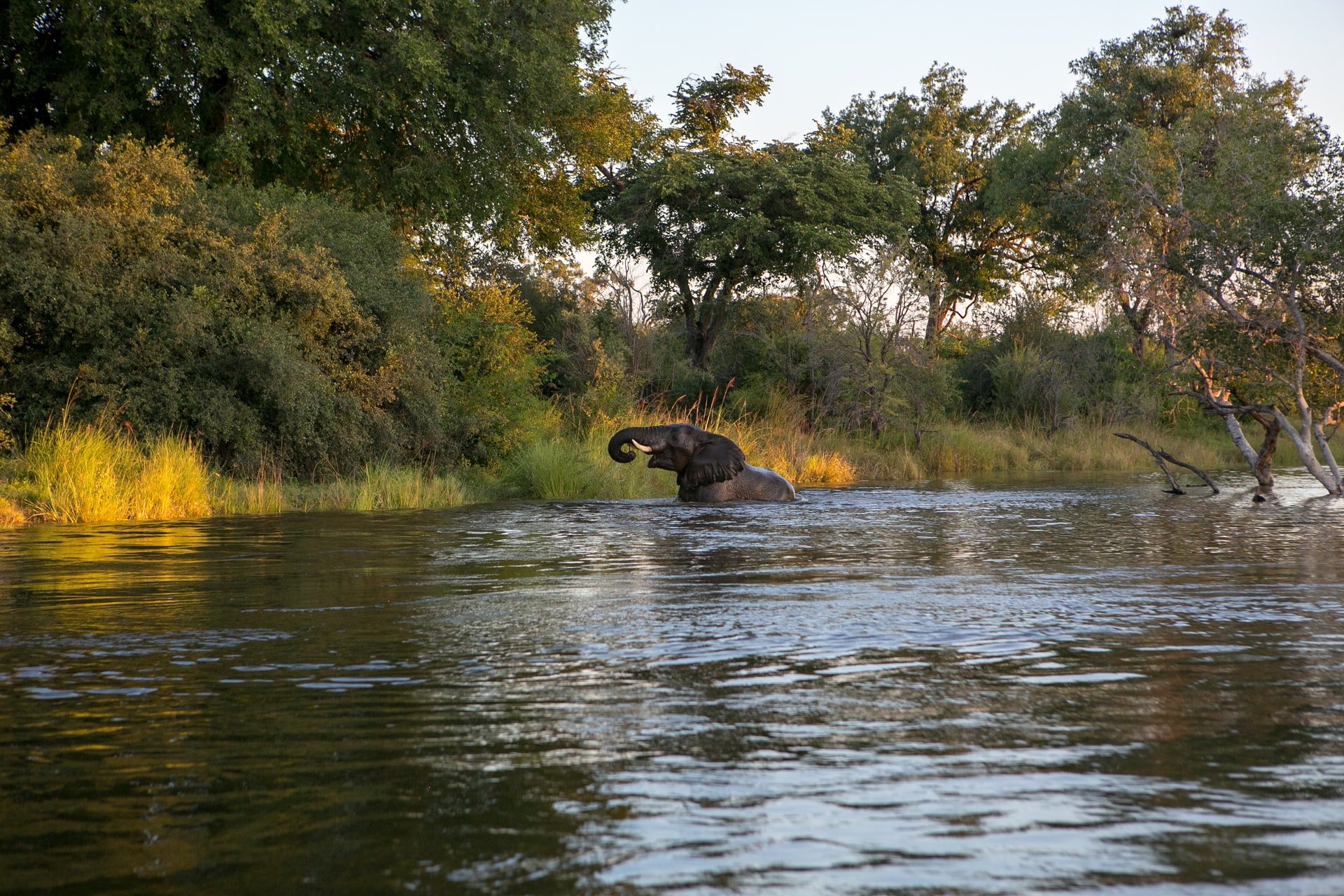
More than 50 men traverse the steep, rocky gorge. They balance as many as three kayaks on their back each, along with other equipment for rafting companies offering trips in the Batoka Gorge. Sweat glistens on their skin; they earn a dollar for each kayak. These porters come from the Indigenous Tokaleya villages situated along the edge of the gorge, on either side of the Zambia-Zimbabwe border. For the Tokaleya, the Zambezi River is an essential and sacred deity. It’s also a source of income. Tens of thousands of tourists raft the Zambezi’s rapids each year, drawn to the region’s rich ecosystem. Alongside the Tokeleya, birds, fish, and other wildlife make their home in the gorge.
Yet the section of the river that runs through Batoka Gorge is threatened. In June 2019, the General Electric Company of the United States and the Power Construction Corporation of China signed a deal with the Zambian and Zimbabwean governments to build and finance the Batoka Gorge Dam. The danger from a massive hydroelectric project, which was first proposed nearly 70 years ago, has become urgent.
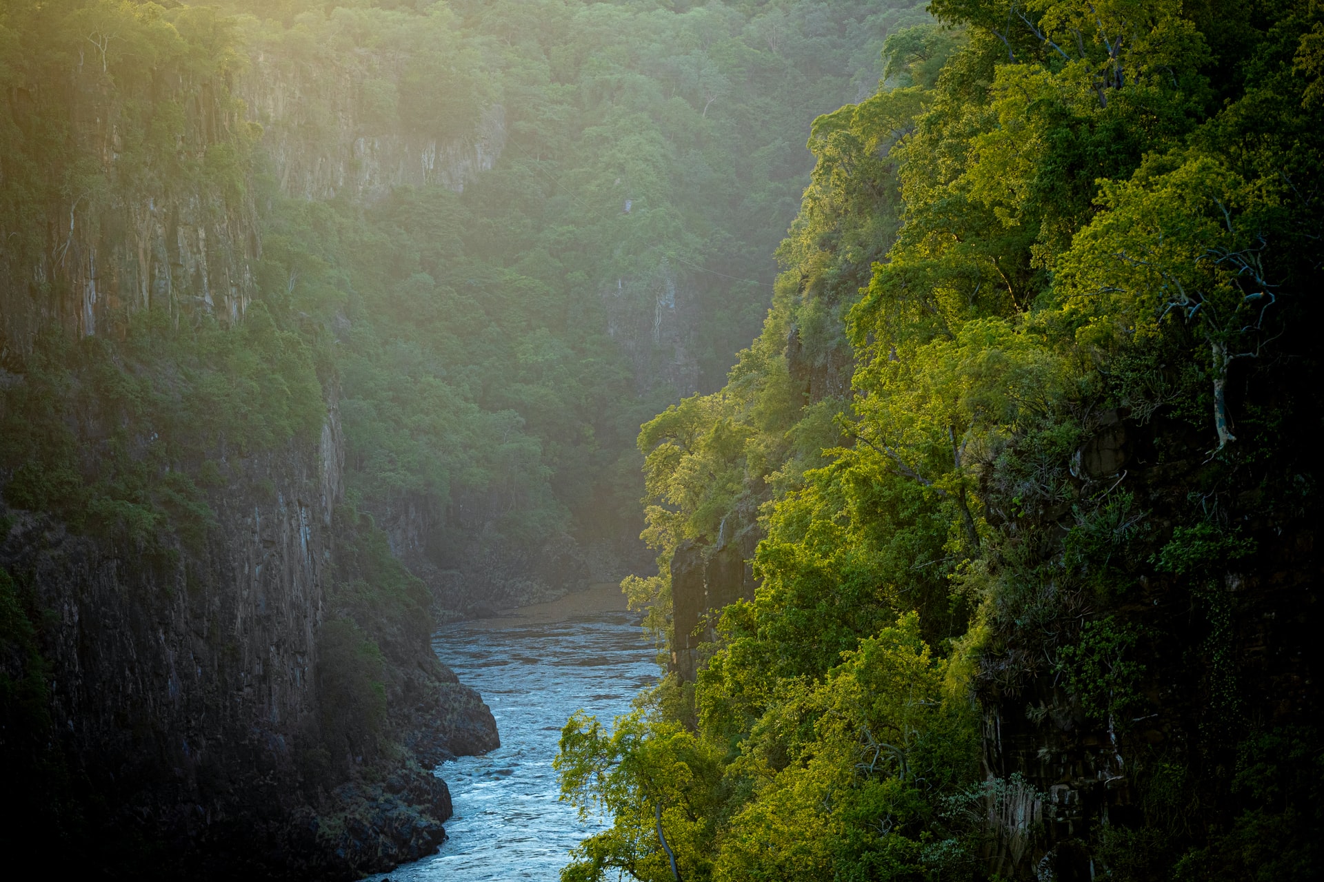
Africa’s fourth largest river, the Zambezi flows through six countries. The Batoka Gorge section begins at the bottom of Victoria Falls, the largest waterfall in the world, also called Mosi-oa-Tunya, or “The Smoke That Thunders.” A few miles from Livingstone, Zambia, massive roaring waters spill from the sky and turn clear green as the river races through steep, dark canyon walls down the 50-mile gorge. The river then meanders for another 200 miles until it reaches Lake Kariba, the world’s largest reservoir by volume and an example of what Batoka Gorge could become.
I am a river guide, and in October 2019, I embarked on a four-day trip down Batoka Gorge as part of a two-week river guide training. Most of our guides, Melvin Ndelelwa, James Linyando, and Emmanuel Ngenda, were from the Tokaleya villages. Ndelelwa, who was a porter before becoming a river guide, pulled out a picture of a fish he caught at a hidden pool below the falls. It was almost as big as he is. His father was a porter his whole life. Becoming a raft guide in Zambia is hard work. The possibility of learning to guide energizes the porters.
Ndelelwa explains how his younger brother carves ebony root to make Nyami Nyami necklaces. The Nyami Nyami is a mythic river god, a serpent with the head of a fish. Legend has it, this god is angry that his sweetheart is trapped downstream behind the giant Kariba Dam. In 1956, a year into construction, the Nyami Nyami flooded the river, wreaking havoc on the construction site. The odds of another flood in 1957 were a thousand to one. Yet the river rose three meters higher than before, destroying the bridge, cofferdam, and parts of the main wall.
The guides told us that the Nyami Nyami would protect us when we wear the necklace that honors his sweetheart. On the river, I touched mine often, praying for safe passage. I am terrified of big water and scared of flipping. The Zambezi is a huge volume river with little exposed rock. It is extremely challenging, with long and powerful rapids, steep gradients, and big drops. Flipping is common. In high-pressure areas, you can’t even depend on your life jacket to keep your head above water.
On the river, I clung to the raft in awe and terror at the size of the waves. October is the dry season, when the water is low. In December, the rains raise the river and turn it muddy brown. Linyando navigated ahead in a safety kayak while Ngenda captained our raft. At one point between rapids, he pointed out the camouflaged crocodiles sun-bathing on rocks.
Halfway through the training, I was invited to guide the most challenging rapid, Gulliver’s Travels. I had already guided the rapid just prior called Devil’s Toilet Bowl twice, but my angle was off on this third attempt. The raft flipped backwards. I went deep underwater. It was dark and silent. A shaft of light appeared. Then more light. I surfaced. We turned the boat upright, but my confidence was shaken. I thought of backing out of Gulliver’s Travels, until the guides encouraged me. Back in the boat, I sent the raft through.
Throughout the trip, I felt that the guides protected me. Ndelelwa offered his sandal for the steep hike out after I lost my shoe. “This is my home,” he said. “It’s easy for me to walk barefoot.” Later, when I encountered a puff adder — a venomous snake with a bite that can be deadly — near my sleeping bag, Ngenda helped me move closer to the fire. “We sleep here,” he said. “The snakes don’t like fire.” It smolders all night smoking fish for breakfast, a staple food in villages along the gorge.
IN 2015, THE WORLD BANK funded an Environmental and Social Impact Assessment (ESIA) that concluded that the dam is a “cheap” solution to the “electricity deficit” of Zambia and Zimbabwe. An airport and road have already been constructed. The reservoir of the 550-foot tall mega-dam will be 16 square miles and a half-mile from the put-in just below Victoria Falls, impacting a UNESCO World Heritage Site sacred to the Tokaleya peoples. The entire canyon will be drowned and destroyed.
If the dam build goes ahead, wildlife who live and breed in the gorge will be lost or displaced. The Cornish jack and bottlenose fish need fast-moving water to survive. The extremely rare Taita falcon is endemic to Batoka Gorge — it nests and breeds only here. The hooves of the small klipspringer antelope are designed to jump up and down the canyon. They will not be able to live on top. Leopards that live in the gorge will be forced to move to higher ground, becoming more vulnerable to hunting and poaching.
The ecological damage is layered with the human toll. Downstream from Batoka Gorge, the Kariba Dam, built in the late 1950s, displaced 57,000 Indigenous Gwembe Tonga and Kore Kore peoples, while stranding thousands of animals on islands. Kariba Dam has also demonstrated that imprisoning a river damages water quality, reduces the amount of water available for people and wildlife downstream, and harms the fertility of the land. Dams can also spread waterborne diseases such as malaria and schistosomiasis, while mega-dams may cause earthquakes and destructive floods.
Plus, the lifespan of a dam is 50 years. Less than 30 years after construction, Kariba Dam began falling apart, causing earthquakes and operating at less than 30 percent its proposed capacity. Falling water levels have made it increasingly less productive. The Chinese construction company regularly pours concrete into the wall to keep it from buckling. If it broke, it could cause a tsunami that would impact much of Mozambique and even Madagascar, potentially killing millions.
The Batoka Gorge project will cost around four billion dollars. It is supposed to take 10 to 13 years to complete, but some locals have noticed that high cost infrastructure projects often do not reach completion in Zambia. Increasing droughts due to climate change raise the question whether there will be enough water to operate a dam. Electricity generated is likely to be sold to foreign countries for income, while local people become poorer.
The dam will also displace river guides and most likely the villages along the gorge. Tourism is the third largest industry in Zambia. The governments say the dam’s construction will create jobs, but many of these jobs go to Chinese nationals hired by Chinese companies, and after construction ends, few will be needed to operate the dam. Some say the dam will create new tourism opportunities, like parasailing and wakeboarding, but crocodiles and hippos proliferate in flat water, making these activities risky.
China is rapidly expanding its global reach, including in Africa, through its Belt and Road Initiative, an ambitious infrastructure project extending to 60 countries and counting. The country has already financed two Zambian airports and the Itezhi Tezhi Dam, and owns a 60 percent share of Zambia national broadcasting service. As many less developed countries borrow big money from China for big infrastructure projects, they are incurring large debts. The debt incurred can be crushing to the food supplies, health services, and education of local people. As Daimone Siulapwa writes in the Zambian Observer, huge kickbacks are the root of the problem. They motivate Zambian leaders to negotiate deals with China. Millions of dollars go missing. Projects are not finished. The natural world and local people suffer.
Most river guides hope the dam never happens, but local rafting companies are afraid to speak out against it. They fear repercussions — from being shot to having their passport or business license revoked. International support is imperative if we want to see this river protected.
ALONG THE RIVER, villagers carve and sell wooden figurines: elephants, rhinos, lions, water buffalo. Ndelelwa always buys some, though he does not need them. I bought carvings too, and the vendor insisted on giving me a few extra.
Then Ndelelwa invited me to his village to eat nshima, a traditional thick maize porridge. We sat outside the round mud huts with grass roofs. Five children ran over to look at me with toothy smiles and a wide-eyed curiosity. As we ate from one bowl, I thanked them in their dialect, “Ndalumba.”
If the river is dammed, I wonder, what will happen to these people? How will they survive?
The last time I flipped the raft on the Zambezi, the waves were gentle. We held the perimeter rope of the capsized boat as we floated through a narrow section of canyon. Ngenda smiled as he turned the boat upright.
Dam projects are rarely stopped in industrial civilization. Save the Zambezi formed to oppose the construction of this dam. They seek help in challenging the ESIA. This dam will likely go ahead unless there is an unprecedented outcry of resistance. The Nyami Nyami protected us on the river. Perhaps his rage may once again knock down any walls placed in his path. I touch my necklace and pray for the river.
Contact Marie-Louise Kellett of Save the Zambezi, a Waterkeeper Alliance Affiliate, savethezam@gmail.com to get involved.
Rebecca Wildbear is a river and soul guide who helps people tune in to the mysteries that live within the Earth community, dreams, and their own wild Nature, so they may live a life of creative service. She has been a guide with Animas Valley Institute since 2006 and is the author of the forthcoming book Playing & Praying: Soul Stories to Inspire Personal & Planetary Transformation.
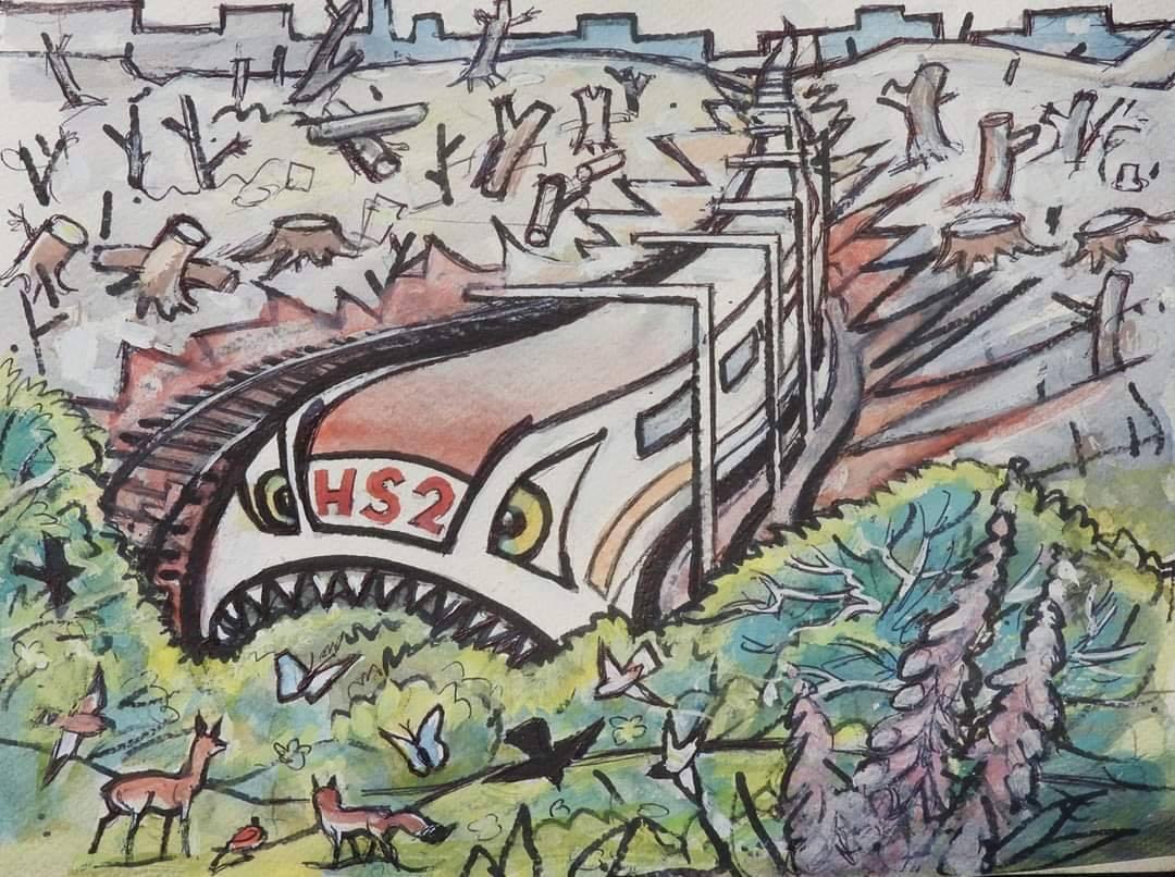
In this writing Ben asks questions about a rail development that is destroying the natural world. He asks what it would take to stop the development and why we are not all talking about it.
Is high speed rail the pinnacle of civilisations’ insanity?
Probably not, unfortunately, but it is an excellent example. Standing in the same place for centuries should mean something. The men must have made a mistake. They have destroyed a National Asset. The National Heritage has a list of criteria for granting protected status that includes being in the same place for centuries. Why have they just demolished a possible candidate for the National Heritage List for England? The answer is, it was a tree who was razed to the ground and not a building. The tree was in the way of “progress” and those who get in the way are often crushed.<
Imagine a country so insane it would spend £100 billion during a pandemic and one of the worst recessions in human history, just to speed up a journey by 20 minutes. That’s 5 billion a minute. Imagine the same project would destroy over 700 wildlife sites including sites designated by that same culture as Sites of Special Scientific Interest (SSI) and not be carbon ‘friendly’ for at least a hundred years.
Imagine it would simultaneously threaten the water supply of its biggest city and use between 6 and 10 million liters of water during its construction. Now imagine the same project has been made obsolete by a virus that has stopped people travelling for business. Of course you do not have to imagine it. The country is the UK and it is as insane as the culture it is part of Industrial civilisation.
High Speed Rail (HS2)
The first stage of HS2 will make the rail journey from the UK’s London to Birmingham 1200 seconds quicker. That is for people who can afford the tickets, which are likely to be in the region of £50. What are people going to do with these 20 minutes? If they were commuting there is probably little they can do at work that they could not have done on the train.
The rational arguments for HS2 do not exist. There are none. But the project will continue. Why? Because it has already started, too much money has been spent and too much embarrassment will be caused, if it stopped. For a culture that prides itself on its rationality, this is baffling. Even when the evidence is so strong, it is hard to accept that our own culture is insane.
Right now there are brave people occupying woods and sleeping in tree houses attempting to slow down the HS2 project and the pointless destruction it is causing. Their efforts are courageous and valuable. Their resistance probably won’t stop HS2, but their actions will not be in vain because the morality of what they are doing is clear for all beings who care to learn about it.
What would it take to stop HS2?
The people in the camps are above ground and peaceful. But what if there was another, completely separate, group of militant underground activists using the hit and run tactics of successful resistance groups? Would sabotage stop HS2? Would sand or water or bleach in the engines of their destructive machines stop them? Would constant, relentless physical intimidation of the workers make the project impossible to complete?
What would a truly effective campaign look like and why are we not talking about it?
Ben Warner is a longtime guardian with DGR, a teacher, and an activist.
Featured image artist unknown via Stop HS2 campaign. There are suggestions of how you can help resist the destruction on their website: stophs2.org.
Godwin Vasanth Bosco reports on extreme precipitation that has fallen on the Nilgiri plateau of southern India the last few years. These extreme and unprecedented rain events have led to massive landslides and other ecological damage. Little has been done to address the crisis. Featured image: A massive landslide in one of the largest sholas in the Avalanche region of the Nilgiris, with hundreds of native trees and the stream ecology washed away.
Crumbling Ancient Mountain Ecology
Written and photographed by Godwin Vasanth Bosco / Down to Earth
Thousands of trees lay dead and strewn around the western parts of the Nilgiri Plateau in southern India.
Deep gashes scar ancient mountains slopes, standing a stark contrast to the lush green vegetation that they otherwise support. As conservationists, activists, and concerned people in various parts of India are fighting to protect forests and wilderness areas from being deforested, mined, and diverted to `developmental’ projects, there is another level of destruction that is happening to our last remaining wild spaces. Climate change is causing the widespread collapse of ecosystems.
Carbon dioxide levels in the atmosphere have just hit record-breaking levels of 417 ppm in May 2020. It has never been so high in the last 3 million years. Along with global warming caused sea-level rise and the melting of polar ice caps and glaciers, the steep increase in greenhouse gas concentrations has led to a surge in the frequency of extreme climate events. A region of the earth where climate change caused weather extremities are exceedingly apparent are the coastal plains and the Western Ghats regions of southern India. In the last four years, this region has been affected by eight tropical cyclones and consecutive extreme rainfall events during the southwest monsoon periods of the last two years.
These bouts of intense storms have been interspersed with periods of severe droughts, heatwaves, deficient, and failed monsoons.
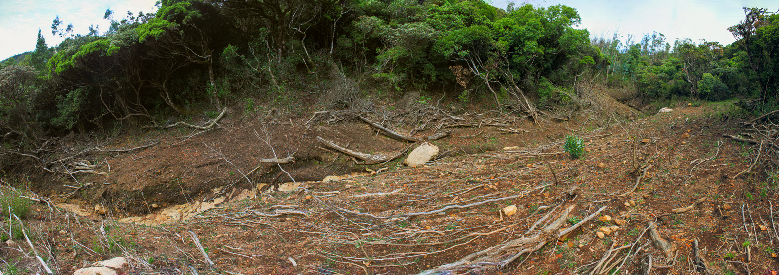
On August 8, 2019, the Avalanche and Emerald valley regions, which are part of the Kundha watershed, received an unprecedented amount of over 900 mm [2.9 feet] of rainfall in 24 hours.
It broke the record for the highest rainfall ever recorded in Tamil Nadu, by nearly twice the amount. Over four days, this region experienced close to 2500 mm [8.2 feet] of rainfall. To put this in perspective, the nearest city (100 km east) in the plains of Tamil Nadu, Coimbatore, receives around 600 mm of rain annually. The Kundha watershed bore a deluge that was four times the annual rainfall amount, over just four days.
The upper watershed of the Kundha River is a complex of several peaks above 2400 meters and broad deep valleys. The Kundha River, which is a primary tributary to the Bhavani that feeds into the Cauvery, is fed by numerous streams and rivulets at the headwater sections.
With the barraging downpour, nearly every stream and rivulet burst its course. Vast tracts of precious soil and shola ecology slipped away on either side of the watercourses. Gone are the rich black soil layers topped with spongy humus that line the streams; washed away are dark moss and wild balsam covered rocks that shaped the flow of every stream; lost are the thousands of shola trees, dwarf bamboo and forest kurinji that guarded the streams, saplings, ferns and orchids of the forest floor. In place of these are deep cuts of gauged out the earth, revealing the red underlying lateritic soil layers, and lightly shaded freshly exposed rocks.
Numerous large landslides have occurred on intact grassland slopes too.
Uprooted and washed away trees, and dead Rhododendron arboreum ssp nilagiricum trees in a broad valley near the Avalanche region.
Native shola trees and stream ecology completely washed away on either side of tributaries of the Kundha River
Shola-grassland mosaic in danger
The cloud forest ecology, known as sholas, is specialized in growing along the folds and valleys of these mountains. They are old-growth vegetation and harbour several endemic and rare species of flora and fauna. These naturally confined forests are already some of the most endangered forest types, because of habitat loss and destruction.
The recent episode of extreme precipitation caused landslides, have dealt a telling blow on these last remaining forest tracts. What is even more shocking is that montane grassland stretches have also experienced large landslides.
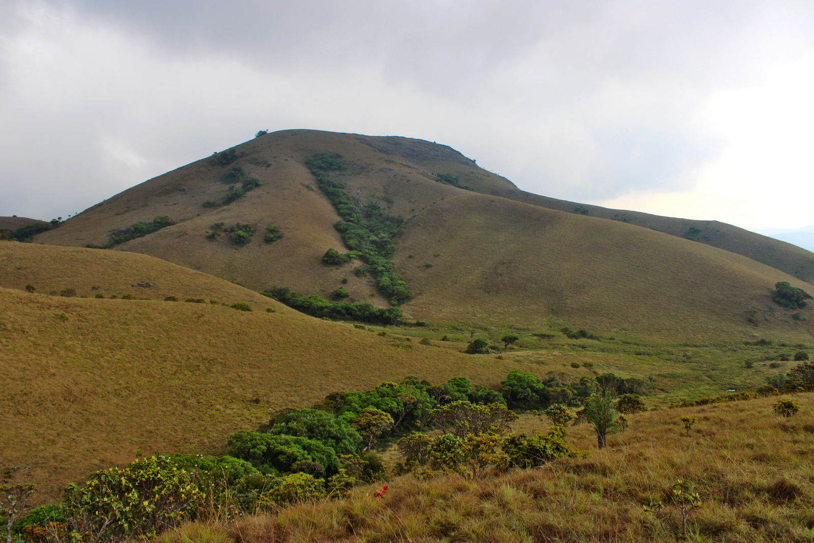
The montane grasslands occur over larger portions of the mountains here, covering all the other areas that sholas do not grow in. Together, the shola-grassland mosaic is the most adept at absorbing high rainfall amounts and releasing it slowly throughout the year, giving rise to perennial streams. Over a year they can experience an upwards of 2500 to 5500 mm of rainfall, which is intricately sequestered by complex hydrological anatomy that carefully lets down most of this water, using what is needed to support the ecology upstream.
The native tussock grasses especially are highly adapted to hold the soil strongly together on steep slopes. However, even this ecology is now giving way under pressure from extreme weather events. The shola-grassland mosaic ecology cannot withstand the tremendously high amounts of rainfall (over 2400 mm) that occur in significantly short periods (over 4 days). Worsening climate change is driving the intensity and frequency of extreme weather events, resulting in a level of ecosystem collapse, never witnessed before.
An example of intact shola-grassland mosaic in the hills of the Nilgiri plateau, with the sholas growing in valleys and grasslands covering the slopes.
In the southwest monsoon season of 2018, similar events of unusually high rainfall occurred over the highland districts of Idukki, Wayanad, and Coorg, causing hundreds of landslides. A predominant view was that this was primarily because of the indiscriminate construction of roads and proliferating concretization of the hills.
However, even within the highly stable shola-grassland ecology, a large number of landslides have occurred in spots with no apparent forms of disturbance such as roads and pathways cut through them. This signifies that climate-change has reached a level that is beyond the capacity of the ecosystem and land resilience.
What is causing the collapse of the last remaining wild spaces is the culmination of every action that has contributed to the climate crisis.
These actions invariably stem from places that have long lost their plant ecological cover—urban-industrial-agricultural complex. There is fatally no time to keep ignoring this primary cause. Even if we ignore this and look to safeguard the last remain wilderness areas from being deforested or `developed’, they are vulnerable to climate change-related destruction.
Threats closer to the last remaining ecological spaces must be also curtailed. For instance, despite the consecutive years of extreme precipitation over short periods, in the Nilgiri Biosphere region, there are hardly any steps being taken to address ecological security. Building regulations stand to get eased and road expansion works continue in full swing.
However, worryingly similar to what happened in the last two years when much of the annual rainfall was concentrated over a few days later in the monsoon period, this year too, 2020 has be no different. The onset of the monsoon was delayed, and large parts of peninsula experienced a significant deficiency well into the monsoon period. This year’s monsoon has brought intense, short bursts of extreme rainfall, not only in the Western Ghats regions and southern India, but all across the Indian subcontinent.
Destruction by dams and tunnels
Neela-Kurinji or Strobilanthes kunthiana flowering in the grassland habitats of the Nilgiris. This spectacle takes place only once in 12 years
The Kundha watershed region can be broadly divided into two sections – the higher slopes and the descending valleys. Hundreds of landslides occurred in both these sections, with shola-grassland ecology dominating in the higher slopes, and various types of land-uses such as tea cultivation, vegetable farming, villages and non-native tree plantations dominating the descending valleys. The descending valleys are also studded with several dams and hydroelectric structures.
The Kundha Hydro-Electric Power Scheme is one of the largest hydropower generating installations in Tamil Nadu-with 10 dams, several kilometers of underground tunnels, and a capacity of 585 MW. In addition to this, this system is now getting two more dams and a series of tunnels, to set up large pumped storage hydropower facilities. The claim is to generate 1500 MW, of electricity during peak demand hours, but while using almost 1800 MW in the process.
With the level of destruction that extreme precipitation events are bringing to the Kundha watershed, it is disastrous to add more large dams and tunnels. The intensity of floods has turned so strong that even the largest dam complexes in the world, face threats of being breached.
An Aerides ringens orchid growing on a shola tree.
Safeguarding the last remaining zones of ecology and biodiversity from threats of direct destruction is crucial. Concurrently, the larger world-wide urban-industrial-agricultural complex, from where the climate crisis stems from needs drastic change. The constant incursions into more and more ecological spaces in the form of new dams, roads, and buildings, are also connected to this complex.
Whether it is the landslides in the grasslands of the high elevation plateaus in southern India; the melting glaciers of the Himalayas in northern India; the dying coral and rising sea levels elsewhere in the planet; the global coronavirus (Covid-19) pandemic that has brought about unimaginable changes – we have to understand the interconnectedness of these dire effects and learn from nature.
Godwin Vasanth Bosco is an ecologist working to restore shola and grassland ecology in the Nilgiri Biosphere. He is the author of the book Voice of a Sentient Highlandon the Nilgiri Biosphere.
This piece was first published on Down to Earth. All the photographs were taken by the author himself.
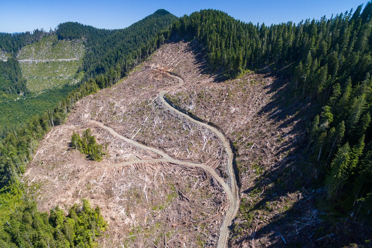
A third blockade has started to stop the logging of near the headwaters of Fairy Creek. To learn more about the blockade in Fairy Creek, read the media release by the organizers of the blockade, and listen to interviews with Joshua Wright here and here. Access the official Facebook page here.
Two weeks into a campaign to halt logging of ancient rainforests in the last intact watershed of the San Juan River system, activists have set up a third blockade on unceded Pacheedaht territory!
Grassroots forest defenders from across Vancouver Island have successfully prevented Teal Jones Group from blasting logging roads into the unlogged headwaters of the Fairy Creek watershed for the past two weeks.
The first blockade was established on Monday, August 10th, where the new roads were about to crest a ridge into the west side of the watershed. The blockaders successfully turned away the road builders early that morning. Teal Jones removed their road building equipment on Tuesday, August 11th, and the blockade has remained in place continuously since then.
On August 17th, in light of government inaction to meet the blockaders demands, a second blockade was established just to the east of the Fairy Creek watershed, preventing Teal Jones from building roads which have been approved for construction into that side of the rainforest, located on unceded Pacheedaht Territory.
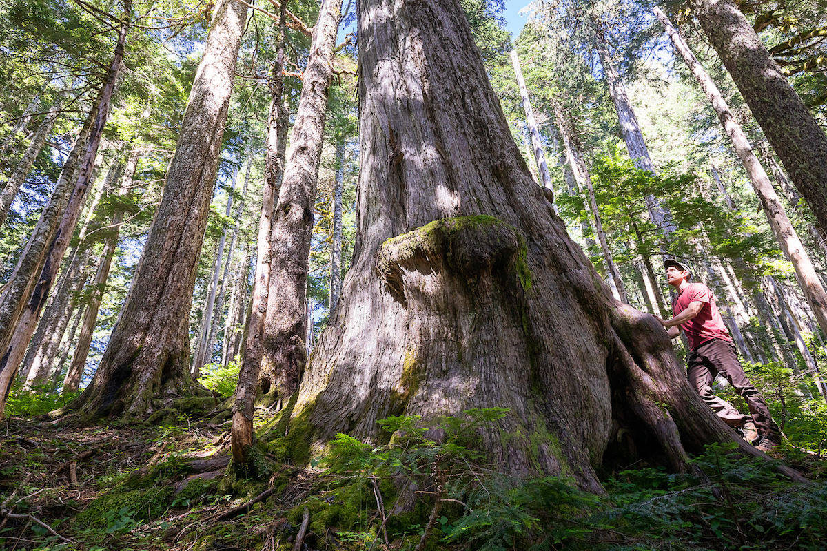
And on the evening of August 23rd, a third blockade was established. The third blockade is located on a logging road on Edinburgh mountain (also unceded Pacheedaht Territory). With the exception of Eden Grove on Edinburgh mountain, contiguous old-growth corridors have been severed between the rich valley bottom and the protected upper reaches. The infamous Big Lonely Doug stands in stark contrast to clear cut in a cutblock on Edinburgh, the sole remaining giant fir in the cut. Lonely Doug has become an internationally recognized symbol for BC’s devastating logging practices. Just up the mountain, logging is ongoing. This is what the newest blockade will stop.
Photo shows Teal Jones old-growth logging operations adjacent to Fairy Creek. Photo by Ancient Forest Alliance.
This new blockade also obstructs old growth logging already in progress east of Fairy Creek.
This stretch of ancient forest is contiguous with the intact old growth forest within the Fairy Creek watershed and contains high value valley bottom old growth forest that would be fully eradicated if the logging was allowed to continue. A massive, ancient cedar recently felled by Teal Jones in one of the old growth cut blocks now being blockaded:
“If anyone has ever felt called in their heart to take a stand for old growth forests, we invite them to join us here in Premier John Horgan’s own electoral riding: at our first blockade, or at this new, more easily accessible second blockade,” stated Cowichan Valley resident Caimen Shapiro.
Teal Jones, the licence holder of TFL 46, over the past month has begun road construction in the old growth hotspot of Fairy Creek that would enable them to clear-cut the upper Fairy Creek watershed, near Port Renfrew. The company has felled and graded several hectares of old growth forest on a road network that, had it not been for our first blockade, would have breached the ridgeline and entered the watershed.
Protection of Old Growth Forests
In view of the forthcoming release of theOld Growth Strategic Review (OGSR) report and recommendations, being held up by the BC government for up to 6 months from early May, with no firm release date to the public, we are again asking the Premier to establish:
1. The immediate and permanent protection of the entire Fairy Creek Valley, thereby nullifying all cut blocks and road construction approvals in the watershed and contiguous old growth forests. We demand this take place without a ‘land swap’ that would remove protections from other old growth forests to compensate Teal Jones.
2. An immediate end to old growth logging on Vancouver Island.
In an article in The Narwhal, Jan. 27, 2020, Gary Merkel, one of the two commissioners of the OGSR states: “I think the thing that surprised me the most is the degree of unanimity and common thinking around ‘we need to get back to the land’ and about moving past political cycles … we’re hearing it from almost everywhere,” Merkel told The Narwhal in a joint phone interview with Gorley: “We’re managing ecosystems — that are in some cases thousands of years old — on a four-year political cycle. The management systems change from government to government,” said Merkel, the former chair of both the Tahltan Nation Development Corporation and the Columbia Basin Trust.
We are now at the stage of final eradication of the ancient coastal temperate rainforest, reduced to less than 3% of its original extent by logging.
Port Renfrew has billed itself as the Big Tree Capital of Canada and this form of tourism has become the backbone of its economy. Once again, this future is threatened by the indiscriminate eradication of the ancient forests in this region. Here is a dramatic drone video of Fairy Creek watershed, recently captured by a young firefighter showing road-building crews cresting the ridge into the very last unlogged watershed in the San Juan River valley rainforest: https://www.youtube.com/watch?v=kBnhktwJIo4
If you are in a position to help you can find you way with this information: Blockade Directions: Blockade #1 (established August 10): GPS coordinates: 48°38’32.56″N 124°21’21.25″W
Featured image by Ancient Forest Allianc. Captured earlier this month from the Granite (Renfrew) Creek watershed, just over the ridge to the east of Fairy Creek in Pacheedaht territory. Teal-Jones was – until recently – also constructing roads and starting to clearcut old-growth forest in this area. The second blockade has now been set up by independent activists to prevent the company from continuing its destructive practices here as well.
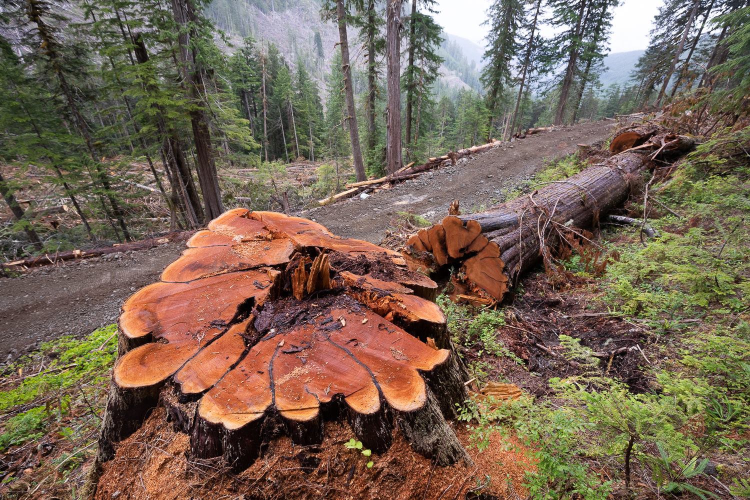
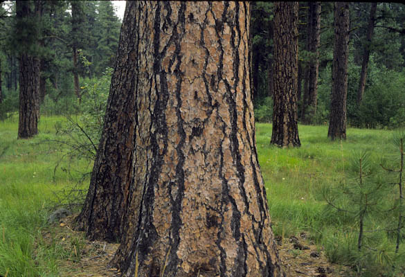
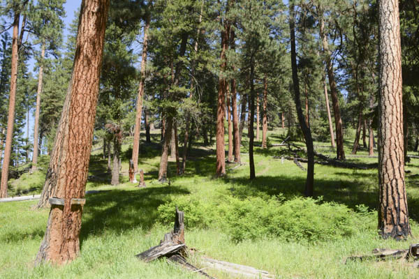
Large and old-growth trees in the dry eastern region of the U.S. state of Oregon are under threat as the agency which regulates Forest Service lands plans to remove existing protections, George Wuerthner reports.
Old-growth grand fir on the Ochoco National Forest could be logged if the proposed removal of the 21-inch rule is adopted. Photo by George Wuerthner
The Forest Service has begun a 30 day comment period on its proposal to eliminate the 21-inch rule or what is known as the Eastside screens. The plan would remove a prohibition against cutting trees larger than 21 inches in the drier forests east of the Cascades in Oregon and Washington. The agency suggests that forests are denser than historical conditions and have shifted in their species composition. Not all researchers agree with this interpretation, but since these scientific studiesdon’t support more logging, they are usually ignored.
The agency researchers conclude that thinning forests is necessary to promote “forest health” and cutting of larger trees will hasten this transition. Since big trees enhance the profitability of timber sales, there is intense pressure from the timber industry for cutting big trees. However, the elimination of the 21- inch rule will increase the removal of large trees critical to healthy forest ecosystems.
The 21-inch rule was implemented in 1994 to protect larger trees from logging, partially in response to the realization that big trees have a disproportional ecological influence. Unlike the ancient forests west of the Cascades inhabited by the spotted owls, which gained some protection from the Endangered Species Act, eastside forests were vulnerable to the removal of old-growth forests.
Large trees, even if dead, provide important ecological functions such as carbon storage and wildlife habitat. Photo by George Wuerthner
In response to the loss of large trees created by excessive logging, Congress convened a scientific panel to review the issue. However, unlike many such scientific panels that rely exclusively on forestry schools and/or the Forest Service for advice, Congress asked the Wildlife Society, the American Fisheries Society, the Society for Conservation Biology, and the American Ornithologists’ Union to produce the Eastside Forests Scientific Society Panel report. The panel came out with 13 suggestions, including a prohibition on cutting larger trees older than 150. The Forest Service adopted this policy recommendation.
But times have changed.
With the advent of the Trump Administration, there is intense pressure to increase the cut of timber. This pressure, along with collaborators who are more than willing to accommodate the timber industry’s and Forest Service demands (and rely exclusively on their science), many members of collaboratives including some so-called environmental groups support more logging.
In yet another example of the tail wagging the dog, the Forest Service now suggests that to “restore” eastside forests, and “save” them from (god forbid) death from wildfire or beetles, the agency must log the forest.
Part of the underlying assumption behind restoration is that forests are denser now than in the historical past due to fire suppression. The idea that you can restore the forest to some “historic” condition ignores the fact that all vegetation is a reflection of climate. The reason we see more mortality from fires, beetles, drought, and other ecological processes is primarily to changing climate. It’s warmer and drier. With less precipitation, higher temperatures, and more drought, you have the perfect ingredients for wildfire and bark beetle mortality.
There are many things wrong with this perspective.
Trying to emulate the historic forest condition created by the climate at that point in time, is not relevant to the forest structure today.
Part of the assumption behind removal of 21-inch screens is that eastside forests were characterized by open stands dominated by ponderosa pine as seen here. However, some researchers challenge the assumption that such forest structure was as common as presumed. Photo by George Wuerthner
Furthermore, natural evolutionary processes like bark beetles, drought, and fire are better, selecting which trees should and will survive than a logger with a chainsaw. For instance, it has been demonstrated that some trees have greater resilience to bark beetle predation, but this genetic advantage is not readily visible to foresters. By randomly logging/thinning the forest, logging may reduce the number of trees with genetic resistance to natural stresses, degrading the “resiliency” of the forest.
In a sense, the Forest Service and its collaborative allies see natural ecological processes like fire and beetles as the “enemy”. Somewhat like the attitude of some hunters view predators like wolves and cougars as “damaging” the deer and elk herds, many foresters and agency personnel view natural mortality from fires and beetles as counter to forestry goals of “green trees” and a source of fodder for sawmills.
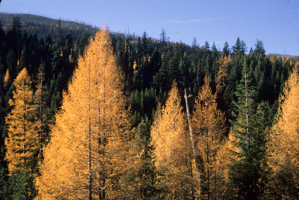
Western larch, Glacier Mountain, Strawberry Mountains, Malheur National Forest, Oregon
This industrial forestry perspective is widely held in the timber industry, Forest Service, and its collaborative allies.
Yet dead trees are essential to healthy forest ecosystems.
They store carbon. They provide habitat as snags and down wood to many species from salamanders to animals as large as bears. For instance, grizzly bears rely on ants found in down trees for a significant proportion of their summer diet. And down trees in streams enhance the productivity of aquatic ecosystems. A substantial portion of birds and other wildlife utilize snags and dead trees at some point in their lifecycles. This is why some researchers have reported high biodiversity in the snag forests that result after a wildfire or bark beetle attacks.
Another rationale for eliminating the 21-inch rule is to reduce competition for resources and increase the remaining trees’ growth. Fast-growing trees are a goal of the Industrial Forestry Paradigm, but it is not necessarily good for healthy forest ecosystems. Slow-growing trees have denser wood, which makes the snags and down wood that remains after they die more resistant to rotting. Therefore, such dense wood is retained longer in the environment providing the above wildlife habitat and carbon storage benefits.
Although it is seldom admitted, one of the chief reasons for removing the 21-inch rule is to increase the economic viability of logging projects.
This is revealed in a recent review of the 21 inch rule in a paper recently published by the Forest Service. In that review, the authors suggest, ” Including larger trees in restoration prescriptions can increase the acreages where fuel treatments are financially feasible. Prestemon et al. (2012) showed that allowing the harvest of live trees over 21 inches increased the acreage in the West where fuel treatments were economically viable, even without considering avoided damage values”.
The paper goes on to note that: “Throughout the West, including live trees over 21 inches in fuel treatment harvests increased the viable treatment area by 2.6 times.” The review also notes: “It is important for managers and stakeholders to consider how large harvested trees can be processed locally to support local mills and be consistent with collaborative group goals.”
Here we see that meeting the goals of the collaboratives is more important than preserving healthy forest ecosystems.
The review admits that: “if no timber products could be sold from forest restoration actions, there was no place on the east side where the expected net economic benefit from fuel treatment would be positive, even when accounting for avoided wildfire damage.” As a consequence, we get to the heart of the issue. Without logging big trees, most thinning and other projects on eastside forests make no economic sense.
One way logging is further justified is by stewardship contracts. Stewardship contracts permit the Forest Service to take profits from timber sales and utilize for other forest projects like mitigating the ecological damage from previous logging projects by removal of culverts or closure of roads. I have often heard the so-called environmental representatives on collaboratives justify logging to me by saying, “ ?”
Of course, I support closing roads, but we don’t need to build more roads and log the forest to get some money to fix the damage from previous logging projects. Given the amount of money, the FS typically loses on timber sales. Putting agency funds towards road closure and other real restoration could be accomplished without having to log the forest to pay for these projects.
Last week we ran a story on an anti-logging blockade at Fairy Creek, near Port Renfrew on Vancouver Island in western Canada. Since then, the blockade has held strong and a second blockade has been established nearby, stopping further old-growth logging.
A few days ago, Max Wilbert spoke with Joshua Wright, a spokesperson for the blockade, for The Green Flame podcast. That interview can be found below.
The blockade protects ancient old-growth forest stands, including the 9th largest Alaska Yellow Cedar known to exist and other trees thousands of years old, in the Fairy Creek area near Port Renfrew, on unceded Pacheedaht territory. Support is urgently needed to maintain and expand this blockade. As Joshua explains, this is a critical moment for protecting the last old-growth forests on Vancouver Island. Residents of the region: contact the blockaders, donate, spread the word, and most importantly go to the blockade yourself.

 IN 2015, THE WORLD BANK funded an Environmental and Social Impact Assessment (ESIA) that concluded that the dam is a “cheap” solution to the “electricity deficit” of Zambia and Zimbabwe. An airport and road have already been constructed. The reservoir of the 550-foot tall mega-dam will be 16 square miles and a half-mile from the put-in just below Victoria Falls, impacting a UNESCO World Heritage Site sacred to the Tokaleya peoples. The entire canyon will be drowned and destroyed.
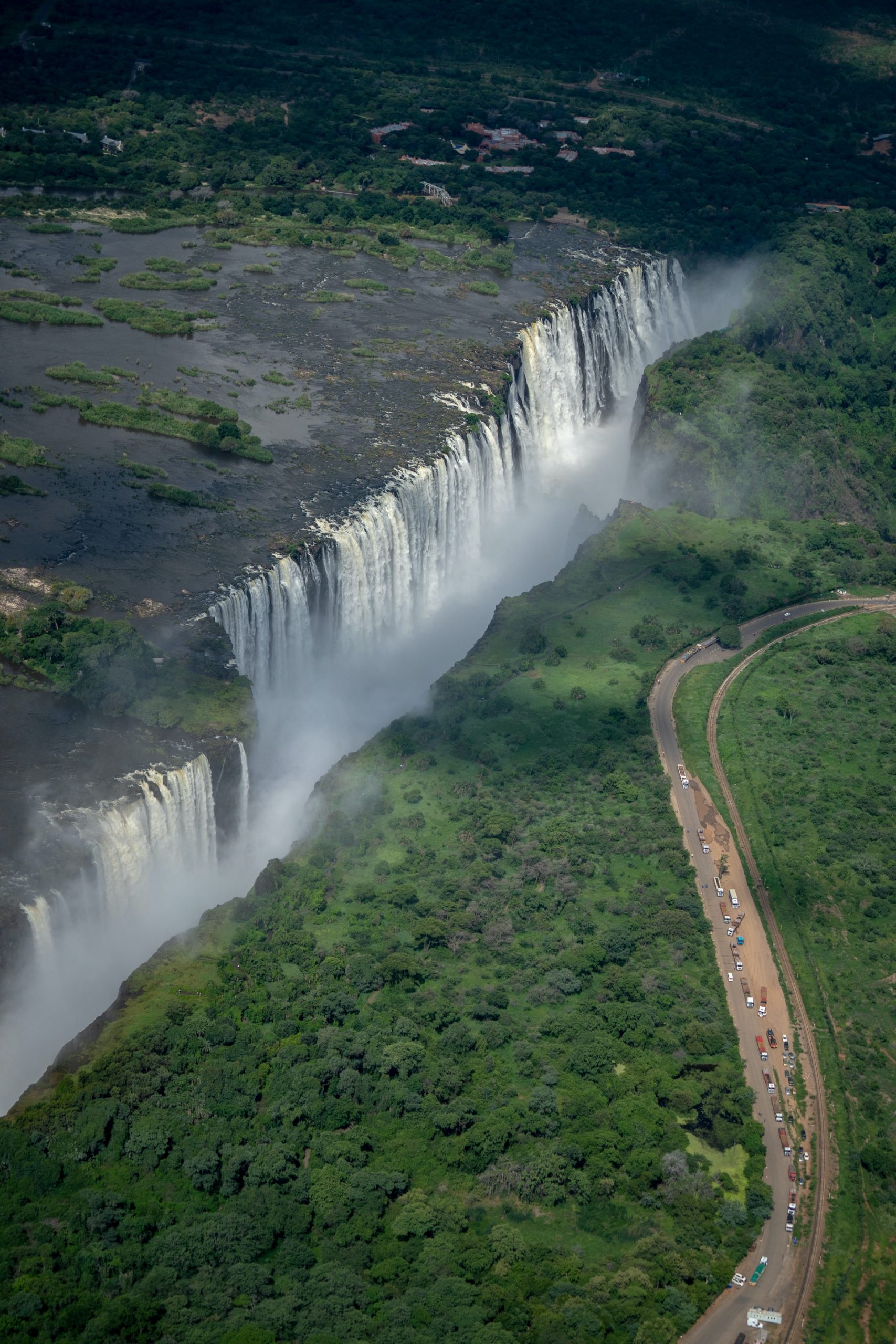
 Rebecca Wildbear is a river and soul guide who helps people tune in to the mysteries that live within the Earth community, dreams, and their own wild Nature, so they may live a life of creative service. She has been a guide with Animas Valley Institute since 2006 and is the author of the forthcoming book Playing & Praying: Soul Stories to Inspire Personal & Planetary Transformation.