New Map shows US West Rangeland Health
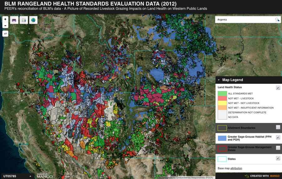
Searchable BLM reports and satellite images for 20,000 grazing allotments By Tay Wiles / High Country News Featured image: The map includes blue-tinted areas that represent Greater sage grouse habitat, underneath the tens of thousands of tinted grazing allotments. Image by High Country News. When the Bureau of Land Management ordered the removal of cattle from public rangeland this summer near Battle Mountain, Nevada, the state was in its third year of severe drought. Conditions were too dry to sustain the number of cattle that were grazing there, the BLM contended. Locals responded in part by announcing a “ Cowboy Express” ride from Bodega Bay, California to Washington, DC to protest federal overreach and to demand that local District Manager Doug Furtado be ousted. ...