by DGR News Service | Apr 27, 2014 | Obstruction & Occupation, Toxification
By Dan Collyns / The Guardian
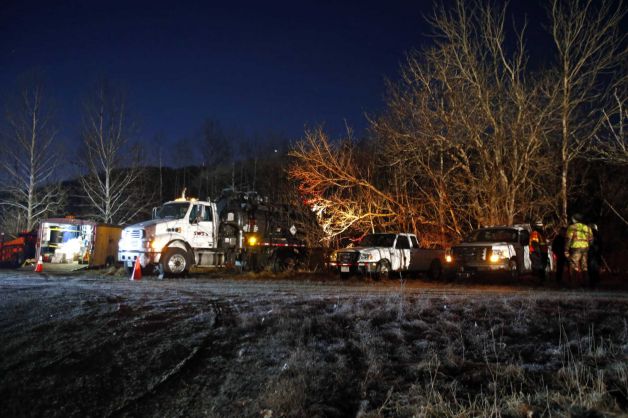
Around 500 Achuar indigenous protesters have occupied Peru’s biggest oil field in the Amazon rainforest near Ecuador to demand the clean-up of decades of contamination from spilled crude oil.
The oilfield operator, Argentine Pluspetrol, said output had fallen by 70% since the protesters occupied its facilities on Monday – a production drop of around 11,000 barrels per day.
Native communities have taken control of a thermoelectric plant, oil tanks and key roads in the Amazonian region of Loreto, where Pluspetrol operates block 1-AB, the company said on Thursday.
Protest leader, Carlos Sandi, told the Guardian that Achuar communities were being “silently poisoned” because the company Pluspetrol has not complied with a 2006 agreement to clean up pollution dating back four decades in oil block 1-AB.
“Almost 80% of our population are sick due to the presence of lead and cadmium in our food and water form the oil contamination,” said Sandi, president of FECONACO, the federation of native communities in the Corrientes River.
Pluspetrol, the biggest oil and natural gas producer in Peru, has operated the oil fields since 2001. It took over from Occidental Petroleum, which began drilling in 1971, and, according to the government, had not cleaned up contamination either.
Last year, Peru declared an environmental state of emergency in the oil field.
But Sandi said the state had failed to take “concrete measures or compensate the native people” for the environmental damage caused.
He claimed Achuar communities were not receiving their share of oil royalties and the state had failed to invest in development programmes in the Tigre, Corrientes and Pastaza river basins that had been most impacted by oil exploitation.
He said the Achuar were demanding to meet with the central government to talk about public health, the environment and the distribution of oil royalties.
“We aren’t against oil exploitation or development we are calling for our rights to be respected in accordance with international laws,” he said.
“Conversations are under way to bring a solution to the impasse,” Pluspetrol told Reuters. “A government commission is there and we hope this is resolved soon.”
Over the past year, the Peruvian government has declared three environmental emergencies in large areas of rainforest near the oil field after finding dangerous levels of pollution on indigenous territories.
Peru’s Environment Ministry said in a statement last week that a commission formed by government and company representatives has been assigned to work with communities to tackle pollution problems and other concerns.
From The Guardian: http://www.theguardian.com/environment/2014/apr/25/indigenous-protesters-occupy-perus-biggest-amazon-oilfield
by DGR News Service | Mar 20, 2014 | Climate Change
By Renee Lewis / Al Jazeera
Climate change may be stunting fish growth, a new study has said. Fish sizes in the North Sea have shrunk dramatically, and scientists believe warmer ocean temperatures and less oxygenated water could be the causes.
The body sizes of several North Sea species have decreased by as much as 29 percent over a period of four decades, according to the report, published in the April issue of Global Change Biology.
The report presents evidence gathered as researchers followed six commercial fish species in the North Sea over 40 years. Their evidence showed that as water temperatures increased by 1 to 2 degrees Celsius, an accompanying reduction in fish size was observed.
It is generally accepted among scientists that decreased body size is a universal response to increasing temperatures, known as the “temperature size rule,” the report said. But before this report, led by scientists at Scotland’s University of Aberdeen, there was no empirical evidence showing this response in marine fish species.
The scientists warned that fish stunting cannot be unequivocally blamed on temperature changes, but they did observe fish stunting across varying species and backgrounds that coincided with a period of increasing ocean temperature.
Other factors that could have influenced fish size include fisheries-induced evolution and intensive commercial fishing — which favors larger specimens. But, the scientists said, these causes would not be likely to affect growth rates across species, which was observed in the North Sea study.
Scientists at the University of Washington have been working on a similar study, looking at many species of fish from Alaska to California. Tim Essington, an associate professor of aquatic and fishery sciences at UW who is working on the study, said he was looking into whether changes in fish body size could be related to environmental parameters.
“We haven’t seen the same strong response,” Essington told Al Jazeera. “But we have seen variation in the sizes of some stocks, like halibut. Its body size has been shrinking sharply over the past 10 years, and has resulted in reduced catch quotas and higher prices at the supermarket.”
He said various factors explain why UW results were different from those of the Scottish team. University of Aberdeen scientists were looking at a much more localized area and a unique data set, and had many more years of data to make comparisons.
Overall, Essington said the Aberdeen findings represented a plausible hypothesis that should be looked at more closely, and that warmer temperatures could explain the stunting.
“Fish aren’t any different than us. It’s all about the difference between how much we eat and how much energy we expend. And they’re arguing that temperature is changing the fishes’ energy versus expension rates,” which could result in smaller sizes, Essington said.
The Aberdeen findings echoed earlier model-derived predictions that fish would shrink in warmer waters. Those projections for future fish size reduction are already being seen in the North Sea, scientists said.
The first global projection of the potential for fish stunting in warmer, less oxygenated oceans was carried out by the University of British Columbia in 2012, and published in the journal Nature Climate Change.
The projection said changes in ocean and climate systems by 2050 could result in fish that are 14 to 24 percent smaller globally.
“It’s a constant challenge for fish to get enough oxygen from water to grow, and the situation gets worse as fish get bigger,” said Daniel Pauly, principal investigator with the University of British Columbia’s Sea Around Us Project, and the co-author of the UBC study.
The study warned that strategies must be developed to curb greenhouse-gas emissions or risk disrupting food security, fisheries and the very way ocean ecosystems work.
From Al Jazeera America: http://america.aljazeera.com/articles/2014/3/19/report-climate-changestuntingfish.html
by DGR News Service | Mar 18, 2014 | Toxification
By Reuters
A major oil pipeline owned by Sunoco Logistics Partners LP leaked thousands of gallons of crude oil into a nature preserve in southwest Ohio late on Monday.
Between 7,000 and 10,000 gallons (26,000-38,000 liters) of sweet crude leaked into the Oak Glen Nature Preserve about a quarter of a mile from the Great Miami River, according to early estimates from the Ohio Environmental Protection Agency.
The leak, which occurred on a line operated by Mid-Valley Pipeline Co, a division of Sunoco, was discovered at 8:20 p.m. EDT on Monday (0020 GMT Tuesday). The company shut the line, which helped reduce the pressure of the leaking oil, an EPA spokeswoman said, but it was unclear if oil was still spewing from the pipe.
Some oil reached a wetland a mile away and on Tuesday, clean-up crews were preparing to vacuum the wetland, located 20 miles north of Cincinnati.
The oil did not appear to have reached the Great Miami River, though tests were still being completed, the EPA said.
“The extent of impact to the resource is currently unknown,” said a statement from the Great Parks of Hamilton County, which oversees the Oak Glen preserve. “The EPA is assessing the situation to determine appropriate action.”
Sunoco was not immediately available for comment.
The pipeline is part of Sunoco’s mid-west system that runs about 1,000 miles from Longview, Texas to Samaria, Michigan, providing crude oil to a number of refineries, primarily in the U.S. Midwest.
Read more from The Raw Story: http://www.rawstory.com/rs/2014/03/18/major-oil-pipeline-leaks-more-than-7000-gallons-of-crude-oil-into-ohio-nature-preserve/
by DGR News Service | Mar 7, 2014 | Climate Change
By Agence France-Presse
Time is running out for Australia’s iconic Great Barrier Reef, with climate change set to wreck irreversible damage by 2030 unless immediate action is taken, marine scientists said Thursday.
In a report prepared for this month’s Earth Hour global climate change campaign, University of Queensland reef researcher Ove Hoegh-Guldberg said the world heritage site was at a turning point.
“If we don’t increase our commitment to solve the burgeoning stress from local and global sources, the reef will disappear,” he wrote in the foreword to the report.
“This is not a hunch or alarmist rhetoric by green activists. It is the conclusion of the world’s most qualified coral reef experts.”
Hoegh-Guldberg said scientific consensus was that hikes in carbon dioxide and the average global temperature were “almost certain to destroy the coral communities of the Great Barrier Reef for hundreds if not thousands of years”.
“It is highly unlikely that coral reefs will survive more than a two degree increase in average global temperature relative to pre-industrial levels,” he said.
“But if the current trajectory of carbon pollution levels continues unchecked, the world is on track for at least three degrees of warming. If we don’t act now, the climate change damage caused to our Great Barrier Reef by 2030 will be irreversible.”
The Great Barrier Reef, one of the most biodiverse places on Earth, teems with marine life and will be the focus of Australia’s Earth Hour—a global campaign which encourages individuals and organisations to switch off their lights for one hour on April 29 for climate change.
The report comes as the reef, considered one of the most vulnerable places in the world to the impacts of climate change, is at risk of having its status downgraded by the UN cultural organisation UNESCO to “world heritage in danger”.
Despite threats of a downgrade without action on rampant coastal development and water quality, Australia in December approved a massive coal port expansion in the region and associated dumping of dredged waste within the marine park’s boundaries.
The new report “Lights Out for the Reef“, written by University of Queensland coral reef biologist Selina Ward, noted that reefs were vulnerable to several different effects of climate change; including rising sea temperatures and increased carbon dioxide in the ocean, which causes acidification.
It found the rapid pace of global warming and the slow pace of coral growth meant the reef was unlikely to evolve quickly enough to survive the level of climate change predicted in the next few decades.
From Physorg: http://phys.org/news/2014-03-great-barrier-reef-scientists.html
by DGR News Service | Feb 4, 2014 | Colonialism & Conquest, Indigenous Autonomy
By David Hill / Mongabay
The Peruvian government has approved plans for gas company Pluspetrol to move deeper into a supposedly protected reserve for indigenous peoples and the buffer zone of the Manu National Park in the Amazon rainforest.
The approval follows the government rescinding a highly critical report on the potential impacts of the operations by the Culture Ministry (MINCU), the resignation of the Culture Minister and other Ministry personnel, and repeated criticism from Peruvian and international civil society.
A subsequent report by MINCU requested that Pluspetrol abandon plans to conduct seismic tests in one small part of the reserve because of the “possible presence of [indigenous] people in isolation,” but didn’t object to tests across a much wider area. In addition to the seismic tests, the planned operations include building a 10.5km flow-line and drilling 18 exploratory wells at six locations—all of them in the reserve which lies immediately to the west of the Manu National Park and acts as part of its buffer zone (see map below).
The government approved the plans on January 27th when the Energy Ministry issued a resolution on the operation’s Environmental Impact Assessment (EIA), written by Pluspetrol together with consultancy Environmental Resources Management.
The decision was swiftly condemned by AIDESEP. The national indigenous organization accused the government and the Inter-American Development Bank (IDB), which has played a key role in gas operations in that region to date, of violating their commitments.
AIDESEP writes that “many ‘isolated’ indigenous people have already died in the name of supposed ‘progress.’ Enough. If one more brother dies, or is taken ill, or there is conflict, we will hold the state, the gas companies, the IDB and those who irresponsibly promote these policies responsible.”
The Energy Ministry could only approve Pluspetrol’s EIA following favorable opinions from other state institutions such as MINCU, the National Water Authority and, because the buffer zone of a national park is involved, the National Service for Protected Natural Areas (SERNANP).
But MINCU’s initial report, dated July 2013, effectively made it impossible for the operations to go ahead, stating that the impacts on the health of the reserve’s inhabitants could be severe, and warning that the Nahua could be “devastated” and the Kirineri and the Nanti made “extinct.”
Opposition to the operations has included appeals to the UN’s Committee on the Elimination of Racial Discrimination (CERD), the UN’s Special Rapporteur on the Rights of Indigenous Peoples, and the Inter-American Commission on Human Rights.
CERD responded by urging Peru to “immediately suspend” the operations. At the end of a visit in December, the UN Rapporteur recommended that the Peruvian government do an “exhaustive study” and that it shouldn’t proceed unless it ensured indigenous peoples’ rights won’t be violated.
The planned operations constitute an expansion of what is known as the Camisea gas project, Peru’s biggest energy development. There are already several well platforms in the indigenous reserve, which have been producing gas for years.
Almost three-quarters of Pluspetrol’s concession overlaps the reserve—officially called the Kugapakori-Nahua-Nanti and Others’ Territorial Reserve—which was created in 1990 and given greater legal protection in 2003.
The reserve’s inhabitants live in what Peruvian law calls “voluntary isolation” or “initial contact,” having sporadic, little or no contact with outsiders and therefore lacking immunological defenses.
Pluspetrol admitted in its EIA that contact with the reserve’s inhabitants is “probable” during the course of its operations, and that such peoples in general are vulnerable to “massive deaths” from transmitted diseases.
From Mongabay: “Gas company to drill in Manu National Park buffer zone, imperiling indigenous people“