Featured image by Michelle McCarron
Editor’s note: This is the latest installment from Will Falk as he follows the Colorado River from headwaters to delta, before heading to court to argue for the Colorado River to be recognized as having inherent rights. More details on the lawsuit are here. The index of dispatches is here.
by Will Falk / Deep Green Resistance Southwest Coalition
To truly understand someone, you must begin at her birth. So, Michelle and I spent the last two days looking for the Colorado River’s headwaters in the cold and snow above La Poudre Pass on the north edge of Rocky Mountain National Park. The pass is accessible by Long Draw Road off of Colorado Highway 14. Long Draw Road is an unpaved, winding, pot-holed trek that takes you fourteen miles through pine and fir forests and past the frigid Long Draw Reservoir before ending abruptly in a willow’d flat.
We found the road covered in an inch of frosty mud which required slow speeds to avoid sliding into roadside ditches. The drive served as a preparatory period in our journey to the Colorado River’s beginnings. The road’s ruggedness and incessant bumps combined with sub-freezing temperatures to ask us if we were serious about seeing the Colorado River’s headwaters. I was worried that Michelle’s ’91 Toyota Previa might struggle up the pass, but the van continued to live up to the Previa model’s cult status.
Long Draw Road foreshadowed the violence we found at the river’s headwaters. Swathes of clearcut forests escorted the road to the pass. The Forest Service must be too lazy to remove single trees from the road as they fall because Forest Service employees had simply chainsawed every tree within fifty-yards to the left and right of the road. About 3 miles from the road’s end, we ran into a long, low dam trapping mountain run-off into Long Draw Reservoir. We expected to find wilderness in La Poudre Pass, so the dam felt like running into a wall in the dark.
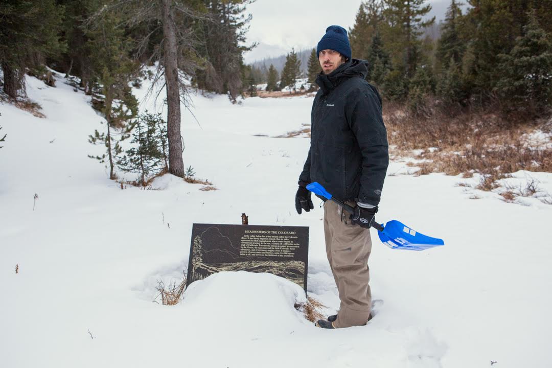
The clearcuts, dam, and reservoir are grievous wounds, but none of them are as bad as the Grand Ditch. We walked a quarter-mile from the end of Long Draw Road where we found a sign marking the location of the river’s headwaters. On our way to the sign, we crossed over a 30-feet deep and 30-feet wide ditch pushing water west to east. We were on the west side of the Continental Divide where water naturally flows west. We contemplated what black magic engineers employed to achieve this feat. The ditch was as conspicuous in La Poudre Pass as a scarred-over gouge on a human face.
The Grand Ditch was begun in the late 1880s and dug by mostly Japanese crews armed with hand tools and black powder. It was built to carry water, diverted from the Colorado River’s headwaters, east to growing cities on Colorado’s Front Range. Close to two feet of swift water ran through the ditch. We learned that even before melting snowpack forms the tiny mountain streams identifiable as the Colorado River’s origins, water is stolen from her. Pausing in a half-foot of powder, I wondered whether the water stored here would end up on a Fort Collins golf course or stirred by the fins of a Vaquita porpoise in the Gulf of California.
Study the Colorado River’s birth and you’ll learn she is born from a wild womb formed by heavy winter clouds, tall mountain peaks, and snowpack. But, she emerges from this womb immediately into exploitation. In La Poudre Pass, the young Colorado River tastes the violence that will follow her the rest of her life.
To repost this or other DGR original writings, please contact newsservice@deepgreenresistance.org
If you continue with your piece on the violence committed to the Colorado River waters, don’t fprget to look at the oilngas industry and their purchase of the millions of gallons of water needed for each well fracked.