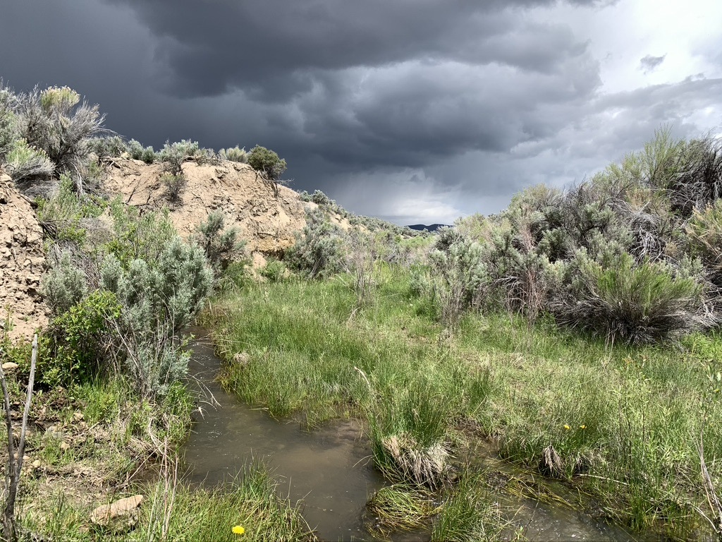
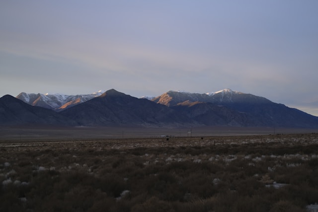
Dispatch From the Lithium Mining War on the West

Dispatch From the Lithium Mining War on the West

A recent financial Webinar features Jindalee mining company executive Lindsay Dudfield selling the company’s plan for an immense lithium mining project that would tear apart the heart of irreplaceable Sage-grouse habitat at McDermitt Creek in southeast Oregon. Australian miner Jindalee has spun itself off as a US company, just as Lithium Americas did when it formed Lithium Nevada Corporation (LNC) to mine Thacker Pass further south in the McDermitt caldera. This positions the miners for federal loan largesse as they pursue mining destruction of the sagebrush sea. I wrote about the extraordinary McDermitt Creek values at stake, and the damage and habitat fragmentation already inflicted by 70 or so previous Jindalee exploration drilling sites here.
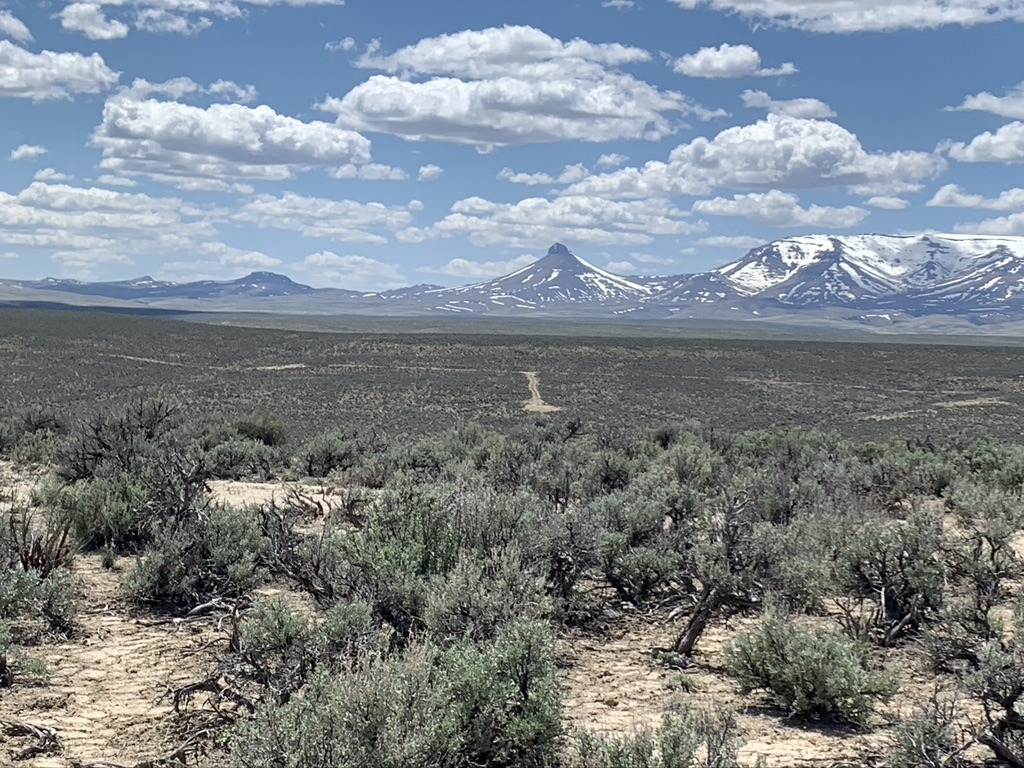
A picture containing outdoor, cloud, plant, shrubland Description automatically generated

Distant view of scar from a new road and just one of Jindalee’s past McDermitt drill sites. Look at how wide open and unencumbered by hills this country is – maximizing the distance any mining disturbance sights and sounds will travel.
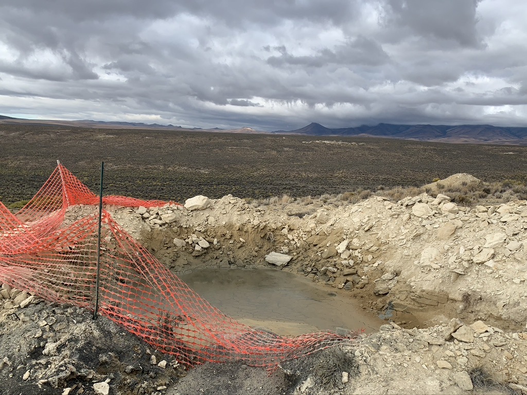
lithium mining

Jindalee drill hole sump. Drilling waste water left to seep into the ground, Wildlife “exclusion” fence fallen down.
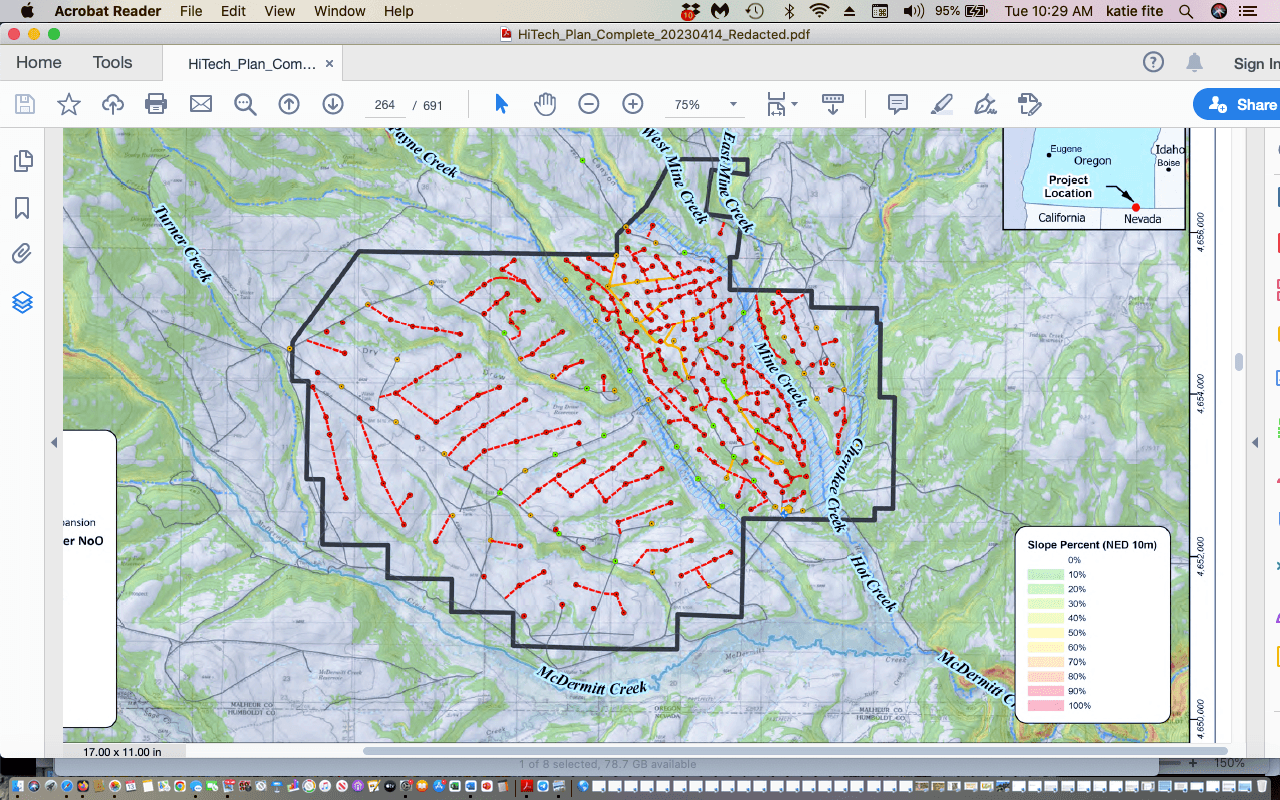
lithium mining This is a map of the ghastly 2023 Jindalee exploration plan to punch in 267 new drill hole and sump sites and construct 30 miles of new roads. It would fragment an area with a very high density of nesting sagebrush songbirds of all kinds. Birds like Sagebrush Sparrow require continuous blocks of dense mature or old growth big sagebrush. Jindalee boasts its consultant environmental and cultural studies have found “no show-stoppers” and “no red flags”. Industry gets the results it wants when it pays for mine consultant work. Federal and state agencies, after a bit of pro forma sniping, acquiesce to what the mine comes up with.

No red flags? Does the company really expect us to believe they or their consultants aren’t aware of the plight of Sage-grouse, and the importance of the stronghold habitat they would wipe out? The 2015 BLM Sage-grouse plan found the entire McDermitt Creek area and nearly all caldera lands were essential for the bird’s survival. BLM determined that a federal mineral withdrawal was necessary to protect this Focal habitat and to ensure Sage-grouse species survival. The withdrawal never happened, stopped first by mining and cattle industry litigation. BLM then began a stand-alone NEPA analysis for the withdrawal. Trump terminated that withdrawal analysis process. Then after a court ruled his action unlawful, BLM foot-dragging has stalled the most recent withdrawal process at the NEPA scoping stage and it appears merged with a cumbersome major plan revision.

Jindalee’s new exploration proposal – a prelude to a mine – would tragically rip apart the Basin heart. A full blown mine here would obliterate it. Mining noise and visual disturbance emanating outward would make the remaining sage ringing the mine site uninhabitable. The site is surrounded by dozens of leks.

The impossibility of mitigating a mega-mine at McDermitt Creek just blasted further into the stratosphere. Mounting scientific evidence shows how seriously the sight and sound disturbance footprint of industrial projects harms the birds. New research examined geothermal energy development impacts from Ormat plants at Tuscarora Nevada and McGinness Hills/Grass Valley near Austin. (I remember the Battle Mountain BLM manager extolling Ormat’s virtues when the McGinness project was pushed through and then later expanded to take a bigger bite out of sage habitat). New research found:

“… sage-grouse population numbers declined substantially in years following the development of a geothermal energy plant … sage-grouse abundance at leks [breeding sites] decreased within five kilometers of the infrastructure and leks were completely abandoned at significantly higher rates within about two kilometers. So, we looked at the mechanisms responsible for declines in numbers and lek abandonment, and we found adverse impacts to survival of female sage-grouse and their nests”.

This reinforces common sense: “Nests located farther from the plant tended to experience higher rates of survival. Interestingly, where hills were located between sage-grouse nests and infrastructure [high topographic impedance], we found the distance effect to be less important. Under those circumstances topography was compensating for the lack of distance and likely serving to reduce effects of light and sound”.

The physical footprint of geothermal energy infrastructure is small relative to other renewable energy … but noise and light pollution emanating from these power plants likely cause larger adverse direct impacts to wildlife populations than infrastructure alone”.

There aren’t big hills to block a lithium mine’s 24 hour a day sight and sound impacts in the McDermitt bowl. The mined area would suffer outright sage obliteration. Surrounding sagebrush would be exposed to unimpeded straight line 24 hour a day mine operation visual impacts and noise of all kinds.

Jindalee must know of the indigenous opposition and resistance to the Thacker Pass lithium mine in the southern caldera, located in similarly unceded Paiute-Shoshone ancestral lands. Controversy and lawsuits over Thacker Pass have been in the headlines for years. It’s a pre-eminent example of an unjust transition to alternative energy and the green-washing of air and water polluting habitat wrecking dirty hard rock mining. Unfortunately, a District Court Judge’s ruling did not halt the Thacker Pass mine construction. However, the lawsuits by environmental groups, Tribes and a local rancher opposing the mine continue. The District Court decision was appealed to the Ninth Circuit, where a hearing is scheduled for June 26.

Thacker Pass mine development would destroy a Traditional Cultural Property, where Paiute-Shoshone ancestors were massacred. This spring, it’s been the site of the indigenous Ox Sam Women’s Camp, Newe Momokonee Nokotun, set up in protest. Descendants of Ox Sam, a survivor of a US cavalry massacre at Thacker Pass, helped establish it.

Jindalee Webinar statements also hint at efforts afoot to alter Oregon state mining processes. After lamenting the project wasn’t in Nevada, Jindalee said it was talking to politicians and the head of the state mining Department (DOGAMI).

The company’s braggadocio made me blow off deadlines and go once again to McDermitt Creek to document its great biodiversity values. I then went from the beauty of singing sagebrush songbirds, newly hatched Sage-grouse chicks and peaking rare plant blooms at McDermitt Creek (photos below) and down into the Montana Mountains by Thacker Pass.
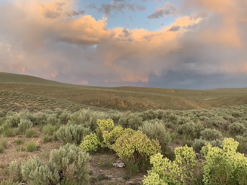
A picture containing cloud, outdoor, grass, sky Description automatically generated

A bird perched on a plant Description automatically generated with medium confidence

Sagebrush Sparrows abound at McDermitt Creek. They’re great little birds and often sing throughout the day. And they’re vanishing from many places. A biologist just told me he thinks they may be extirpated in Morrow County Oregon where he’s long inventoried bird. No larger continuous blocks of lower elevation sage = no Sagebrush Sparrows.
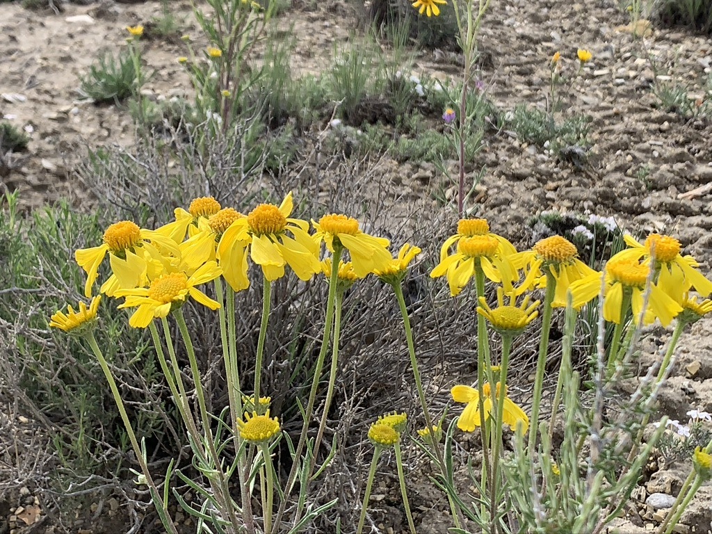
A group of yellow flowers Description automatically generated with medium confidence

Hymenoxys, an Oregon sensitive plant growing on clay soils.

A picture containing outdoor, flower, plant, leaf Description automatically generated

Humboldt Mountains Milkweed, a medicinal plant, on clay soils.
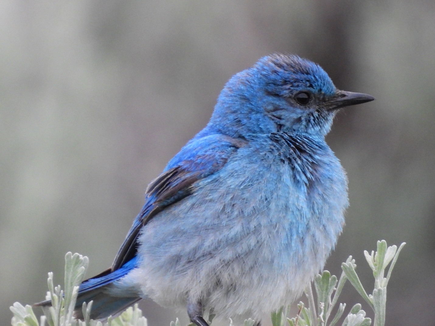
A blue bird standing on a plant Description automatically generated with low confidence

Mountain Bluebird.

A picture containing cloud, outdoor, sky, landscape Description automatically generated

Sky drama all spring long.

A lizard in the dirt Description automatically generated with low confidence

Short-horned Lizard – a master of invisibility.

A bird perched on a branch Description automatically generated with medium confidence

Gray Flycatcher. They nest in head high Basin big sagebrush, which is becoming as scarce as hen’s teeth.

A bird perched on a plant Description automatically generated with medium confidence

Lark Sparrow. They’re exuberant singers and are dining on Mormon crickets at McDermitt Creek.

A close up of a flower Description automatically generated with medium confidence

An indescribable Indian paintbrush hue.

We’re supposed to sit back and let all this beauty and biodiversity be destroyed for a lithium mine? No way.

Thacker Pass – Turmoil, Land Mutilation, Montana Mountains

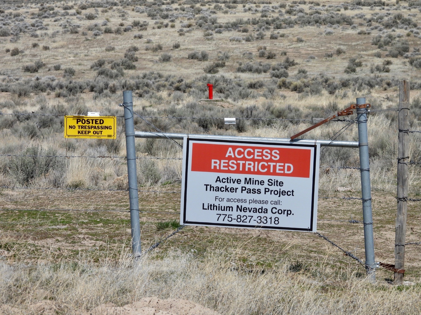
I drove south to Orovada and headed west to the turn-off from the state highway into Pole Creek road, the main access to the Montana Mountains. Thacker Pass lies at the southern base of these mountains. A maroon Allied Security company truck squarely blocked the road. Chain link fencing with No Trespassing and No Drone Zone signs was placed off to both sides.

lithium mining I stopped, got out and approached a security guard who appeared at the truck. He refused to let me pass. After several minutes of my insistent repetition that this was a public road, the BLM mine EIS said this road would always be open, and that blocking use of this road indicated the EIS, the BLM and Lithium Americas had lied, the security guard relented and said he would call the head of security.
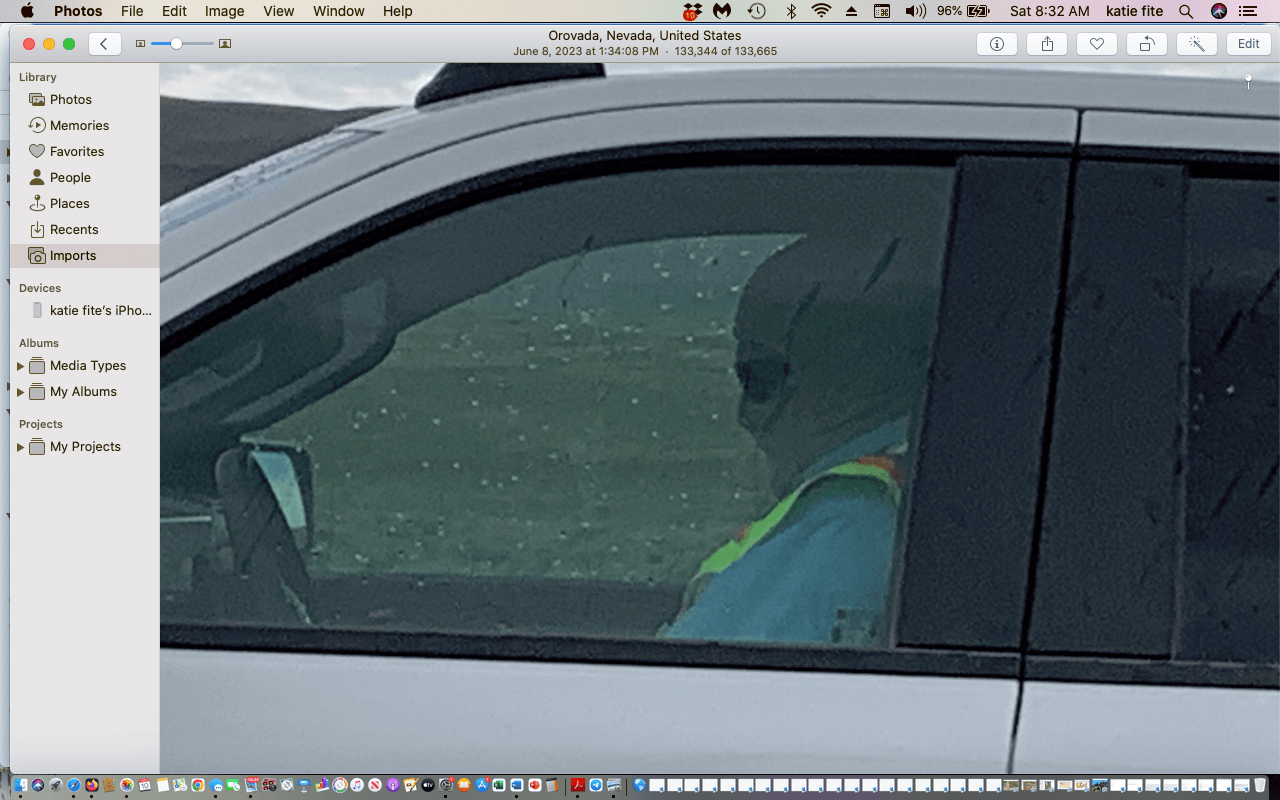
lithium mining  The boss pulled up in a white truck as a sudden rain whirlwind bore down. His face was obscured, and identity concealed by a tan balaclava-like hood and dark sunglasses. When he first arrived, he got out of his truck and pointed a camera device at me. I thought WTF is this – a security firm mercenary decked out for Operation Iraqi Freedom? Abu Ghraib in Orovada? I again repeated repeatedly that this was a public access road, and I was going up into the Montana Mountains to camp. He retreated to his pickup, likely to run me and my license plates through some creepy database. Finally, I was allowed to pass through.

Just up the road was the Ox Sam Protest Camp site, located on a huge mine water pipeline gash that the lithium company had gouged into the earth. The pipeline gash runs right by the sacred Sentinel (or Nipple) Rock. The tents appeared lifeless, flaps blowing open in the rain squall as I drove by. With better cell phone service up in the mountains, I called Winnemucca BLM, asked to talk to a Manager, Assistant Manager, somebody, and told the receptionist that the mine was trying to block the public access road. She said there was no one to talk with. I asked for a Manager’s e-mall address. She refused to give me an address and shunted me to the general BLM mailbox where public comments go to be ignored. Winnemucca is the BLM outpost in charge of enforcing LNC’s compliance with EIS requirements. They’ll be sure to jump on enforcement actions when the public brings potential mining violations to their attention over the next 45-years.

Later I saw a Google alert for “Thacker Pass”, and read that the camp had been raided after an incident. Underscore News/Report for America writes: “On Wednesday, police from the Humboldt County Sheriff’s Office and private security for Lithium Nevada, a subsidiary of Lithium Americas, cleared the camp and arrested one protester.

When I left the next day, the chain link fence with No Trespassing signs was still up by the sides of the access route. The security truck was gone, and I drove on through. A local resident pulled up. We chatted, gazing up at the mountains that were witnessing the lithium mine destruction unfold. He knows the country like the back of his hand. He said you could see over 20 mountain ranges from the Montanas. Our presence generated the interest of security guards who came by to check us out as we stood by the state road right of way. A project worker came and moved the chain link fence with its No Trespassing signs away – at least for now.

Allied Security’s aggressive approach to security has gained notoriety. The Denver city council canceled their contract after two Allied guards beat a black man so hard they caused him permanent brain damage. In May, Time magazine profiled a long troubling history of Allied incidents.

How fitting. Lithium Americas came in claiming Thacker Pass was some kind of great “green” mine, as cover for plain old dirty open pit mining and a noxious lithium processing plant. Now they’ve hired a security firm prone to violence. I don’t know what went down with the Ox Sam camp. But I do know that having the security boss decked out in black ops head gear is an effort to intimidate, and an indication the security firm may have things to hide. Security personnel concealing their identity or playing gatekeeper on a public lands access road in this way have no place at a project on public lands. Months before the Ox Sam camp was set up, LNC had established a manned compound with a building and fencing and what looked like cameras right by the Pole Creek access road. Driving up into the mountains in April to trek across the snow to the Montana-10 lek had already felt like running a gauntlet. I wager that anyone going in or out that public road gets recorded.

LNC has many mining claims staked up in the mountains in Sage-grouse stronghold habitat including at the Montana 10 lek. This makes efforts to limit access or intimidate people so they don’t go up there more concerning. Back home, I consulted the Thacker Final EIS:

SR 293, Pole Creek Road, Crowley Creek Road and Rock Creek Road are the main transportation routes in the Project area. Under Alternative A, LNC would not close, block, or limit in any manner access along these routes”. FEIS at 494-495. The EIS also constrained use of these access roads for certain types of mine activities.

Photos below from up in the Montana Mountains looking down on spring 2023 LNC scars from drilling and bulldozing in migratory bird nesting season. The drilling is creeping upslope. It’s hard to tell if some may be outside the project boundary. Nevada BLM uses in-front-of-the-bulldozer bird survey protocols that are deeply flawed with transects spaced 100 ft. apart – a distance far too wide to detect cryptic sagebrush birds that are experts at concealment. You practically have to step on or by a nest to detect it. The only way to avoid migratory bird “take” is for the mine to not destroy the bird habitat in spring.
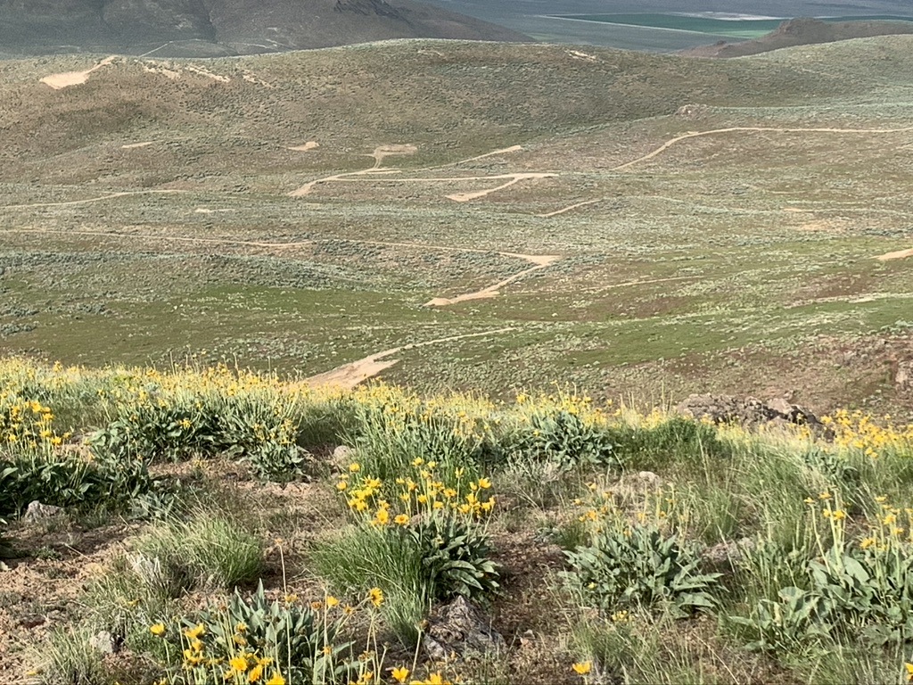
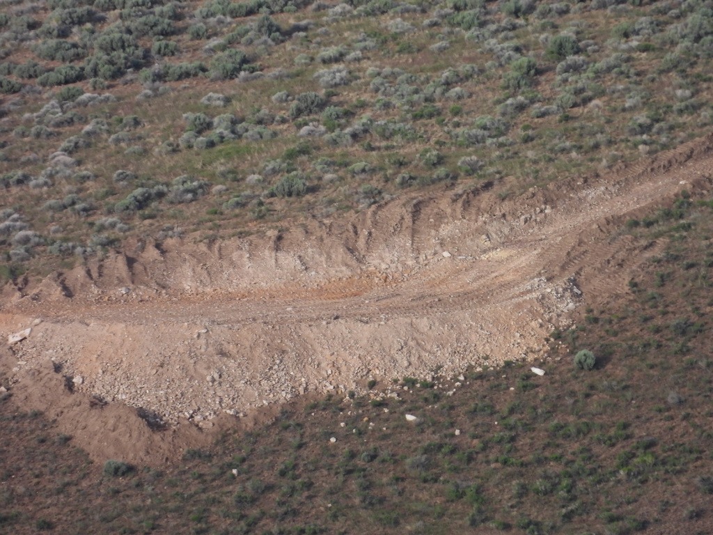
A picture containing outdoor, grass, landscape, mountain Description automatically generatedA picture containing outdoor, ground, mountain, soil Description automatically generatedA picture containing cloud, mountain, outdoor, sky Description automatically generatedLNC’s drill scarring is a mere prelude to the destruction that’s planned – 5,694 acres of outright destruction in a 17,933 acre project zone. The enormity and scale of the planned mine is mind boggling – a deep open pit, a waste rock pile, all types of infrastructure, a lithium smelter/sulfuric acid plant on-site using huge volumes of waste sulfur shipped into a new railroad off-loading site by the Winnemucca airport. The latter was just announced a few months ago, to the dismay of nearby residents who find themselves facing living by a hazardous materials zone. Hundreds of tons of off-loaded material will be trucked to Thacker Pass and burned every day in a plant whose air scrubber design wasn’t even finalized before the Thacker decision was signed by BLM. What stink and toxic pollution will this lithium processing generate? McDermitt caldera soils contain uranium and mercury. Mine water use is estimated to be 1.7 billion gallons annually. Enormous volumes of diesel fuel will be used throughout the mine’s operation. What’s green about all this?

lithium mining

Think of the volume of water that will be sucked through these pipes.
A picture containing cloud, outdoor, grass, plant Description automatically generated

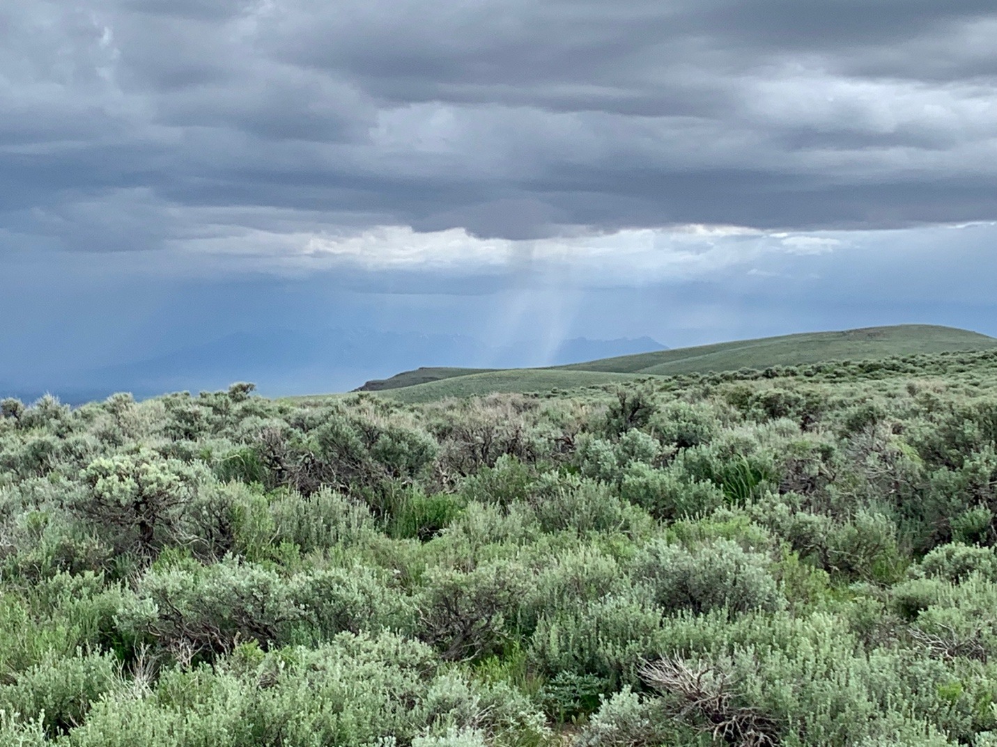
Beautiful dense big sagebrush full of Sage Thrashers, Brewer’s Sparrows, and Sage-grouse sign, up in the mountains where LNC has claims galore.
A picture containing outdoor, flower, sky, plant Description automatically generatedClose up of purple flowers Description automatically generated with low confidenceSacrificing the Interior West for Corporate Energy Dominance While Energy Conservation Lags or Is Forgotten Altogether

Big Green environmental groups and outdoor interests who’ve been silent on the unfolding lithium mine destruction at Thacker Pass, or the tragic destruction of Mojave Desert Tortoise habitat for Big Solar and many other brewing “green” energy controversies better wake up. The lithium boom plague that’s descended on the West is hard rock mining at its worst. Thousands of acres at each mine site become essentially privatized (with security guards) for 40 or 50 years. Much of the land is reduced to waste rock rubble piles, gaping pits, infrastructure all over the place. Local water is used up for processing and for suppressing clouds of dust, and mine pollutants contaminate the air and ground water.

US taxpayers are helping finance these colonialist lithium mines. LNC received commitments for a $600 million dollar loan investment of US tax dollars. General Motors, while continuing to pump out gargantuan trucks and EV Hummers priced at $110,000, provided LNC with a $600 million dollar injection. In the Jindalee Webinar, executive Dudfield assured a questioner that their company will also be “in queue” for similar handouts. The miners are gobbling up funds for a battery technology that may soon be outdated. China is zooming past the US with its development of sodium batteries and is introducing them in low-end vehicles, a sane path forward. Why aren’t these funds going to research alternatives to lithium and safer less earth-wrecking technologies? Why isn’t Nevada Senator Catherine Cortez-Masto directing her attention to spurring new technologies and sustainability? Instead she’s using “critical minerals” mantra to justify introducing a bill to make the 1872 Mining Law even worse, and a wholesale giveaway to mining companies.

Jindalee’s Webinar talk said the company embraced “social license and responsibility”, then later emphasized that McDermitt Creek was “a long, long way” from Oregon population centers like Salem and Portland. This highlights how lithium mine pollution, cultural site desecration, community de-stabilization and ecological damage will be out of sight and out of mind of urban elites.

US government policy is now based on greatly accelerating energy colonialism of all types within our own borders, and especially on willy-nilly sacrifice of the public lands of the Interior West. This allows massively subsidized corporations (often tied to a foreign mothership) and billionaires to retain a chokehold on energy. Conservation is paid lip service. BLM’s Tracy Stone-Manning just announced a new proposed rule making it easier for BLM to hand over public lands to wind and solar developers, furthering de facto public lands privatization for half a human lifespan.

But people are catching on. A surprising thing recently happened in Idaho. The entire Idaho legislature (all the Republicans and the hand full of Democrats alike) voted in favor of a Resolution opposing the BLM Lava Ridge Wind Farm, with its 400 turbines standing 800 feet tall sprawling across 3 counties. Lava Ridge’s plan managed to offend or disgust everybody – from agricultural operations and home site impacts, to Golden Eagle and rare bat killing, to destroying the stark setting of the Minidoka Japanese Internment Camp Monument and marring the Dark Skies and wildness of Craters of the Moon.

The same Legislators, who in a normal year would be inviting Land Grab proponents from Utah to speak in the session, were pushing protection of public lands from this behemoth of LS Power’s subsidiary Magic Valley Energy. It’s facilitated by the planned new LS Power SWIP North renewables-focused transmission line. Idaho Power and PacifiCorp’s Gateway “green” transmission line has also resulted in a stampede for more wind and solar
leases in south-central Idaho.

If you live in the West and love the outdoors, be very afraid of what the Biden administration’s breakneck push for many more of these “green” lines will do to public lands, and your access to areas beyond – once projects feeding energy into the line are built and the fencing goes up. It’s the sagebrush sea equivalent of building a road through the Amazon.

While there are no huge wind farms yet on public lands in Idaho, there are many smaller scale turbine arrays on private lands across the Snake River Plain. It’s become quite apparent that industrial wind is not benign. Above all else, folks realized how badly Idaho was getting screwed by the Lava Ridge project and its export of energy to benefit coastal populations. The Legislature said No to Lava Ridge exploitation of Idaho as an energy colony. Counties in the Mojave Desert are now starting to resist some industrial solar developments overrunning public lands. Remotely sited “renewable” energy or “critical minerals” projects amount to public land privatization. They cause profound losses of many kinds – scarring the land, sucking it dry, extinguishing the wildlife that’s managed to persist in the face of merciless domination since White settlement, trenching a massacre site.

lithium mining I’m outraged at the ecocidal stupidity with which this “energy transition” is being carried out. Will we soon see Jindalee get US tax dollars to wipe out the McDermitt Creek Sage-grouse stronghold? How ironic that would be. Interior just announced funding for major sagebrush habitat restoration using Infrastructure Bill funds in High Priority sagebrush areas. It turns out one of the sites chosen is the Montana Mountains area. Mapping shows it includes the Thacker Pass mine area too, where nearly all the sage is on the verge of being destroyed by LNC. Close review of maps for Interior’s Montana “restoration” project shows it encompasses the McDermitt Creek watershed, hence the entire area coveted by Jindalee for massive new drilling followed by open pit mining. It would be absurd to greenlight Jindalee’s ghastly exploration plan in primo habitat, when the Interior Department has identified this very same landscapeto be among the highest priority for restoration – because so much sage has already been lost already. The caldera is also key for connectivity between Sheldon and Owyhee Sage-grouse populations and for biodiversity preservation.

How long before rejection of lithium and other “critical mineral” mines grips communities, especially as promised jobs evaporate with increased mine automation and robot technology, and as the environment goes to hell? But hey, as LNC is showing us, there’s always a bright future as a security guard– at least until the lithium company gets itself a pack of Robodogs.
lithium mining

Katie Fite is a biologist and Public Lands Director with WildLands Defense.

Threats to Forests in the Capital of India

Threats to Forests in the Capital of India

Editor’s Note: In today’s piece, we bring to you two issues from New Delhi, India. First, the Dwarka forest is being threatened with deforestation for redevelopment projects. Second, the spotted deer in Deer Park are being relocated to a different state because the authorities now believe that the deer have become “unmanageable.” The eco-suicidal drive of our collective culture is what makes decisions. The needs of nature and life come secondary. Both of these issues are a reflection of the same trend. The two issues are followed by a video from one of our readers. We thank Tannuja for providing us with the stories and David for offering the video.


Deforestation in Dwarka Forest

Location

An obscure 120 acre forestland in Dwarka, New Delhi, India.

History

This dense forest, hardly known to the public of Delhi, is located right behind New Delhi Indira Gandhi International Airport’s T3 Terminal. It is a newly grown forest that is under the threat of eradication due to rapid urbanization taking place in the area.

Importance

  1. Home to several species of both flora and fauna. Wildlife such as spotted deer, nilgai, local species of birds and many other animals have been thriving in the jungle peacefully.
  2. This forest is close to Sahibi river, though it is newly grown forest (around after 2008), it falls in the migratory route of Birds arriving at Great Najafgarh Lake.
  3. It also decreases the habitat concentration (overpopulation stress) from Najafgarh Lake.
  4. Delhi airport emissions are on a constant rise. So, this natural forest soaks up all that massive carbon emissions as it is situated pretty close. Shielding Dwarka citizens from jet fumes.
  5. Delhi airport is an urban heat-island and this forest helps regulate the rising temperature.
  6. Reports state that due to excessive groundwater extraction – nearby areas are going to SINK! This forest falls in low lying area so it recharges so much water to keep the Dwarka & Kapashera areas from sinking.

What is the crisis that has struck?

Recently, it was reported by a local resident named Mr. Naveen Solanki, that the forest is rapidly being destroyed by the Railways Authority for Bijwasan Railway Terminal Redevelopment Project. Since January 2022, he has been defending the forest on his own and has even filed a complaint in the Forest Department of New Delhi against the same. Yet the complaints have been going unheard.

Even earlier, the Rail Land Development Authority (RLDA) had been slapped with a fine of almost 5.9 crore rupees (750,000 USD) by the Forest Department for felling 900 trees in the forest. The aggressive and rapid deforestation in the area continues to take place to this date for the Railways Project.

The wildlife that live in the forest, are at large risk of not only losing their home but being killed off as well by having no other option but to come out on the roads and into nearby areas with human settlements.

“Will the Government of India and authorities involved, do the right thing by putting an end to this atrocious eradicating of our forest lands?”

Link to complaints made by Mr. Solanki made public via. his Twitter account


Relocation of Deer from Deer Park

Location

Hauz Khas, South District, New Delhi, India.

History

This is a 60 year old, sprawling 60 acre bio-diversity park that is situated within the heart of the capital city. It was named after activist and social worker Aditya Nath Jha and popularly known as “Deer Park” because of the significant population of spotted deer — which it has been home to for the last six decades.

Importance

  1. A landmark place in the capital, it is home to not just the spotted deer population but hundreds of local species of birds, most notably the Indian peafowl, ducks and also a significant population of Indian monkeys and rabbits, along with a variety of flora as well.
  2. For the last 60 years, the wild animals in the park have been thriving without any direct human intervention so far. Which is a matter of great feat considering Delhi has lost almost its entire wildlife population throughout the courses of its history.
  3. One of the largest green belts to exist in New Delhi, it would be right to call it as one of “the lungs of Delhi” because it, collectively with other green belts, provides clean and fresh air in the otherwise heavily polluted capital city.
  4. Plus, the existence of wild animals and to see them thriving within the park premises, is a sight to behold.

What is the crisis that has struck?

Very recently, The Ministry of Environment, Forest and Climate Change, India, along with The Central Zoo Authority (CZA) has passed an order deeming the existence of spotted deer population in the park as unmanageable.

So, it not only stripped-off the park of its “mini-zoo” title, but has decided to shut it completely by relocating its entire deer population (over 600 in number) to their “natural habitat” in the western state of Rajasthan — to be served as prey to other wild animals there. The place where the government wants to dump them (Rajasthan) is a desert state, with extreme arid climate throughout the year. These deer are used to living in the bearable, if not pleasant climate of New Delhi throughout their hundreds of generations. Now imagine getting dumped somewhere where there are no water sources readily available along with no grassland. The deer would come into a state of shock from not just the animals who’d want to hunt them but also the scarcity of their regular diets which they have been used to for years. The rise in the number of deer should’ve been a matter of pride and celebration, not an excuse to kick them out of their own home and take it all over.

Also, it would completely be put under the management of Delhi Development Authority (DDA) once the deer are relocated, which means that its landscaping would be altered or changed, to make it more accessible to humans/public.

“If the population of deer has become unmanageable, then why are the entire deer being relocated and not just a percentage of them?”

The concerned people of Delhi also fear that once the deer population is gone, then DDA also might start indulging the catering/event mafias in the park — to host private events and parties of the South Delhi elites in the park premises. The park would become a human-infested picnic spot and the talks about the authorities indulging catering/event mafias in its premises later on just might be right.This would only lead to littering and pollution in the park and impact/disturb its other wildlife residents that have been living peacefully there for the last six decades. Plus, many who have grown up in Delhi, have sentimental memories/values attached to the Deer Park. Hence, losing such a wildlife haven that has been there for the last sixty years in the heart of our city, has become nothing less than an utter shock to all of us.

Links to published pieces on the same issue via. various Indian media houses
https://www.livemint.com/news/india/delhi-an-jha-deer-park-loses-its-mini-zoo-tag-deer-to-be-relocated-11687938994427.html
https://www.timesnownews.com/delhi/delhi-deer-park-in-hauz-khas-is-closing-forever-its-deer-to-be-shifted-article-101356425
https://zeenews.india.com/india/delhi-set-to-lose-its-famous-deer-park-in-hauz-khan-heres-why-2627894.html


Warrior’s Choice

Fences, Roads, and Walls Cut Nature Into Pieces

Fences, Roads, and Walls Cut Nature Into Pieces

Editor’s note: one of the worst environmental disasters that nearly no-one has heard of is “habitat fragmentation.” Many ecologists believe that habitat fragmentation is the single most serious threat to biological diversity and is the primary cause of the present extinction crisis.

Fences, roads, utility corridors, and other linear human disturbances increasingly shatter habitats into smaller and smaller pieces, with drastic consequences. This crisis is not being addressed, and it gets worse every day. This article explores one part of this problem: the effects of fencing on Pronghorn.


By Tara Lohan

With the arrival of spring each year, pronghorn that winter in the Upper Green River Valley of Wyoming begin a journey of more than 100 miles to their summer habitat near Grand Teton National Park.

It’s one of the longest migrations of large mammals remaining in North America. But their trek — and a similar one made by mule deer — is made more difficult by human developments along the way, particularly fences.

“The total length of fencing around the world may now exceed that of roads by an order of magnitude, and continues to grow due to a global trend towards land partition and privatization,” wrote researchers of new U.C. Berkeley-led study published in the Journal of Applied Ecology.

Wyoming is no exception. There the researchers found nearly 3,800 miles of fences in their study area alone — twice the length of the U.S.-Mexico border. Their research tracked GPS-collared pronghorn (Antilocapra americana) and mule deer (Odocoileus hemionus) during two years of their migrations to better understand how fences affect the animals’ movements and which kinds of fences may be most difficult.

Fences aren’t always bad for wildlife — some can keep animals off roads, for instance — but they can also pose threats. [Editor’s note: to use precise language, these fences aren’t “good” for wildlife; they partially mitigate some of the harms of roads]

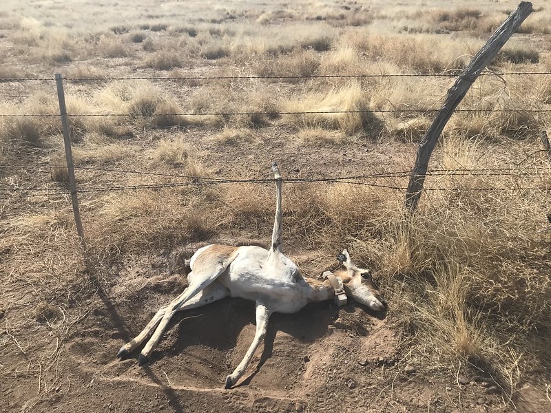
For animals like pronghorn and mule deer, fences can halt or change migration routes. Animals that attempt to go over or under also risk becoming entangled and perishing. Juveniles are particularly at risk. A 2005 Utah State University study of ungulate migration across Colorado and Utah found the youngsters died in fences 8 times more often than adults. Many others died of starvation or predation when they weren’t able to cross fences and were separated from their mothers.

dead pronghorn caught in fence
A radio-collared pronghorn perishes after being tangled in unmodified barb-wire fencing while trying to cross. Photo: Texas Parks and Wildlife Department and the Borderlands Research Institute (CC BY 2.0)

Most of the fences the animals encounter run along the edges of livestock pastures, private property lines or roads, and are composed of four or five strands of barbed wire. Some have woven wire at the bottom, the most common type of fence for corralling sheep but also the most lethal to wildlife.

“A better understanding of wildlife responses to fencing is … critical to conservation,” the researchers of the U.C. Berkeley study wrote.

But here’s what we do know: The study found that both pronghorn and mule deer “were extensively affected by fences.”

Each year an average mule deer encountered fences 119 times and pronghorn 248 times. In about 40% of those encounters, the fence changed the animal’s behavior. And that behavior, they found, was more complex than simply crossing or not crossing the fence.

Often the animals “bounced,” or rapidly moved away from the fence when they couldn’t quickly cross. “Such avoidance of fences can drive animals away from high‐quality resources and reduce habitat use effectiveness,” they wrote.

Other times the animals paced back and forth along the fence line, a behavior that could strain energy resources. And occasionally they became trapped in areas with a high concentration of fences, like livestock pastures.

This can create other problems.

“Constraining animal movements for prolonged periods within limited areas may trigger human–wildlife conflicts,” the researchers found. Pronghorn, for example, have been seen in new developments in Colorado Springs, where they’ve been hit by cars and shown up at the airport.

Mule deer and pronghorn also behave differently when encountering fences. Mule deer are more likely to jump a fence, and pronghorn to crawl under.

“The reluctance to jump means that pronghorn movements can be completely blocked by woven‐wire sheep or barbed‐wire fences with low bottom wires — the two most common types of fences across their home range in North America,” the researchers found.

Considering that the American West may have upwards of 620,000 miles of roadside and pasture fences, “fence modifications for conservation might be more urgent than currently recognized,” they wrote.

Efforts are underway to encourage or require more “wildlife-friendly” fences that “are very visible and allow wild animals to easily jump over or slip under the wires or rails,” according to recommendations from Colorado’s Parks and Wildlife agency.

Further guidance from Sustainable Development Code, an organization that works on sustainability issues with local governments, recommends using smooth, instead of barbed wires; limiting the height of fences 42 inches; allowing 16 inches of clearance at the bottom; and including wide spacing between wires.

person working on fence
Raising net-wire fencing to a height that pronghorn can crawl under. Photo: Texas Parks and Wildlife Department and the Borderlands Research Institute (CC BY 2.0)

“There are other forms of wildlife-friendly fencing, including ‘lay-down’ or temporary fences that permit wildlife crossing during critical migratory seasons,” the group reports.

Making fence lines more visible is also helpful to other animals, including birds. Low-flying birds, like grouse, also die in fences across the West’s rangelands.

That’s why wildlife managers are beginning to push for removing or modifying fences, but the effort can be costly. To address this concern, the researchers developed a software package, available to wildlife managers and other researchers, that highlights fences posing the biggest threats to animal movement. They hope it will help make the best use of limited conservation funds and help protect critical migration pathways.

“We demonstrate that when summed and mapped, these behaviors can aid in identifying problematic fence segments,” they wrote. And that could help save a lot of pronghorn, mule deer and other animals.


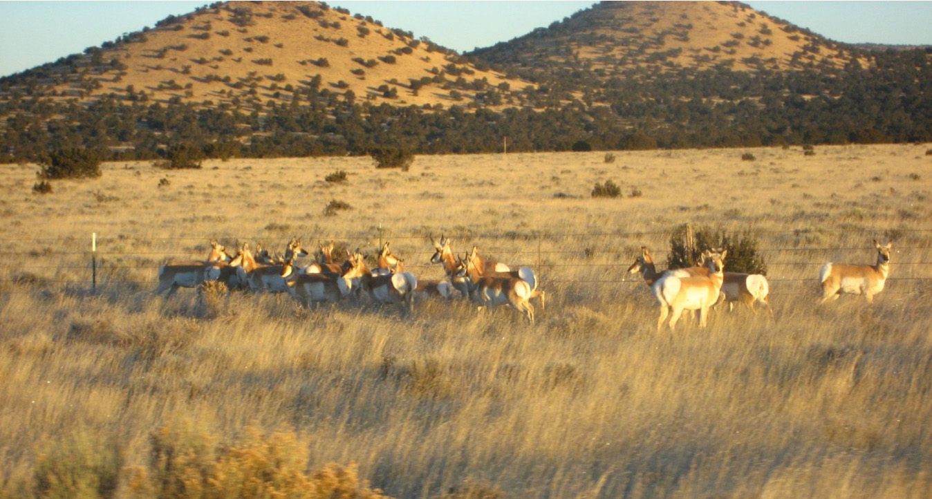
Ths story first appeared at The Revelator. Banner image: Pronghorn encounter a fence line in New Mexico. Photo: Johnida Dockens (CC BY-NC-ND 2.0)

¡Sí a La Vida, No a La Mina! Yes to Life, No to the Mine!

¡Sí a La Vida, No a La Mina! Yes to Life, No to the Mine!

A gold mine project in Veracruz that has run into local opposition  envisions a low CAPEX, simple heap-leach open pit mining operation targeting approximately 100,000 ounces of gold production annually. Gold reserves at the project are estimated at 575,000 ounces which assures high pollution and destruction of the land in order to yield as much of the precious metal.


By Alejandro Beltran Cordero / Weave News

A new gold mine in Veracruz, Mexico, will be the first one in the world to be opened only two miles away from a nuclear reactor and from many pipelines – all in the middle of a densely populated, touristic area that is also the most important migratory route in North America. These are some of the main reasons why local activists are strongly opposing the project.

A History of Colonial Extraction

Mexico has a long mining history. Before the conquest, gold and silver were sought mainly to make jewelry and offerings. Tin, lead, and copper were also mined in the state of Michoacán after the Purembes (Tarascans) found a way to extract and work it. All these minerals were used to make certain tools, utensils and weapons.

But the history of extractivist mining in Mexico begins with the Spanish invasion. Most of the mineral resources were exported to Spain, and it is stated in the General Archive of the Indies (an important Spanish colonial archive housed in Seville, Spain) that 185,000 kilos of gold and 16,000,000 kilos of silver arrived in Spain from America between 1503 and 1660 alone.

“La Paila” and Other New Projects

Despite the efforts of the Spanish crown, however, Mexico still retains vast mineral wealth, and there are currently 21 mining projects about to start up.  The project that concerns us was once known as “Caballo Blanco” and now as “La Paila,” which is the name of the hill where the project is to be located. This would be an open-pit gold mine on the hill of “La Paila” in the municipality of Alto Lucero, Veracruz.

The mining company is a subsidiary of the Canadian Candelaria Mining Corp., which reports that it has 12 concessions on 19,815 hectares of land (roughly 76.5 square miles) for the main project. The company has also identified four “high priority targets” for further exploration in the surrounding area: Bandera Norte, Bandera Sur, Las Cuevas, and Highway North. If permits for these additional projects are approved, it would significantly increase the footprint of Candelaria’s activity in Veracruz.

Impact of Extraction

To operate just one of these projects, thousands of liters of water are required for the leachate lagoon. These are the waste products of the process. They remain in the tanks and contain cyanide, sulfuric acid, mercury and other solvents that will be used to obtain 0.03 grams of gold for each ton of soil. Gold is associated with quartz rocks that must be ground, placed in large mounds, and washed with water mixed with cyanide. This represents a great risk for the populations living downstream from the mine. In addition, the water used for these projects is extracted from the nearby aquifers, leaving the local populations without water.

To extract the rock, large tajos (quarries) are opened that will remain there permanently. Such a process gives no thought to the layer of soil and vegetation that have to be destroyed in order to open these large holes in the earth, leaving a lunar landscape in which life would be impossible.

According to research presented in 2015 in La Jornada Ecoloógica, the following is necessary in order to obtain one ounce of gold, or what is contained in a “US Golden Eagle”:

  • extraction of 150 tons of rock
  • 40 kilos of explosives (enough to demolish a five-story building)
  • processing of 25 to 50 tons of earth leached with cyanide solution
  • release into the environment of three kilos of cyanide salts (enough to kill 60 thousand people)
  • consumption of 100,000 to 150,000 liters of fresh water (enough to provide services to an average family for one year)
  • consumption of 1300kws of electrical energy (enough for an average family for a month)
  • consumption of 450 liters of fossil fuels to maintain water supplies and move mine equipment
  • emission of 650 kg of CO2 into the atmosphere along with other greenhouse gases such as sulfur dioxide and nitrogen oxide

The researchers also report that this type of project offers only 15 person-hours of income to the region, or “the salary of one person working for two days” (La Jornada Ecoloógica 200, August-September 2015).

Meanwhile, over a 20-year period, a gold mine uses 500 thousand tons of explosives, or roughly 40 percent of the explosives used in World War II. And in this case, those explosives would be used at a distance of only three kilometers from the Laguna Verde nuclear plant and two kilometers from five gas pipelines that pass through the region.

Ecological and Cultural Destruction

The area around the “La Paila” project is also an important migratory corridor known as “el rio de rapaces” (“the river of raptors”). It is the migratory route of hundreds of raptor species that travel between Canada and Central America, as well as a large number of hummingbirds and butterflies. In addition, there are 51 endemic and endangered species that live in this area year round.

There is also a community of 1231 cycads, which have an estimated age of between 2,000 and 3,000 years and are the oldest living vegetation in Mexico.  These kinds of large-scale mining projects also have disastrous repercussions for the historical heritage of the region. In this case, the archaeological heritage of Quiahuixtlan and its surroundings would be destroyed.

And all this without even mentioning the 87 communities that would be directly affected by the project through the destruction of agriculture, livestock and fishing in the region.

We would be left without land, without water, without vegetation, without animals, and without spirit.

That’s why we say:  YES TO LIFE, NO TO THE MINE!


This article was produced in its original form with essential assistance from Talking Wings Collective. First published on Dec 4, 2020 in Weave News. You can find the original article here: https://www.weavenews.org/stories/2020/12/4/si-a-la-vida-no-a-la-mina

The Real Origins of Coronavirus Explained

The Real Origins of Coronavirus Explained

Nicolas Casaux outlines the history of humankind, the domestication of animals, and how easily we share disease—the real origins of coronavirus. 


By Nicolas Casaux

There’s an apocryphal aphorism, often attributed to Rousseau, which states that “Civilization is a hopeless race to discover remedies for the evils it produces”. Every day that passes is a new chance to realize this.

The spread of pandemics such as that of the Wuhan coronavirus is one of the many threats to which globalized techno-industrial civilization inevitably exposes itself; one of the many potential disasters it generates and which threatens to destroy it. However, it is vital to consider the real origins of pandemics such as this.  As an article recently published on the website of the famous American History Channel points out, they constitute a recent phenomenon on the scale of human history, peculiar to “civilization”:

“Communicable diseases existed during humankind’s hunter-gatherer days, but the shift to agrarian life 10,000 years ago created communities that made epidemics more possible. Malaria, tuberculosis, leprosy, influenza, smallpox and others first appeared during this period.  
The more civilized humans became, building cities and forging trade routes to connect with other cities, and waging wars with them, the more likely pandemics became.”

Yale anthropologist James C. Scott details the reasons for this in his latest book, Against the Grain. A Deep History of the Earliest States:

“Before extensive human travel, migratory birds that nested together combined long-distance travel with crowding to constitute, perhaps, the main vector for the spread of disease over distance. The association of infection with crowding was known and utilized long before the actual vectors of disease transmission were understood. Hunters and gatherers knew enough to stay clear of large settlements, and dispersal was long seen as a way to avoid contracting an epidemic disease. (…)

The importance of sedentism and the crowding it allowed can not be overestimated. It means that virtually all infectious diseases due to microorganisms specifically adapted to Homo sapiens came into existence only in the past ten thousand years. Many of them perhaps only in the past five thousand. They were, in the strong sense, a “civilizational effect.” These historically novel diseases—cholera, smallpox, mumps, measles, influenza, chicken pox, and perhaps malaria—arose only as a result of the beginnings of urbanism and, as we shall see, agriculture. (…)

No account of the epidemiology of the Neolithic is complete without noting the key role of domesticates: livestock, commensals, and cultivated grains and legumes.

The key principle of crowding is again operative. The Neolithic was not only an unprecedented gathering of people but, at the same time, a wholly unprecedented gathering of sheep, goats, cattle, pigs, dogs, cats, chickens, ducks, geese. To the degree that they were already “herd” or “flock” animals, they would have carried some species-specific pathogens of crowding. Assembled for the first time around the domus, in close and continuous contact, they quickly came to share a wide range of infective organisms. Estimates vary, but of the fourteen hundred known human pathogenic organisms, between eight hundred and nine hundred are zoonotic diseases, originating in nonhuman hosts. For most of these pathogens, Homo sapiens is a final “dead-end” host: humans do not transmit it further to another nonhuman host. (…)

The multispecies resettlement camp was, then, not only a historic assemblage of mammals in numbers and proximity never previously known, but it was also an assembly of all the bacteria, protozoa, helminthes, and viruses that fed on them. The victors, as it were, in this pest race were those pathogens that could quickly adapt to new hosts in the domus and multiply.

What was occurring was the first massive surge of pathogens across the species barrier, establishing an entirely new epidemiological order.

The narrative of this breach is naturally told from the (horrified) perspective of Homo sapiens. It cannot have been any less melancholy from the perspective of, say, the goat or sheep that, after all, did not volunteer to enter the domus. I leave it to the reader to imagine how a precocious, all-knowing goat might narrate the history of disease transmission in the Neolithic.

The list of diseases shared with domesticates and commensals at the domus is quantitatively striking. In an outdated list, now surely even longer, we humans share twenty-six diseases with poultry, thirty-two with rats and mice, thirty-five with horses, forty-two with pigs, forty-six with sheep and goats, fifty with cattle, and sixty-five with our much-studied and oldest domesticate, the dog.  Measles is suspected to have arisen from a rinderpest virus among sheep and goats, smallpox from camel domestication and a cowpox-bearing rodent ancestor, and influenza from the domestication of waterfowl some forty-five hundred years ago. The generation of new species-jumping zoonoses grew as populations of man and beasts swelled and contact over longer distances became more frequent. It continues today. Little wonder, then, that southeast China, specifically Guangdong, probably the largest, most crowded, and historically deepest concentration of Homo sapiens, pigs, chickens, geese, ducks, and wild animal markets in the world, has been a major world petri dish for the incubation of new strains of bird and swine flu.

The disease ecology of the late Neolithic was not simply a result of the crowding of people and their domesticates in fixed settlements. It was rather an effect of the entire domus complex as an ecological module.

The clearing of the land for agriculture and the grazing of the new domesticates created an entirely new landscape, and an entirely new ecological niche with more sunlight, more exposed soils, into which new suites of flora, fauna, insects, and microorganisms moved as the previous ecological pattern was disturbed.”

It is therefore with the advent of civilization, several thousand years ago, that these problems emerged. Subsequently, it was with the beginnings of globalization, several centuries ago, that they gained in intensity, importance and danger. Ray Grigg, a Canadian author, explains it admirably in a short text that I will reproduce below, in full:

“About 250 million years ago, all the distinct continents on Earth existed as one large land mass called Pangea. Over millions of years, at a speed comparable to the growth of fingernails, the shifting tectonic plates of the planet fractured and separated Pangea into the different continents we know today. Some of the puzzle’s pieces still fit together, although many of the shapes are now deformed by various geological dynamics. The east side of South America, for example, fits nicely against the west side of Africa, and North America can be moved across the Atlantic so that the Caribbean snuggles into the northwest bulge of Morocco.

The division of Pangea into separate continents had huge environmental implications. First, and perhaps foremost, it meant that species could no longer move freely around one large land mass. The fractures that filled with oceans isolated them, the drifting segments slowly developed very unique ecologies, and distinctive plants and animals evolved in adaptation to those local peculiarities.

This was the situation encountered by humans as they began moving around the planet about 70,000 years ago. Just a mere 500 years ago, during a surge of exploration and colonization, Europe was sending ships to North and South America, to Asia, Africa and elsewhere. The continents, once ecologically isolated for millions of years, were now being reconnected – not geologically by the movement of tectonic plates but by the physical movement of humans transporting commercial products, plants, animals, viruses and their own particular cultures. The world would never again be the same.

Clearly, this process did not suddenly begin with the arrival of Columbus on a remote Caribbean island in 1492. Commercial products and ideas were travelling between Europe and Asia before then. The Bubonic Plague reached Venice from an eastern seaport a few years prior to 1348, before ravishing Europe in successive waves of pandemic death. But the diseases to which Europeans had developed some immunity – smallpox, measles, mumps, chicken pox, rubella, typhus and cholera – were transported to the New World by later explorers, with devastating consequences to the native populations. Think of this as the beginning of globalization.

Globalization is, in effect, a return to Pangea. In the blink of a geological eye, all the barriers that once separated the continents into distinct ecologies are now being dismantled by the international movement of goods, species and people. Norway rats reached most of the world’s ports on sailing ships, traumatizing every ecology where they arrived – sometimes remedial efforts compounded the trauma by introducing other species that were supposed to predate the rats. Eccentric immigrants imported rabbits to Australia and starlings to North America, both species inflicting devastating damage across their respective continents.
Indeed, globalization is a kind of ecological short-circuiting that throws biological systems into pandemonium.

More than 250 foreign marine species now inhabit San Francisco Bay, transported there by ballast water discharged by freighters from around the world. The same process has brought an estimated 300 exotic plants and animals to the Great Lakes. The Asian carp that now threaten the entire diversity of the Missouri and Mississippi River systems came from a few fish that washed away from nearby ponds during a flood – these voracious fish are now poised to reach the Great Lakes, expanding their sphere of ecological catastrophe. Atlantic salmon, which belong in the Atlantic Ocean, were deliberately imported to the Pacific for commercial reasons, with complex impacts that could damage an entire marine ecology.

Globalization has essentially removed the barriers of time and space that once protected ecologies from contamination and disruption. Diseases, fungi, insects, mammals, amphibians, birds and plants are all distributed helter-skelter around the planet by ships, planes, cars, luggage, souvenirs, shoes, bodies and just about anything else that moves. The various results are species displacement, population explosions and extinctions.
Ecologies that are wholly incapable of dealing with oil get blanketed in it as international pipelines and global tanker traffic disperse this crude energy from sites of supply to demand. AIDS, a world killer of millions, escaped from an isolated African village because of the mass movement of people around the planet. An obscure disease such as West Nile virus spreads across North America after it inadvertently arrives in a mosquito aboard an airplane arriving in New York from southern Europe. Deadly influenzas skitter around the world with the tides of international travellers.

This globalizing process is even wreaking havoc on distinctive human cultures, as travel, technology and media contaminate unique ways of thinking and understanding.

Well-adapted lifestyles are destroyed during this great homogenization process. Languages, essential to preserving and perpetuating cultures, are being obliterated at the rate of one per week. And globalization confuses and debilitates national and local politics as every trade agreement erodes the democratic process by shrinking individual autonomy and robbing resident people of self-determination.

Large as Pangea must have been, it had valleys, deserts, mountains and rivers that would have constrained the movement of species. But, in the New Pangea, no obstacle is great enough to halt the massive tide of movement that is sweeping over the planet. The ecological disturbances it creates are unparalleled in Earth’s history.”

Having highlighted the real origins of the coronavirus it should be obvious that the Covid-19 pandemic is only one logical and unavoidable consequence, among many others, of globalization. Civilization,is a way of life that is harmful to all life on Earth. It  has been constantly ravaging nature for several millennia. It is a culture which constitutes, both socially and ecologically, a real human and natural disaster.

The proper functioning of (industrial) civilization depends on (requires) the destruction of nature. The prosperity of humankind on Earth depends on establishing harmonious and respectful relations with nature. The survival of civilization is contrary to the survival of humankind and the natural world.

May covid-19 serve as an eye-opener.

May we find the strength, the will and the means to stop civilization in its tracks before it is too late.


Nicolas is a French environmental activist and member of DGR. He works as an editor and translator for the french publishing house Editions LIBRE, which he cofounded.

Featured image: Max Wilbert