Editor’s note: Roads in the middle of wildlife, both illegal and legal, cause habitat fragmentation. This, in turn, impacts wildlife. They disturb migration routes of many animals. Many die in roadkill. Some are more likely to be killed than others, affecting the population balance between species. The light pollution alters the circadian rhythms. Other forms of pollution affects other aspects of their lives. Learn more about the impacts of roads on wildlife here.
The following article demonstrates how, in addition to that, roads (mainly unofficial roads) are causing a widespread deforestation in the Amazon rainforest, one of the largest remaining rainforests. Amazon is home to not only some rare species of flora and fauna, but also to some of the last remaining uncontacted peoples in the world. Destruction of Amazon is an annihilation of these species and the lifestyles of these people.
By Antenor Savoldi Junior/Mongabay
- A groundbreaking study using satellite data and an artificial intelligence algorithm shows how the spread of unofficial roads throughout the Amazon is driving widespread deforestation.
- One such road is on the verge of cutting across the Xingu Socioenvironmental Corridor, posing a serious risk of helping push the Amazon beyond a crucial tipping point.
- Unprotected public lands account for 25% of the total illegal road network, with experts saying the creation of more protected areas could stem the spread and slow both deforestation and land grabs.
- Officially sanctioned roads, such as the Trans-Amazonian Highway, also need better planning to minimize their impact and prevent the growth of illegal offshoots, experts say.
The Americas have a long history of occupation based on the destruction of nature and the violent massacre of native peoples, all in the name of a particular idea of “progress.” Brazil’s military dictatorship, which ran from 1964 to 1985, embraced this ideology to the point it had a specific motto — “integrate to not surrender” — for its nationalist project for the Amazon Rainforest. That mindset is still alive in the systemic and uncontrolled spread of unofficial roads in the Amazon, and the extent of this destruction is becoming increasingly clear.
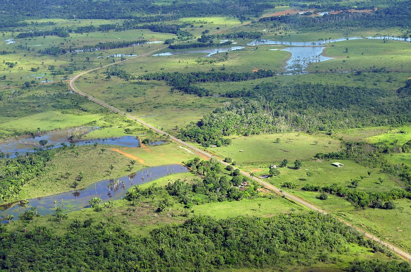
A study by the Brazilian conservation nonprofit Imazon identified 3.46 million kilometers (2.15 million miles) of roads in what’s known as the Legal Amazon, an administrative region that spans the nine Brazilian states located within the Amazon Basin. The researchers estimated that at least 86% of the extent of these roads are unofficial, “built by loggers, goldminers, and unauthorized land settlements from existing official roads.” The sprawling network of roads also means that 41% of the Amazon Rainforest is already cut by roads or lies within 10 km (6 mi) of one.
While two-thirds of the road extent identified in the study is on private properties and settlements, the other third is on public lands. Here, unofficial roads have mushroomed, particularly in public areas without special protection from the government. The roads in these public areas run 854,000 km (531,000 mi), accounting for a quarter of the total in the Amazon.
According to Imazon, roads in these areas point to criminal activities such as illegal logging, mining, and land grabbing. The study also shows that 5% of the road network is inside conservation units, and 3% within Indigenous territories, running a total 280,000 km (174,000 mi) inside these ostensibly protected areas.
“These are arteries of destruction,” study co-author Carlos Souza Jr., an associate researcher at Imazon who coordinates the institute’s Amazon monitoring program, told Mongabay by phone. “The roads are opened to extract wood, and the ramifications spread from the main line, where the trucks and heavy machinery are.” He added the degradation is followed by the occupation of these areas, in what’s become a very familiar pattern in the Amazon.
According to Souza, previous studies estimated the length of official roads at around 80,000 km (nearly 50,000 mi) in the Brazilian Amazon, composed of federal, state and municipal highways and roads in official settlements, all of which are part of the planned infrastructure.
But the official numbers are much lower. The Federal Department for Transport Infrastructure (DNIT) told Mongabay in an email that it acknowledges 23,264 km (14,455 mi) of paved and unpaved roads within the Legal Amazon. That’s a tiny fraction of the more than 3 million km of mostly undocumented roads that Imazon identified in the region.
“Roads created without planning by municipalities, states and the federal government don’t appear on official maps,” Souza said, “but they end up being incorporated into the municipal network, demanding public money for their maintenance.”
The Imazon study, published in July in the journal Remote Sensing, used 2020 images from the Sentinel-2 satellite made available by the European Space Agency. The researchers applied an artificial intelligence algorithm created by Imazon to analyze the images.
Past efforts at making out roads in stacks of satellite images took researchers months of poring over the pictures. This time around, Imazon’s algorithm cut the analysis time to just seven hours, allowing the researchers to focus on the data. Studies using the previous methods had already indicated that the advance of unofficial roads was a driver of deforestation in the Amazon, but the new research will allow scientists to recreate a historical series with data from previous years using the new algorithm for the entire Amazon region.
Souza said mapping and monitoring the spread of roads is crucial to identifying threats to the forest, its people, and traditional communities. Previous studies have already shown that 95% of deforestation happens within 5.5 km (3.4 mi) of a road, and 85% of fires each year occur within 5 km (3.1 mi). Accounting for only the official road network, deforestation would be at least 50 km (31 mi) from the nearest road, and fires 30 km (18.6 mi) away.
“That proves mapping clandestine roads improves deforestation and fire risk prediction models and can be used as a tool to prevent forest destruction,” Souza said. “Monitoring usually looks for deforestation after the forest has already been cut down. If monitoring focuses on roads, the potential to prevent deforestation is huge.”
Souza and the team at Imazon are also building a network to deploy their tool in tropical forests worldwide to map the road footprint in other areas under pressure, such as the Congo Basin and Indonesia. PrevisIA, a deforestation prediction tool, is already using the new database. According to the latest analysis by Imazon, 75% of deforestation occurred within 4 km (2.5 mi) of PrevisIA’s predictions.
Both by length and density (the ratio between the area covered and the length of the road), unofficial roads in the Amazon are concentrated in the states of Mato Grosso, Pará, Tocantins, Maranhão and Rondônia. The data show that the zone known as the “arc of deforestation,” on the southeastern edge of the biome, continues to be the most targeted, but also points to a surge in the south of Amazonas state, western Pará, and the Terra do Meio region in central Pará.
Souza said that while most roads are very well maintained in private areas and with no public access, regulatory bodies such as the DNIT should work with environmental protection agencies to restrict traffic on these roads.
An imminent threat
An example of an illegal road that presents a danger to one of the most extensive contiguous forests in the Amazon was detected by Rede Xingu+, a network of conservation NGOs. The organization spotted an unofficial road running 42.8 km (26.6 mi) across two important conservation areas: the Terra do Meio Ecological Station and the Iriri State Forest. The road threatens to divide the Xingu Socioenvironmental Corridor, a 28-million-hectare (69-million-acre) swath of native forest that’s home to 21 Indigenous territories and nine conservation units.
According to the Instituto Socioambiental (ISA), an NGO that advocates for environmental and Indigenous rights, the illegal road starts in a deforestation hub inside the Triunfo do Xingu Environmental Protection Area. From there, it’s on the verge of completing the connection between the municipalities of Novo Progresso and São Felix do Xingu, a center for the illegal timber and gold trades. With just 10 km (6 mi) of forest to cut through in Iriri, the road could soon reach the Curuá River, inside the state forest, completing the connection and slicing right through the Xingu corridor, increasing the vulnerability of its forests dramatically.
“The threat is imminent,” Thaise Rodrigues, a geoprocessing analyst at the ISA, told Mongabay by phone, “and so far we are not aware of any legal action to stop it.” Rede Xingu+ spotted the road for the first time in January this year. Its progress was interrupted for a few months when it reached a mine inside the Terra do Meio Ecological Station. As of May this year, work on the road resumed, and it reached the Iriri State Forest. In July and August, the monitoring showed 575 hectares (1,420 acres) of deforestation around this road.
“When a large mass of forest is broken, it becomes vulnerable. The roads cause fragmentation, which intensifies deforestation,” Rodrigues said. The ISA has criticized both the Pará state and the federal governments for their inaction, given that both are responsible for the protected areas inside the Xingu corridor. The illegal road increases what’s known as the “edge effect,” where areas of forest exposed to clearings such as roads become more vulnerable to threats. And the deforestation wrought by these threats drives the Amazon closer toward a “tipping point,” beyond which the rainforest loses its ability to self-regenerate and devolves into a dry savanna.
According to the ISA, the Xingu corridor holds an estimated 16 billion metric tons of carbon dioxide, and its mass of lush vegetation is responsible for generating the “flying rivers” of water vapor that bring rain to the rest of the continent. Splitting up swaths of forest with roads also causes a loss of connectivity, which directly impacts the migration of aquatic and terrestrial wildlife, while accelerating the desertification of the soil. The ISA points to another serious risk: opening up the rainforest brings humans closer to the 3,000 known coronavirus species that Amazonian bats carry, making another global pandemic ever more likely.
Near the Iriri State Forest, the Baú Indigenous Territory is already under heavy pressure from mining activities and the deforestation front advancing from the municipality of Novo Progresso.
“The greater the network of roads around and inside protected areas,” Rodrigues said, “the greater the access for the consolidation of such illegal activities.”
She added that unprotected public areas are even more susceptible to land grabs. “The delimitation of protected areas would help, but the public authorities need to show interest in protecting these areas and the communities that live there.”
Imazon’s Souza said the creation of protected areas is the fastest way to contain the spread of these roads, since there’s little chance of land grabbers gaining legal title to the land that’s designated as protected.
“Deforestation is an expensive business,” he said, “and nobody will spend money if there’s no chance of owning that land in the future.” That applies even to areas where roads have already been cut, since that would make them less appealing to speculators.
Official roads are also risks
Experts say Brazil should also rethink the construction of government-built roads. One example is the BR-230, a project conceived under the military dictatorship that’s become a problem child for successive administrations. Construction of the road, known as Trans-Amazonian Highway, began in 1969, and it was inaugurated in 1972 despite not having been completed. Today, it cuts more than 4,000 km (2,500 mi) through the Amazon from Brazil’s northeast coast, with long stretches still unpaved and rendered completely impassable during the rainy season. The combination of cost, logistics, and the inherent difficulty of building colossal infrastructure in the middle of the forest have meant it’s still uncompleted 50 years after its inauguration.
Besides the Trans-Amazonian Highway, there’s the BR-163, which connects Cuiabá, in Mato Grosso, to Santarém, in northern Pará; and the BR-319, from Manaus, in Amazonas, to Porto Velho, in Rondônia. Both are expected to cut across the Brazilian Amazon in different directions. Experts say that despite being officially sanctioned projects, the precarious planning behind them compounds the risks to the region’s environment.
A 2020 study evaluated 75 road projects in the Amazon, including in Brazil, Bolivia, Colombia, Ecuador and Peru, composed of 12,000 km (nearly 7,500 mi) of planned roads. It showed that, if carried out over the next 20 years, the roads would cause the deforestation of 2.4 million hectares (5.9 million acres) of forest. Besides the environmental damage linked, 45% of the projects would also generate economic losses. Canceling these unfeasible projects would save $7.6 billion and 1.1 million hectares (2.7 million acres) of forests, the study showed.
It also made the case that carefully picking a smaller number of projects could achieve 77% of the economic benefits with only 10% of the socioenvironmental damage.
“Every project will cause environmental damage to some degree,” study co-author Thaís Vilela, a senior economist at the Washington, D.C.-based Conservation Strategy Fund, told Mongabay in an email. “But there is a subset of projects that have a positive financial return with lower environmental and social impacts.”
The research considered variables such as the project’s initial cost, deforestation, ecological relevance of the area, access to schools and health centers, and breaches of environmental regulations.
“Often, decision makers only consider the financial costs and benefits of the project,” Vilela said, “and there are political demands that often do not follow the economic logic.”
The research shows that the economic prospects of a project go from positive to negative when the potential environmental and social impacts are accounted for. To pave 2,234 km (1,388 mi) of the Trans-Amazonian Highway, for instance, 561,000 hectares (1.38 million acres) of forest would be destroyed. In terms of the impact on biodiversity, water, carbon storage, and the integrity of protected areas, BR-163, BR-230, and BR-319 would do the most significant damage to the environment, the study found. Paving 496 km (308 miles) of BR-163 alone would cause 400 million metric tons of carbon dioxide emissions by 2030.
As dire as these figures look, the true extent of the damage would be even greater because of the unofficial roads that would sprout off these main highways, the study authors said. Construction and improvement of these primary roads, they wrote, “might potentially lead to the construction of secondary, tertiary, and even illegal roads in the region, promoting additional impacts.”.
“Unofficial roads usually come from official ones,” Imazon’s Souza said. He blamed poor environmental impact assessments for allowing this proliferation of roads, adding that the major official highways also harm protected areas and Indigenous territories.
“There are areas where roads should not be built, as environmental and social damage would be greater than potential benefits,” Vilela said. “Ideally, the definition of these variables should involve all individuals directly affected by the project.”
The DNIT told Mongabay that its responsibility is limited to federal roads listed in the National Road System database, which doesn’t include unofficial roads. Mongabay also contacted IBAMA, the Brazilian environmental protection agency, and ICMBio, the government institute that oversees protected areas, but didn’t receive any response to requests for comment by the time this story was published.
Citations:
Botelho, J., Costa, S. C., Ribeiro, J. G., & Souza, C. M. (2022). Mapping roads in the Brazilian Amazon with artificial intelligence and Sentinel-2. Remote Sensing, 14(15), 3625. doi:10.3390/rs14153625
Barber, C. P., Cochrane, M. A., Souza Jr, C. M., & Laurance, W. F. (2014). Roads, deforestation, and the mitigating effect of protected areas in the Amazon. Biological Conservation, 177, 203-209. doi:10.1016/j.biocon.2014.07.004
Vilela, T., Malky Harb, A., Bruner, A., Laísa da Silva Arruda, V., Ribeiro, V., Auxiliadora Costa Alencar, A., … Botero, R. (2020). A better Amazon road network for people and the environment. Proceedings of the National Academy of Sciences, 117(13), 7095-7102. doi:10.1073/pnas.1910853117
“Amazon rainforest” by CIFOR is licensed under CC BY-NC-ND 2.0.