Editor’s Note: The mainstream environmental movement has been co-opted not only into believing that renewables can save the planet, but also in the tactics used to accomplish that. A lot of the movement uses advocacy as the one and only strategy against systems of power. The main problem with the advocacy is that it places power in the hands of the state and diminishes the power that we have as individuals and as communities. On the contrary, the organizing model recognizes the power that we hold and focuses on increasing that power through collective, coordinated actions. (For more on this, read Jane McAlevey’s book “No Shortcuts: Organizing for Power in a New Gilded Age.”)
This is an editorial piece by Hugo Blanco, a Peruvian peasant and political figure. It is a call to action for all to recognize the power we have as individuals and as communities to organize into a powerful social movement.
At times we are struck by a feeling of reporting the same news over and over again. Such as the death of a Kukama child poisoned by leaking oil, together with the memory of other deaths marked by the same, obscenely inhuman cruelty. The same news of a river filling up with crude oil or a mine tailing killing our people. And another horrific murder inside a police station, the mob of uniformed beasts furiously beating vulnerable children, pregnant women and the elderly.
It is perhaps because the people’s life of the last 530 years has been one of struggle, resisting the death that comes brandishing and bullets.
Nonetheless, we are now well aware that these attacks by the capitalist system — pollution, persecution, and prison — are neither accidental nor isolated incidents. Rather, they are planned, strategic acts of war against the people, in the service of the growth of capitalist development. That is, not for the development of alternatives but of ever-increasing profits.
The Mapuche people and the women of Iran, the communities of Colombia’s Cauca Valley, the Zapatistas, and dark-skinned immigrants are not suffering collateral damage, nor are they affected just by economic interests. Rather, they are military targets of those protecting the transnational corporations and banks that deal in gold, gas, timber, water and crops. It is all about money and power.
At times the military objective is the people’s consciousness, in which case they spread a mass of lies and nonsense that can still end up convincing the public. We can come to believe, for example, that it is a very good idea to become the world’s largest exporter of asparagus, leading to eliminating the biodiversity by planting only asparagus. The crop is kept far from us while the people starve in a landscape rendered sterile.
Or it can seem reasonable that the high mountains are worthless in their natural state, that the waters are polluted in order to make us the leading exporter of copper, and again we are left with the with the hill health that comes from living in a sterile environment.
All of this is for our benefit in name only, as those who profit from these services are not the ones who dig and sow. We are left with nothing but the land rendered sterile.
Later they will tell us that our votes are needed in order to ensure that all of this can change. We will have to participate in the elections, join the campaigns and cast the right votes. However, it is hard to believe that when we know that over there in the national government they take by centimeters what has been lost by kilometers in our forests.
And it is harder still when we catch on that official justice is just another mercenary bought and paid for. (Just look at how many corrupt prosecutors are at large in Abya-Yala, holding hands with the genocidal armed forces while in the embrace of servile news media!)
Social movements in defense of our territories — whether at the level of the community, neighborhood, individual, spirituality or consciousness — are our hope to tackle hunger, sickness and environmental destruction. And it is by organizing and sharing our experiences that we can progress from demanding our rights to recovering our lost autonomy. There are as many realities in the struggle for life as there are landscapes in our Mother Earth. Each people has its own altitude, latitude, language and history.
In the beginning God had it easy, as He only had to create where there was nothing. We, on the other hand, have to create in the midst of pain, alienation and discouragement; we have to clean up the polluted rivers while keeping up our courage.
But that is what we are here for, to transform the world and ourselves. The sun and rain will be there for us in our struggle.
This is the Editorial from the current issue of Lucha Indígena, the newspaper published by Peruvian peasant leader and ecosocialist Hugo Blanco. Translation courtesy of Christopher Starr. Derek Wall’s biography, Hugo Blanco: A Revolutionary for Life, is an excellent account of Blanco’s lifelong struggle for indigenous rights.
Editor’s note: The Ambler road is being planned in Alaska to connect the Dalton Highway with the Ambler Mining District. It will cross the Arctic National Park, state lands and native lands. The road in itself poses many threats to the wildlife which is described in the following piece. Many stakeholders are involved in this project, some of them support it and some of them oppose it. Proponents include the Congressional delegates from Alaska and native tribes who hope to benefit from the added jobs in their economy. Those who oppose it are the native groups whose subsistence hunting and gathering is threatened by the road and conservationists.
As George Wuerthner mentions in this piece, for a long time, the mining project was not feasible economically, and thus the area was protected from extraction. As we are extracting the last remaining fossil fuels, mining sites like these, which were too expensive in the past, become more necessary for the so called energy transition. We can expect this trend to grow in the future. As fossil fuels peak, there will be more and more extraction of these last remaining pockets of minerals. This mining prospect in Alaska is just another example of this.
While much conservation and political attention have focused on whether to allow oil development in the Arctic National Wildlife Refuge, another project, the Ambler Mining Project, and road construction proposal may pose even greater threats to the Arctic’s wildlife and wildlands. Despite this threat, The Ambler project has thus far received far less attention from the media, politicians and conservation organizations.
The proposed 211-mile Ambler Road would connect the Dalton Highway (pipeline haul road) with the Ambler Mining District in the western Brooks Range. The ore belt that stretches for 200 miles contains copper, cobalt, lead, and zinc and could be one of the most valuable deposits in the world, especially as people turn to electric vehicles.
There is new interest in encouraging the US development of critical minerals and energy, and the Ambler Mining proposal benefits from this push for US sources of minerals.
Although these deposits have been well-known for decades, the cost of mining, smelting, and transportation has precluded development. (I knew about the ore deposits in the 1970s when I lived and worked along the Kobuk River).
Years ago, I taught a class on Alaskan Environmental Politics. I emphasized that Alaska has more oil, coal, minerals, and even forests than most other parts of the United States. Many of these resources remain undeveloped because of the harsh climate, remote locations, and lack of access.
There are, for instance, substantial forest resources in Southeast Alaska. Still, they cannot be cut and transported without government subsidies because it’s cheaper to log trees in Oregon or Washington.
The Prudhoe Bay oil fields were the world’s 10th most significant oil reserves, and the other nine were in the Middle East. The Prudhoe Bay oil fields would have remained undeveloped had it not been for the construction of the Alaskan Oil Pipeline, which made these oil reserves economic to develop.
The Ambler Mineral deposits are considered “world-class.” Getting a road to the Ambler Deposits is the first step in making mining operations profitable. The Bureau of Land Managment (BLM) and the Corps of Engineers under the Trump Administration approved the road plan in 2020, and officials agreed to issue a 50-year right-of-way for the Alaska Industrial Development and Export Authority, the state public corporation working to develop the project.
However, the Biden Administration halted the road project while a Supplemental EIS process mandated by the courts was completed. However, my sources in Alaska suggest this may be for show. The comment period ended on November 4th, and the BLM review will likely be published sometime in the new year.
If you want to understand politics, all you have to do is follow the money.
The mining claims are owned mainly by local Iñupiat people living in NW Alaska coast and inland along the Kobuk River, represented by NANA corporation. They also operate the Red Dog Zinc mine, one of Alaska’s most significant mining and polluted sites.
During the land selection process created by the Alaska Native Claims Settlement Act (ANCSA), native people targeted the lands with valuable known mineralization or fossil fuel resources.
In the case of the Ambler mines, NANA shareholders are likely to be employed during road construction and mining operations.
One study estimates that 20% of all construction jobs will be held by local villagers, providing significant money input into these rural villages. NANA corporate leaders likely believe they are working in the best interests of their constituency.
In addition to NANA and some residents who would benefit from jobs and royalty payments, the road is also supported by the state of Alaska. The Alaska Industrial Development and Export Authority (AIDEA) would own Ambler Road.
Alaska’s Congressional Delegation, including newly elected half-Native Democrat Mary Peltrola and Republican Senator Lisa Murkowski, support the road and mining proposal. Peltrola has also joined her Republican counterparts in the Senate to support oil development in the Naval Petroleum Reserve.
The road, if built, would likely lead to road sprawl and the expansion of development in the region, including perhaps oil development in the Naval Petroleum Reserve to the north of the Brooks Range.
Although the supporters point out that the road would be a private road only accessible to industrial use, opponents point out that the same claim was made about the Pipeline Haul Road. However, in 1994 the state opened the Pipeline Road (Dalton Highway) for unrestricted, public use.
Opposition to the road comes from Tanana Chiefs and other Athabascan Indians living along the Koyukuk River and tributaries. The Athabascan would gain no advantage to a road except perhaps for more accessible and cheaper shipment of supplies. But they fear the road would disrupt subsistence hunting and gathering.
The Athabascans are not necessarily opposed to mining or oil development themselves. Doyon Native Corporation, which represents the Athabascan people of the Yukon Basin, during the land selection process of the Alaskan Native Claims Settlement Act has specifically targeted mineralized lands. Today, they have several active mining operations. However, Doyon has neither endorsed or opposed the Ambler Road and mining projects.
However, Doyon has proposed alternative road access to the Ambler district from Nome.
So, in essence, the road is pitting one ethnic native group against another.
In addition to opposition from some native people, many conservationists also oppose the road. The Ambler Road, if built, would cross the Gates of the Arctic National Park and Preserve and numerous other protected areas like the Kobuk Wild and Scenic Rivers.
The National Park Service did an excellent review of the potential impacts of the road on wetlands, water quality, fish, wildlife, subsistence, and recreational impacts on the park that applies to the total road mileage.
Conservationists and native people opposed to the mine have produced a good video about how the road would impact the Arctic:
An environmental review by the BLM in 2020 found that the road would impact salmon, caribou, and other wildlife.
Roads can be semi-permeable barriers, and although crossing such obstacles is possible, caribou may shift or entirely abandon their seasonal habitat. The disturbance and activity along the road and mining operations are likely to affect caribou in other ways. Studies have shown that caribou may travel up to 9.3 miles to avoid roads and 11.2 miles to avoid settlements.
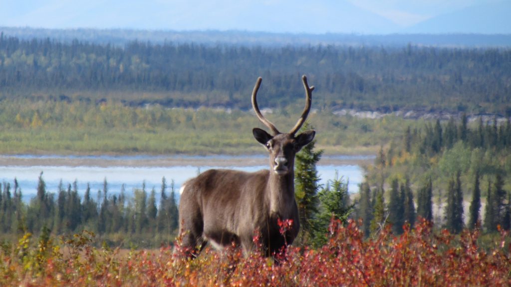
Thousands of caribou like this one traditionally cross the Kobuk River near Onion Portage in the fall. Accessibility statement: Single caribou looks directly at the camera surrounded by red shrubs, with river and forest in background.
For instance, a study of the Native-owned Red Dog Mine Industrial Access road north of Kotzebue found that just four vehicles an hour affected the migration of 30% of collared caribou, or approximately 72,000 individuals of the 2017 population estimates.
Linear features like roads also are used by predators like wolves. This can increase predator influence on prey like caribou. Roads and seismic lines in Alberta have led to increased predation on woodland caribou.
It also does not take much imagination to see that this road will eventually be extended to the coast by Kotzebue, fragmenting the entire western Brooks Range’s ecosystems.
Nevertheless, the road’s construction was approved by the Trump administration. However, the Biden Administration has ordered the Bureau of Land Management to reevaluate the Environmental Review.
The BLM accepted comments until November 4th. Whether the BLM review changes the decision to move forward with the road remains to be seen.
But my sources in Alaska say that the Biden Administration is likely to approve the road to help Alaskan politicians, perhaps with stricter regulations designed to address environmental concerns. The Biden Administration doesn’t want to oppose new Democratic Congressional Representative Mary Petrola who is a supporter of the mine road. Murkowsi was critical to Democrats in voting to convict Donald Trump for his role in the Jan. 6th insurrection, was one of three GOP to vote for nomination of Judge Ketanji Brown Jackson and she was the only GOP member to support the Voting Rights Bill. Biden does not want to alienate her potential support for other Democratic agenda votes.
I can’t emphasize enough that this road is one of the biggest threats to the Arctic’s wildlands and wildlife. It is bigger than just the development impacts that may result from the Ambler Mining operations. I have no doubts that the road, if built, will eventually make other mineral and oil, and gas sources economically viable to develop.
George Wuerthner is a professional photographer, writer, and ecologist. He has written more than three dozen books on natural history and other environmental topics. He is currently the Ed of Public Lands Media. Wuerthner has visited hundreds of mountain ranges around the West, more than 400 wilderness areas, more than 200 national park units, and every national forest west of the Mississippi. Listen to Derrick Jensen’s latest interview with George Wuerthner.
Editor’s note: Mainstream environmentalists have been demanding that countries across the world declare a “climate emergency.” But what does a climate emergency mean? What will the consequences be? Is there a possibility that it will be more detrimental to the environment? In this piece, Elisabeth Robson argues how declaring a climate emergency can be worse for the environment.
“Climate emergency”. We hear these words regularly these days, whenever there is a wild fire, a flood, or an extreme weather event of any kind. We hear these words at the annual Conference of Parties (COPs) on climate change held by the United Nations Framework Convention on Climate Change (UNFCCC), including at the COP27 meeting happening right now in Egypt. And we hear these words regularly from organizations petitioning the U.S. government to “declare a climate emergency”, and from Senators requesting the same.
Most recently, here in the U.S., we heard these words on October 4, 2022 when a group of US Senators led by Senator Jeff Merkley (D-OR) urged President Biden to “build on the inflation reduction act” and “declare a climate emergency”, writing: “Declaring a climate emergency could unlock the broad powers of the International Emergency Economic Powers Act and the Stafford Act*, allowing you to immediately pursue an array of regulatory and administrative actions to slash emissions, protect public health, support national and energy security, and improve our air and water quality.”
The requests by these Senators include two related specifically to electric vehicles:
* Maximize the adoption of electric vehicles, push states to reduce their transportation-related greenhouse gas emissions, and support the electrification of our mass transit;
* Transition the Department of Defense non-tactical vehicle fleet to electric and zero-emission vehicles, install solar panels on military housing, and take other aggressive steps to decrease its environmental impact.
The Senators continue, “The climate crisis is one of the biggest emergencies that our country has ever faced and time is running out. We need to build off the momentum from the IRA and make sure that we achieve the ambition this crisis requires, and what we have promised the world. We urge you to act boldly, declare this crisis the national emergency that it is, and embark upon significant regulatory and administrative action.”
What the Senators are requesting is that President Biden invoke the National Emergencies Act (NEA) to go above and beyond what the Biden Administration has already done to take action in this “climate emergency” by invoking the Defense Production Act and passing the Inflation Reduction Act. This is not the first time a US president has been asked to declare a climate emergency by members of Congress, but it is the most recent.
Invoking the Defense Production Act, as the administration did in April, 2022, allows the administration to support domestic mining for critical minerals (including lithium, cobalt, nickel, and manganese, which readers of this blog will recognize as essential ingredients in batteries for EVs and energy storage) with federal funding and incentives in the name of national security.
The Inflation Reduction Act, passed in August, 2022, codified into law support for domestic mining of 50 “critical minerals” to supply renewables and battery manufacturing. This law directly supports EV manufacturing by offering tax credits to car companies that use domestic supplies of metals and minerals above a certain threshold (40% to start).
We’ve already seen how the Biden Administration is using its powers under these two acts (the Defense Production Act (DPA) and the Inflation Reduction Act (IRA)) to encourage more domestic mining for “critical minerals” and the expansion of electric vehicles and charging stations. Mining companies are “celebrating”, as one journalist wrote, including Lithium Americas Corporation (LAC) whose CEO said of the IRA “We’re delighted with it.” Car companies getting support from the government to expand manufacturing, companies getting support for building out the EV charging networks, battery-making companies, and the Department of Defense must also be celebrating the infusion of government cash and the tax incentives coming their way.
The administration would have even more power to fund and incentivize mining, manufacturing, development and industry with the National Emergencies Act, or NEA. The NEA empowers the President to activate special powers during a crisis. These powers could include loan guarantees, fast tracking permits, and even suspending existing laws that protect the environment, such as the Clean Air Act, if the administration believes these laws get in the way of mining, manufacturing, and other industrial development required for addressing the climate emergency.
As described in the Brennan Center’s Guide to Emergency Powers and Their Use, in the event a national emergency is declared, such as a climate emergency, the “President may authorize an agency to guarantee loans by private institutions in order to finance products and services essential to the national defense without regard to normal procedural and substantive requirements for such loan guarantees” [emphasis added]. This authorization could occur, as stated in the NEA, “during a period of national emergency declared by Congress or the President” or “upon a determination by the President, on a nondelegable basis, that a specific guarantee is necessary to avert an industrial resource or critical technology item shortfall that would severely impair national defense capability.”
Included in the long list of requirements for a Department of Energy (DoE) loan guarantee, the loan applicant must supply “A report containing an analysis of the potential environmental impacts of the proposed project that will enable DoE to:
(i) Assess whether the proposed project will comply with all applicable environmental requirements; and
(ii) Undertake and complete any necessary reviews under the National Environmental Policy Act (NEPA) of 1969.”
In the event a climate emergency is declared, could the administration then be able to “authorize an agency to guarantee loans” to a corporation “without regard” for these requirements? If so, then a corporation could potentially skip the NEPA process currently required for a new mining project, and not bother to do an assessment about whether their project would comply with all applicable environmental requirements (e.g. requirements under the Endangered Species Act, the Clean Air Act, and the Clean Water Act).
In other words, a corporation could proceed with their project, such as a lithium mine, with little to no environmental oversight if the Administration believes the resulting products are “essential to national defense.”
We already know that the Biden Administration believes that lithium production is essential to national defense: they have explicitly stated this in their invocation of the Defense Production Act and in the Inflation Reduction Act.
Declaring a “climate emergency” would give the administration free rein to allow corporations to sidestep environmental procedures that are normally required during the process of permitting a project like a mine, resulting in more harm to the environment.
Aside from these technical details about the implications of declaring a climate emergency, we know that most organizations, including those participating in COP27 and the 1,100 organizations that signed a February 2022 letter to President Biden urging him to declare a climate emergency, are demanding actions that would further harm the environment, such as “maximiz[ing] the adoption of electric vehicles” and “transition[ing] the Department of Defense…to electric and zero-emission vehicles” as demanded in the Senators’ October 4 letter to President Biden.
While these actions may reduce some greenhouse gas emissions, neither of these actions will reduce other harms to the environment, because these actions require more extraction and more development. And neither of these actions will reduce greenhouse gas emissions at a scope large enough to solve the climate crisis. What the activists, organizations, and Senators crying out for the President to declare a climate emergency seemingly fail to understand is that the climate emergency isn’t the only emergency we face.
Industrial development, and more specifically, industrial agriculture, has caused a 70% reduction in wildlife numbers just since 1970. This is an emergency inextricably linked with and just as dire as the climate crisis, yet the Senators and organizations calling for a climate emergency don’t demand a reduction in overall industrial development, only a reduction in fossil fuels development.
Each year, 24 billion tons of topsoil are lost, due primarily to industrial agriculture practices and deforestation. In 2014, the UN estimated that if current degradation rates continue, all the world’s top soil could be gone within 60 years. This too is an emergency inextricably linked with and just as dire as the climate crisis, yet again, the Senators and organizations calling for a climate emergency don’t demand actions to rebuild and restore soil.
Industry, including the military-industrial complex, has polluted the entire planet with toxic levels of mercury, lead, PCBs, dioxins, forever chemicals such as PFAS chemicals, and micro- and nano-plastics. These toxics are in the water we drink, the food we eat, and the air we breathe—“we” being, of course, not just humans but all wildlife on the planet. Again, this is an emergency just as dire as the climate emergency.
More than 50 million gallons of wastewater contaminated with arsenic, lead, and other toxic metals flows daily from some of the most contaminated mining sites in the U.S. into groundwater, rivers, and ponds. Mining waste that is captured must be stored and/or treated indefinitely “for perhaps thousands of years,” as the Associated Press wrote memorably in a 2019 article on mining waste. Replicate this kind of mining waste pollution around the world, and obviously, this too is an emergency just as dire as the climate emergency.
All of these emergencies are related to climate change, of course. The more our societies develop, the more harm we do to the natural world, including the atmosphere.
“Development” is really global technological escalation by industry to extract more materials more efficiently, destroying more of the planet in its relentless theft of “resources.” The more our societies develop, the less habitat for life is left, and the more we overshoot the ability of the Earth to sustain us and the rest of the species on Earth.
We ignore these other emergencies at our peril. Indeed, ignoring them in favor of the climate emergency often exacerbates these emergencies. When the organizations mentioned above demand increases in electric vehicles, increases in batteries, increases in renewables, and increases in climate mitigation and adaptation (building sea walls, retrofitting and improving roads and bridges, moving entire cities), what they are demanding is more development, not less, which means more harm, not less, to the natural world. For instance, we know that the materials required to supply the projected battery demand in 2035 will require 384 new mines. That’s to supply the materials just for batteries.
Ultimately, what most organizations that support declaring a climate emergency want is not to protect life on this planet, but rather, to protect this way of life: the one we’re living now, the one that’s killing the planet. These organizations believe that we can simply replace CO2-emitting fossil fuels with EVs and so-called renewables, and keep living these ecocidal lifestyles we have become accustomed to.
We know this to be true, because we can see it directly in the actions already taken by the Biden administration, actions that will dramatically increase mining in the U.S. Mining increases the destruction of the natural world, meaning MORE habitat loss, not less. Mining increases toxic pollution. Mining increases deforestation. Mining increases top soil loss. In other words, these actions will significantly worsen all the emergencies we, and all life on the planet, face.
Rather than demand governments around the world declare a “climate emergency,” we could instead demand governments around the world declare an “ecological overshoot emergency.” In place of demands to increase industry, increase mining, and build new cars and new energy infrastructure, we could instead demand governments reduce industry, end mining, help wean us completely away from cars, and dramatically reduce energy extraction, production, and consumption. In place of demands to continue a way of life that cannot possibly continue much longer, with its relentless destruction of the natural world, we could instead demand that all societies around the world center what makes life possible on this planet: flourishing and fecund natural communities, of which we could be a thriving part, rather than dominate and destroy.
Join us and help Protect Thacker Pass, or work to defend the wild places you love. We can’t save the planet by destroying the planet in the name of a “climate emergency.”
~~~
* In their October 4 letter to President Biden, the Senators mention how invoking the NEA could “unlock the broad powers of the International Emergency Economic Powers Act and the Stafford Act.” The International Emergency Economic Powers Act (IEEPA) authorizes the president to regulate international commerce after declaring a national emergency, for instance by blocking transactions with corporations based in foreign countries, or by limiting trade with those foreign countries. This would, like the IRA, incentivize building domestic supply chains and manufacturing capabilities. The Stafford Disaster Relief and Emergency Assistance Act encourages states to develop disaster preparedness plans, and provides federal assistance programs in the event of disaster. In the event of an emergency, such as a declared climate emergency, the President could direct any federal agency (e.g. FEMA) to use its resources to aid a state or local government in emergency assistance efforts, and to help states prepare for anticipated hazards. In the event of a declared climate emergency, this would unleash federal funds and other incentive programs to states to build and harden infrastructure that is vulnerable to wildfire, floods, severe storms, ocean acidification, and other effects of climate change.
“All ethics so far evolved rest upon a single premise: that the individual is a member of a community of interdependent parts. The land ethic simply enlarges the boundaries of the community to include soils, waters, plants and animals, or collectively the land.” – Aldo Leopold, The Land Ethic, A Sand County Almanac.
Land change is a scientific term you’re not likely to hear in mainstream climate conversation, which is a shame, because what it refers to, the climatic effects of human damage to living landscapes, is a big part of the climate crisis. I talk in greater detail about land change and how it got left out of the climate narrative in an earlier Resilience piece, called Putting the Land Back in Climate. Here, I want to consider the effects of this omission, not only in the practical terms of climate policy, but in terms less definitive. What does it mean to our treatment of the land that it’s gotten to be left out of our picture of climate? Or another way of putting it: how does not knowing that our local landscapes hydrate, cool and stabilize our climates, affect our relationship with those landscapes or lack thereof?
But first I want to be clear that nothing here questions or counters the danger of carbon emissions, the greenhouse effect, or subsequent global warming. Land change should be seen as being in addition to these things, or more to the point, intimately entwined with them. The climate, when fully comprehended, emerges as a constellation of actors and effects, physical and biological, with an unimaginable complexity of feedbacks and signals. To reduce it all to quantities of carbon, and speak only of that, is to miss the thing itself.
So let’s quickly review what land change is and how it got left out the climate picture.
One way to think of land change is as original climate change. We began changing climates as soon as we started draining marshes and plowing soil, as observed in the time-worn adage: desert follows the plow, and seen now in deserts like those of the Middle East, which were once lush with marshlands and cypress-draped hills. The reason has to do with water cycles, which are largely invisible to us. We don’t see the roots underground, interlinking with extravagant webbings of soil fungi, soaking up spongelike massive quantities of water, around 600 liters per day for the average tree. Nor do we see the water evaporating from microscopic pores under the surfaces of leaves and needles, which like all evaporation, is profoundly cooling. And we don’t see the columns of vapor rising from trees and fields, feeding the clouds overhead to rain somewhere else and continue the cycle. Lastly, we don’t see the soil absorbing and holding that moisture, banking the landscape against drought and flood. Life not only sequesters carbon, it sequesters water as well. The two, it turns out, go hand in hand.
Scientists refer to this with the term evapotranspiration and know it to be fundamental to the hydration, cooling and moderation of local and regional climates. It follows then, that when we damage, or “change” land it dries out, heats up, and becomes prone to hydrological extremes like drought, floods and heatwaves. Sound familiar?
When coal and oil was discovered, a new cause of climate change entered the picture: emissions of greenhouse gasses. And early climate science treated it that way, as an additional cause, not the cause. Mediterranean-climate expert Millan Millan remembers that time, referring to it as a “two-legged” climate understanding—one leg for land change and hydrological effects and a second leg for carbon emissions and the greenhouse effect. So how then did we arrive at an official narrative which describes only carbon emissions as the cause of climate change? What happened to the land leg?
A clue can be found in the titles of the IPCC’s periodical Assessment Reports, such as the most recent assessment Global Climate Change 2021: The Physical Science Basis. What is meant by those last four words? The easiest answer is to think of the physical science basis is as the mathematic, or quantitative basis, the basis necessary for the computer modelling of climate. When CO2 emissions emerged as a climate threat, science immediately turned to computer modelling to ascertain and predict the effects. Carbon emissions, well dispersed in the atmosphere, proved highly amenable to such modeling, while the biological/hydrological processes of land change were the opposite. Though we can feel the effects of land-change, and are surrounded by it in the form of wastelands and vanished species, it is almost impossible to render in quantitative terms. The processes are too detailed, complex, varied and changing.
A good many scientists are currently working to resolve the matter, quantifying land change effects and bringing them into global computer models, and we can expect the next round of IPCC assessments to include some of this work. But that’s still five to six years off, and by then trillions will have been spent on industrial infrastructure causing how much land change?
This must be the first and most tragic effect of leaving land change and water cycles out of the analysis. Nature disappears, reduced to quantities of carbon, buried under tech jargon, sacrificed all over again for a new era of human device and progress. To the plow, the ax and cattle drive, we now add the solar farm, transmission corridor and a new generation of mines.
Environmentalism has suffered mightily from this formulation, and now confronts a kind of ecological Sophie’s Choice: either sacrifice the land or sacrifice the climate. It can be that stark. Consider the US state of Virginia, who’s recently passed climate legislation is resulting in thousands of acres of forest being cut for solar farms and transmission corridors, much of it to support data centers for tech corporations like Google and Microsoft. Meanwhile, those citizens who elect to protect their forests rather than sacrifice them for energy generation are labeled NIMBYs.
But there’s more. With this big industrial push comes a parallel push for what is being called “permit reform.” The Inflation Reduction Act, recently passed in the US, contains 1.2 billion dollars to staff up permitting agencies in an attempt to rush this infrastructure. And I noticed, when Senator Joe Manchin tried to attach a “permit reform” bill to the IRA, the official environmental opposition was carefully directed at only the permitting reform around fossil fuels. Presumably, they are for it when it comes to industrial infrastructure deemed “green” or “clean.” Thus, another dichotomy: big green working to take away permitting power from little green, the locals defending their own land bases. Ask yourself how long you think such contradictions can last.
There’s a personal dimension here as well. I know for myself, once I began learning about the biological, water-based aspects of climate, my view of climate and the natural world transformed. Muir’s oft-quoted observation, “when we try to pick out anything by itself, we find it hitched to everything else in the universe” suddenly came alive. I discovered, over and over, that when I grabbed the thread called “climate” it was hitched to everything on Earth, part of something very much alive and capable of recovery. And with that my doom, not my worry and concern and grief, but that powerless sense of doom vanished. I stood on different ground, having come to know its power.
Now I see my surroundings, my climate-shed if you will, not as climatically helpless against rising CO2 emissions, but the very basis for climate healing and recovery. This is what happens when you bring the living land back into the climate equation, it comes alive. The land turns ally, and a new clarity emerges, with a very different set of priorities.
First, protect all remaining wild and semi-wild places. They are the last living links to the once cool, wet Holocene climate, which we can still save. Understand that where land is at its healthiest, so it’s climate function.
Second, restore the lands we’ve already damaged. Here is where hope literally grows. For buried within the sad fact that half of Earth’s land has been converted to human use, is the stunning comprehension of just how much land is available and waiting for restoration, bringing new carbon sequestration and water cycling to the climate system at game-changing scale.
Third, stop “changing” land. Housing developments, logging, road building, solar farming, all continue with no public awareness of the climate damage being done. Integrate land change into the environmental review process.
Fourth, slow down, cool down—the only thing that ever has reduced emissions. The land is telling it needs rest and recovery, not to be subjected to a new industrial revolution.
Do we really need decades of climate modelling to figure these things out? Might there be other ways of approaching this crisis?
We are not alone in this. For the land, though degraded, still retains its potential for regeneration. Given a little protection, ecosystems recover. Even the poorest soils contain ancient seeds of bygone life, awaiting only water. And in the field, the land’s enthusiasm for reemergence continually exceeds the expectations of those working to restore it. It turns out that regeneration, and the passion for regeneration, is in the very grain and fiber of all that surrounds us.
Those seeds are in us too. That’s the invitation. But only the land, and the processes of life, can bring the water.
Editor’s Note: While climate change is taken as THE pressing ecological concern of current era, biodiversity loss is the often less known but probably more destructive ecological disaster. UNEP estimates we lose 200 species in a day. That is 200 species that are never going to walk the Earth again. With these, we lose 200 creatures that play a unique and significant part in the natural communities, and immeasurable contributions of each to the health of the nature.
This study finds 69% average drop in animal populations since 1970. Over those five decades most of the decline can be traced to habitat destruction. The human desire for ever more growth played out over the years, city by city, road by road, acre by acre, across the globe. It is to want a new cell phone and never give a second thought as to where it comes from. Corporations want to make money so they hire the poor who want only to feed their families and they cut down another swath of rainforest to dig a mine and with it a dozen species we haven’t even named yet die. Think about what goes into a house to live in and the wood that must come from somewhere, and the coal and the oil to power it, and to power the cars that take people from there to the store to buy more things. And on and on, that is the American Dream.
Wildlife populations tracked by scientists shrank by nearly 70%, on average, between 1970 and 2018, a recent assessment has found.
The “Living Planet Report 2022” doesn’t monitor species loss but how much the size of 31,000 distinct populations have changed over time.
The steepest declines occurred in Latin America and the Caribbean, where wildlife abundance declined by 94%, with freshwater fish, reptiles and amphibians being the worst affected.
High-level talks under the U.N. Convention on Biological Diversity (CBD) will be held in Canada this December, with representatives from 196 members gathering to decide how to halt biodiversity loss by 2030.
In 2014, as temperatures topped 40° Celsius, or 104° Fahrenheit, in eastern Australia, half of the region’s black flying fox (Pteropus alecto) population perished, with thousands of the bats succumbing to the heat in one day.
This die-off is only one example of the catastrophic loss of wildlife unfolding globally. On average, wildlife populations tracked by scientists shrank by nearly 70% between 1970 and 2018, a recent assessment b WWF and the Zoological Society of London (ZSL) found.
“When wildlife populations decline to this degree, it means dramatic changes are impacting their habitats and the food and water they rely on,” WWF chief scientist, Rebecca Shaw, said in a statement. “We should care deeply about the unraveling of natural systems because these same resources sustain human life.”
WWF’s “Living Planet Report 2022,” launched this October, analyzed populations of mammals, birds, amphibians, reptiles and fish. “It is not a census of all wildlife but reports how wildlife populations have changed in size,” the authors wrote.
In 2014, as temperatures topped 40°C, or 104°F, in eastern Australia, half of the region’s black flying fox (Pteropus alecto) population perished, with thousands of the bats succumbing to the heat in one day. Image by Andrew Mercer via Flickr (CC BY-NC-SA 2.0).
A million species of plants and animals face extinction today, according to a landmark 2019 report from the Intergovernmental Science-Policy Platform on Biodiversity and Ecosystem Services (IPBES), an international scientific body. The new analysis uncovers another aspect of this biodiversity crisis: The decline of wild populations doesn’t just translate into species loss but can also heighten extinction risk, particularly for endemic species found only in one location.
Instead of looking at individual species, the Living Planet Index (LPI) on which the report is based tracks 31,000 distinct populations of around 5,000 species. If humans were considered, for example, it would like tracking the demographics of countries. Population declines in one country could indicate a localized threat like a famine, but it was happening across continents, that would be cause for alarm.
The steepest species declines occurred in Latin America and the Caribbean, where wildlife abundance dropped by 94% on average. In this region, freshwater fish, reptiles and amphibians were the worst affected.
Freshwater organisms are at very high risk from human activities worldwide. Most of these threats are linked to habitat loss, but overexploitation also endangers many animals. In Brazil’s Mamirauá Sustainable Development Reserve, populations of Amazon pink river dolphin or boto (Inia geoffrensis) fell by 65% between 1994 and 2016. Targeted fishing of these friendly animals for their use as bait contributed to the decline.
Climatic changes render terrestrial habitats inhospitable too. In Australia, in the 2019-2020 fire season, around 10 million hectares (25 million acres) of forestland was destroyed, killing more than 1 billion animals and displacing 3 billion others. For southeastern Australia, scientists showed that human-induced climate change made the fires 30% more likely.
These losses are happening not just in land-based habitats but also out at sea. Coral reefs and vibrant underwater forests are some of the most threatened ecosystems in the world. But they’re being battered by a changing climate that makes oceans warmer and more acidic. The planet has already warmed by 1.2°C (2.2°F) since pre-industrial times, and a 2°C (3.6°F) average temperature rise will decimate almost all tropical corals.
However, the bat deaths in Australia, Brazil’s disappearing pink river dolphins, and the vulnerability of corals are extreme examples that can skew the index, which averages the change in population sizes. In fact, about half of wildlife populations studied remained stable and, in some cases, even grew. Mountain gorillas (Gorilla beringei beringei) in the Virunga Mountains spanning Rwanda, the Democratic Republic of Congo and Uganda number around 604 today, up from 480 in 2010.
Despite these bright spots, the overall outlook remains gloomy. Even after discounting the extremes, the downward trend persists. “After we removed 10 percent of the complete data set, we still see declines of about 65 percent,” Robin Freeman, an author of the report and senior researcher at ZSL, said in a statement.
Often, habitat loss, overexploitation and climate change compound the risk. Even in cases where a changing climate proves favorable, the multitude of threats can prove insurmountable. Take bumblebees, for example. Some species, like Bombus terrestris or the buff-tailed bumblebee, could actually thrive as average temperatures rise. But an assessment of 66 bumblebee species documented declining numbers because of pesticide and herbicide use.
The report emphasizes the need to tackle these challenges together. Protecting habitats like forests and mangroves can, for example, maintain species richness and check greenhouse gas emissions. The kinds of plants and their abundance directly impact carbon storage because plants pull in carbon from the atmosphere and store it as biomass.
An assessment of 66 bumblebee species documented declining numbers because of pesticide and herbicide use. Image by mikaelsoderberg via Flickr (CC BY 2.0).
One of the deficiencies of the LPI is that it doesn’t include data on plants or invertebrates (including insects like bumblebees).
The report was released in the run-up to environmental summits that will see countries gather to thrash out a plan to rein in climate change in November and later in the year to reverse biodiversity loss. Government leaders are set to meet for the next level of climate talks, called COP27, in Egypt from Nov. 6-13. At the last meeting of parties, known as COP26 in Glasgow, U.K., last year, nations committed to halt biodiversity loss and stem habitat destruction, partly in recognition that this would lower humanity’s carbon footprint.
In December, the 15th meeting of the Conference of the Parties to the U.N. Convention on Biological Diversity (CBD) will be held in Montreal. Representatives from 195 states and the European Union will meet to decide the road map to 2030 for safeguarding biodiversity.
Citations:
Herbertsson, L., Khalaf, R., Johnson, K., Bygebjerg, R., Blomqvist, S., & Persson, A. S. (2021). Long-term data shows increasing dominance of Bombus terrestris with climate warming. Basic and Applied Ecology,53, 116-123. doi:10.1016/j.baae.2021.03.008
Herbertsson, L., Khalaf, R., Johnson, K., Bygebjerg, R., Blomqvist, S., & Persson, A. S. (2021). Long-term data shows increasing dominance of Bombus terrestris with climate warming. Basic and Applied Ecology,53, 116-123. doi:10.1016/j.baae.2021.03.008
Outhwaite, C. L., McCann, P., & Newbold, T. (2022). Agriculture and climate change are reshaping insect biodiversity worldwide. Nature,605(7908), 97-102. doi:10.1038/s41586-022-04644-x
Sobral, M., Silvius, K. M., Overman, H., Oliveira, L. F. B., Raab, T. K., & Fragoso, J. M. V. 2017. Mammal diversity influences the carbon cycle through trophic interactions in the Amazon. Nature Ecology & Evolution,1, 1670–1676. doi:10.1038/s41559-017-0334-0
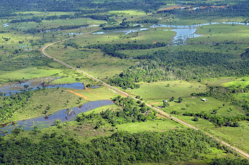
Editor’s note: Roads in the middle of wildlife, both illegal and legal, cause habitat fragmentation. This, in turn, impacts wildlife. They disturb migration routes of many animals. Many die in roadkill. Some are more likely to be killed than others, affecting the population balance between species. The light pollution alters the circadian rhythms. Other forms of pollution affects other aspects of their lives. Learn more about the impacts of roads on wildlife here.
The following article demonstrates how, in addition to that, roads (mainly unofficial roads) are causing a widespread deforestation in the Amazon rainforest, one of the largest remaining rainforests. Amazon is home to not only some rare species of flora and fauna, but also to some of the last remaining uncontacted peoples in the world. Destruction of Amazon is an annihilation of these species and the lifestyles of these people.
A groundbreaking study using satellite data and an artificial intelligence algorithm shows how the spread of unofficial roads throughout the Amazon is driving widespread deforestation.
One such road is on the verge of cutting across the Xingu Socioenvironmental Corridor, posing a serious risk of helping push the Amazon beyond a crucial tipping point.
Unprotected public lands account for 25% of the total illegal road network, with experts saying the creation of more protected areas could stem the spread and slow both deforestation and land grabs.
Officially sanctioned roads, such as the Trans-Amazonian Highway, also need better planning to minimize their impact and prevent the growth of illegal offshoots, experts say.
The Americas have a long history of occupation based on the destruction of nature and the violent massacre of native peoples, all in the name of a particular idea of “progress.” Brazil’s military dictatorship, which ran from 1964 to 1985, embraced this ideology to the point it had a specific motto — “integrate to not surrender” — for its nationalist project for the Amazon Rainforest. That mindset is still alive in the systemic and uncontrolled spread of unofficial roads in the Amazon, and the extent of this destruction is becoming increasingly clear.
A study by the Brazilian conservation nonprofit Imazon identified 3.46 million kilometers (2.15 million miles) of roads in what’s known as the Legal Amazon, an administrative region that spans the nine Brazilian states located within the Amazon Basin. The researchers estimated that at least 86% of the extent of these roads are unofficial, “built by loggers, goldminers, and unauthorized land settlements from existing official roads.” The sprawling network of roads also means that 41% of the Amazon Rainforest is already cut by roads or lies within 10 km (6 mi) of one.
While two-thirds of the road extent identified in the study is on private properties and settlements, the other third is on public lands. Here, unofficial roads have mushroomed, particularly in public areas without special protection from the government. The roads in these public areas run 854,000 km (531,000 mi), accounting for a quarter of the total in the Amazon.
According to Imazon, roads in these areas point to criminal activities such as illegal logging, mining, and land grabbing. The study also shows that 5% of the road network is inside conservation units, and 3% within Indigenous territories, running a total 280,000 km (174,000 mi) inside these ostensibly protected areas.
“These are arteries of destruction,” study co-author Carlos Souza Jr., an associate researcher at Imazon who coordinates the institute’s Amazon monitoring program, told Mongabay by phone. “The roads are opened to extract wood, and the ramifications spread from the main line, where the trucks and heavy machinery are.” He added the degradation is followed by the occupation of these areas, in what’s become a very familiar pattern in the Amazon.
According to Souza, previous studies estimated the length of official roads at around 80,000 km (nearly 50,000 mi) in the Brazilian Amazon, composed of federal, state and municipal highways and roads in official settlements, all of which are part of the planned infrastructure.
But the official numbers are much lower. The Federal Department for Transport Infrastructure (DNIT) told Mongabay in an email that it acknowledges 23,264 km (14,455 mi) of paved and unpaved roads within the Legal Amazon. That’s a tiny fraction of the more than 3 million km of mostly undocumented roads that Imazon identified in the region.
“Roads created without planning by municipalities, states and the federal government don’t appear on official maps,” Souza said, “but they end up being incorporated into the municipal network, demanding public money for their maintenance.”
The Imazon study, published in July in the journal Remote Sensing, used 2020 images from the Sentinel-2 satellite made available by the European Space Agency. The researchers applied an artificial intelligence algorithm created by Imazon to analyze the images.
Past efforts at making out roads in stacks of satellite images took researchers months of poring over the pictures. This time around, Imazon’s algorithm cut the analysis time to just seven hours, allowing the researchers to focus on the data. Studies using the previous methods had already indicated that the advance of unofficial roads was a driver of deforestation in the Amazon, but the new research will allow scientists to recreate a historical series with data from previous years using the new algorithm for the entire Amazon region.
Souza said mapping and monitoring the spread of roads is crucial to identifying threats to the forest, its people, and traditional communities. Previous studies have already shown that 95% of deforestation happens within 5.5 km (3.4 mi) of a road, and 85% of fires each year occur within 5 km (3.1 mi). Accounting for only the official road network, deforestation would be at least 50 km (31 mi) from the nearest road, and fires 30 km (18.6 mi) away.
“That proves mapping clandestine roads improves deforestation and fire risk prediction models and can be used as a tool to prevent forest destruction,” Souza said. “Monitoring usually looks for deforestation after the forest has already been cut down. If monitoring focuses on roads, the potential to prevent deforestation is huge.”
Souza and the team at Imazon are also building a network to deploy their tool in tropical forests worldwide to map the road footprint in other areas under pressure, such as the Congo Basin and Indonesia. PrevisIA, a deforestation prediction tool, is already using the new database. According to the latest analysis by Imazon, 75% of deforestation occurred within 4 km (2.5 mi) of PrevisIA’s predictions.
Both by length and density (the ratio between the area covered and the length of the road), unofficial roads in the Amazon are concentrated in the states of Mato Grosso, Pará, Tocantins, Maranhão and Rondônia. The data show that the zone known as the “arc of deforestation,” on the southeastern edge of the biome, continues to be the most targeted, but also points to a surge in the south of Amazonas state, western Pará, and the Terra do Meio region in central Pará.
Souza said that while most roads are very well maintained in private areas and with no public access, regulatory bodies such as the DNIT should work with environmental protection agencies to restrict traffic on these roads.
An imminent threat
An example of an illegal road that presents a danger to one of the most extensive contiguous forests in the Amazon was detected by Rede Xingu+, a network of conservation NGOs. The organization spotted an unofficial road running 42.8 km (26.6 mi) across two important conservation areas: the Terra do Meio Ecological Station and the Iriri State Forest. The road threatens to divide the Xingu Socioenvironmental Corridor, a 28-million-hectare (69-million-acre) swath of native forest that’s home to 21 Indigenous territories and nine conservation units.
According to the Instituto Socioambiental (ISA), an NGO that advocates for environmental and Indigenous rights, the illegal road starts in a deforestation hub inside the Triunfo do Xingu Environmental Protection Area. From there, it’s on the verge of completing the connection between the municipalities of Novo Progresso and São Felix do Xingu, a center for the illegal timber and gold trades. With just 10 km (6 mi) of forest to cut through in Iriri, the road could soon reach the Curuá River, inside the state forest, completing the connection and slicing right through the Xingu corridor, increasing the vulnerability of its forests dramatically.
“The threat is imminent,” Thaise Rodrigues, a geoprocessing analyst at the ISA, told Mongabay by phone, “and so far we are not aware of any legal action to stop it.” Rede Xingu+ spotted the road for the first time in January this year. Its progress was interrupted for a few months when it reached a mine inside the Terra do Meio Ecological Station. As of May this year, work on the road resumed, and it reachedthe Iriri State Forest. In July and August, the monitoring showed 575 hectares (1,420 acres) of deforestation around this road.
“When a large mass of forest is broken, it becomes vulnerable. The roads cause fragmentation, which intensifies deforestation,” Rodrigues said. The ISA has criticized both the Pará state and the federal governments for their inaction, given that both are responsible for the protected areas inside the Xingu corridor. The illegal road increases what’s known as the “edge effect,” where areas of forest exposed to clearings such as roads become more vulnerable to threats. And the deforestation wrought by these threats drives the Amazon closer toward a “tipping point,” beyond which the rainforest loses its ability to self-regenerate and devolves into a dry savanna.
According to the ISA, the Xingu corridor holds an estimated 16 billion metric tons of carbon dioxide, and its mass of lush vegetation is responsible for generating the “flying rivers” of water vapor that bring rain to the rest of the continent. Splitting up swaths of forest with roads also causes a loss of connectivity, which directly impacts the migration of aquatic and terrestrial wildlife, while accelerating the desertification of the soil. The ISA points to another serious risk: opening up the rainforest brings humans closer to the 3,000 known coronavirus species that Amazonian bats carry, making another global pandemic ever more likely.
Near the Iriri State Forest, the Baú Indigenous Territory is already under heavy pressure from mining activities and the deforestation front advancing from the municipality of Novo Progresso.
“The greater the network of roads around and inside protected areas,” Rodrigues said, “the greater the access for the consolidation of such illegal activities.”
She added that unprotected public areas are even more susceptible to land grabs. “The delimitation of protected areas would help, but the public authorities need to show interest in protecting these areas and the communities that live there.”
Imazon’s Souza said the creation of protected areas is the fastest way to contain the spread of these roads, since there’s little chance of land grabbers gaining legal title to the land that’s designated as protected.
“Deforestation is an expensive business,” he said, “and nobody will spend money if there’s no chance of owning that land in the future.” That applies even to areas where roads have already been cut, since that would make them less appealing to speculators.
Official roads are also risks
Experts say Brazil should also rethink the construction of government-built roads. One example is the BR-230, a project conceived under the military dictatorship that’s become a problem child for successive administrations. Construction of the road, known as Trans-Amazonian Highway, began in 1969, and it was inaugurated in 1972 despite not having been completed. Today, it cuts more than 4,000 km (2,500 mi) through the Amazon from Brazil’s northeast coast, with long stretches still unpaved and rendered completely impassable during the rainy season. The combination of cost, logistics, and the inherent difficulty of building colossal infrastructure in the middle of the forest have meant it’s still uncompleted 50 years after its inauguration.
Besides the Trans-Amazonian Highway, there’s the BR-163, which connects Cuiabá, in Mato Grosso, to Santarém, in northern Pará; and the BR-319, from Manaus, in Amazonas, to Porto Velho, in Rondônia. Both are expected to cut across the Brazilian Amazon in different directions. Experts say that despite being officially sanctioned projects, the precarious planning behind them compounds the risks to the region’s environment.
A 2020 study evaluated 75 road projects in the Amazon, including in Brazil, Bolivia, Colombia, Ecuador and Peru, composed of 12,000 km (nearly 7,500 mi) of planned roads. It showed that, if carried out over the next 20 years, the roads would cause the deforestation of 2.4 million hectares (5.9 million acres) of forest. Besides the environmental damage linked, 45% of the projects would also generate economic losses. Canceling these unfeasible projects would save $7.6 billion and 1.1 million hectares (2.7 million acres) of forests, the study showed.
It also made the case that carefully picking a smaller number of projects could achieve 77% of the economic benefits with only 10% of the socioenvironmental damage.
“Every project will cause environmental damage to some degree,” study co-author Thaís Vilela, a senior economist at the Washington, D.C.-based Conservation Strategy Fund, told Mongabay in an email. “But there is a subset of projects that have a positive financial return with lower environmental and social impacts.”
The research considered variables such as the project’s initial cost, deforestation, ecological relevance of the area, access to schools and health centers, and breaches of environmental regulations.
“Often, decision makers only consider the financial costs and benefits of the project,” Vilela said, “and there are political demands that often do not follow the economic logic.”
The research shows that the economic prospects of a project go from positive to negative when the potential environmental and social impacts are accounted for. To pave 2,234 km (1,388 mi) of the Trans-Amazonian Highway, for instance, 561,000 hectares (1.38 million acres) of forest would be destroyed. In terms of the impact on biodiversity, water, carbon storage, and the integrity of protected areas, BR-163, BR-230, and BR-319 would do the most significant damage to the environment, the study found. Paving 496 km (308 miles) of BR-163 alone would cause 400 million metric tons of carbon dioxide emissions by 2030.
As dire as these figures look, the true extent of the damage would be even greater because of the unofficial roads that would sprout off these main highways, the study authors said. Construction and improvement of these primary roads, they wrote, “might potentially lead to the construction of secondary, tertiary, and even illegal roads in the region, promoting additional impacts.”.
“Unofficial roads usually come from official ones,” Imazon’s Souza said. He blamed poor environmental impact assessments for allowing this proliferation of roads, adding that the major official highways also harm protected areas and Indigenous territories.
“There are areas where roads should not be built, as environmental and social damage would be greater than potential benefits,” Vilela said. “Ideally, the definition of these variables should involve all individuals directly affected by the project.”
The DNIT told Mongabay that its responsibility is limited to federal roads listed in the National Road System database, which doesn’t include unofficial roads. Mongabay also contacted IBAMA, the Brazilian environmental protection agency, and ICMBio, the government institute that oversees protected areas, but didn’t receive any response to requests for comment by the time this story was published.
Citations:
Botelho, J., Costa, S. C., Ribeiro, J. G., & Souza, C. M. (2022). Mapping roads in the Brazilian Amazon with artificial intelligence and Sentinel-2. Remote Sensing, 14(15), 3625. doi:10.3390/rs14153625
Barber, C. P., Cochrane, M. A., Souza Jr, C. M., & Laurance, W. F. (2014). Roads, deforestation, and the mitigating effect of protected areas in the Amazon. Biological Conservation, 177, 203-209. doi:10.1016/j.biocon.2014.07.004
Vilela, T., Malky Harb, A., Bruner, A., Laísa da Silva Arruda, V., Ribeiro, V., Auxiliadora Costa Alencar, A., … Botero, R. (2020). A better Amazon road network for people and the environment. Proceedings of the National Academy of Sciences, 117(13), 7095-7102. doi:10.1073/pnas.1910853117


.jpg)