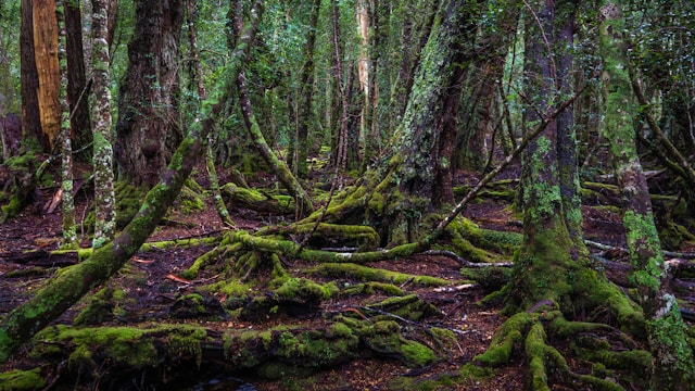
On December 14th 1982, a blockade was launched to stop the construction of a hydroelectric dam that would have flooded Tasmania’s Franklin and Gordon rivers and surrounding old-growth forests. Over the next 3 months, over 1,340 people were arrested for trespassing, occupying roads and work sites, and chaining themselves to equipment. The protest gained widespread national and global support and played a major role in the cancellation of the project.
Tasmanian Wilderness Society blocks dam construction (Franklin River Campaign) 1981-83
In 1976, the Hydro Electric Commission of Tasmania solidified their plans with the Australian government to build a dam across the Franklin and Gordon Rivers, in the Franklin-Gordon Wild Rivers National Park. The Tasmanian Wilderness Society formed not long after this announcement to take action against the Hydro Electric Commission and their plans to bulldoze the surrounding wilderness for the construction of the dam. The director of the Wilderness Society and leader of the anti-dam campaign for the following seven years was Bob Brown, a local environmentalist and general practitioner.
From 1976 through 1981, the Tasmanian Wilderness Society focused on creating awareness and education through public meetings, pamphlets, and tours of the Franklin River. They focused heavily on the danger to endangered species and ancient rain forests that flooding would have as a result of the Hydro Electric dam being built.
In 1981, the discovery of ancient aboriginal paintings in caves of the lower Franklin River region ignited the controversy. The caves were filled with not only Aboriginal paintings, but campfires, tools and animal bones that dated back thousands of years. This discovery created an even larger debate over the construction of the dam, bringing it into the political sphere, as Australia was nearing both state and federal elections. Candidates chose a side of the issue to include in their platform. Throughout their actions, the Tasmanian Wilderness Society maintained pressure to urge politicians to take a definite stance on the Franklin Dam issue.
The Tasmanian state government announced plans to hold a referendum to engage citizens in the Hydro Electric Commission’s decision. The Wilderness Society asked that a “NO DAMS” option be included in the referendum. In the lead-up to the referendum, the campaigners distributed yellow, triangular “NO DAMS” stickers. The Tasmanian government announced that the referendum would have two options, both of which took the construction of the dam as given. The two options only differed by location: Gordon Below Franklin and Gordon above Olga. The Wilderness Society encouraged voters to take part in a “Write-in”, by writing “NO DAMS” on their ballot in protest. When the government held the referendum on 12 December 1981, 33% of the voters wrote “NO DAMS” on their ballots.
Although federally the Australian Labour Party was quite popular in their anti-dam platform, pro-dam political parties were more popular in the Tasmanian state. In May 1982, the Liberal party under Robin Gray (a pro-dam politician) won the majority of seats in Tasmania and Gray became the Premier. Upon his election, he announced plans to begin construction. The dam itself was to cover 33 kilometers of the Franklin River and 37 kilometers of the Gordon River.
In response to this decision, in August and September, Bob Brown went on tour screening films of the Franklin River to raise support and awareness. Brown and the Wilderness Society also organized rallies to gain the attention of influential political figures. During a Melbourne rally, David Bellamy, a British botanist and T.V. presenter toured expressed their anti-dam positions to the 5,000 participants. The goal of this portion of the campaign was to increase pressure on the Prime Minister Malcolm Fraser to intervene through Tasmanian State government and stop the dam. Fraser did not intervene and override the state legislation, as he believed it was a state government issue
and not a federal one.
In November 1982, 14,000 people converged on the streets of Melbourne for another rally. Bob Brown announced that they would blockade the construction of the dam site beginning on 14 December 1982.
On 14 December 1982, 2,500 people converged at the dam site to participate in the blockade. Protesters made a human chain through the forest to prevent construction workers from entering the site. Protesters also blockaded by water on canoes, to prevent police from bringing machinery into the site by a barge. These blockaders maintained morale and enthusiasm through the use of song. Protesters developed songs over the course of the campaign that were regularly sung during rallies, marches, in jail, and at the blockade site. Folk singer Shane Howard wrote the official anthem of the campaign, titled “Let the Franklin Flow”. During the course of the blockade, police arrested 1,440 people. David Bellamy and Claudio Alcorso (a Hobart Millionaire) participated in the blockade and were arrested.
On 1 March 1983, the Wilderness Society held a day of action during which 231 people were arrested in their boats on the Gordon River and the Wilderness Society’s flag was flown above the Hydro Electric Commission building in Hobart, Australia.
The Tasmanian Wilderness Society drew further attention on 2 March 1983 by printing full-page colour photographs in Australian newspapers of the Franklin River area. The captions on these publications read, “Could you vote for a party that would destroy this?” This was an attention-grabbing act as few publications used colour at the time.
On 5 March 1983, the Australian Labour Party under new Prime Minister, Bob Hawke (who maintained an anti-dam platform) won the federal election and announced that he
would halt the dam construction. The Australian Labour Party introduced regulations under the National Parks and Wildlife Conservation Act 1975. Additionally, Hawke declared the Franklin River area a World Heritage site, outlawing the dam under the World Heritage Properties Conservation Act 1983.
The Tasmanian state ignored the new regulations, as they believed that the federal government could not legally intervene in this state-level issue. The company contracted by the Tasmanian government continued clearing the site until the federal government brought the Tasmanian government to High Court on 31 May 1983. On 1 July 1983, the High Court ruled in favour of the federal government and proclaimed that they could legally enforce the international standards for a World Heritage Site on a state government.
The Franklin River campaign was so successful that it largely ended the generation of electricity through hydro dams in Australia. The federal government demanded that the Tasmanian government give a compensation package of $270 million to the Wilderness Society.
Sources
Walker, J. (2013, July 01). The day the franklin river was saved. Retrieved from https://web.archive.org/web/20130817151559/http://www.australiangeographic.com.au/outdoor/anniversary-of-the-franklin-river-campaigns-success.htm (Link not working 2 March 2022 – Australian Geographic)
The Wilderness Society. (n.d.). History of the franklin river campaign 1976-83. Retrieved from http://www.wilderness.org.au/history-franklin-river-campaign-1976-83. Link not working 2 March 2022
Gibbs, C. J. Legal Database, (1983). Commonwealth v. Tasmania (the Tasmanian dam case). Retrieved from website: http://law.ato.gov.au/atolaw/view.htm?DocID=JUD/158CLR1/00002 (Link not working 2 March 2022)
Documentary – The Franklin River Blockade, The Wilderness Society, 2006
Watch a 20-minute documentary, including footage of various blockade actions. It can be viewed in two parts.
The Wilderness Society. (Producer). (2006, October 17). The Franklin River Blockade 1983, Tasmania (Part 1 of 2) [Web Video]. Retrieved from https://www.youtube.com/watch?v=rGpy8_v3tmI
The Wilderness Society. (Producer). (2006, October 17). The Franklin River Blockade 1983, Tasmania (Part 2 of 2) [Web Video]. Retrieved from https://www.youtube.com/watch?v=HhCGFHkzifQ
The story of the Tasmanian Dam case in 1983 from a lecture on Commonwealth environmental laws at The University of Queensland, Brisbane, Australia, given by Dr Chris McGrath in 2015.
To conclude then, while the Franklin blockade demonstrates the limitations of protest in Australia it shows that symbolic protest can influence important decisions. Symbolic protest will be of use to protesters in a limited set of circumstances.
The Franklin River blockade became one of the most iconic in Australian history, stopping the damming of the river and bringing footage of rugged forests and civil disobedience into loungerooms of the country on the news. Members of Goanna (playing as the Franklin Gordon River Ensemble) soundtracked the blockade with the singalong anthem Let The Franklin Flow.
Here is an Easy Read Guide called The Franklin River Story. Easy Read uses clear, everyday language matched with images to make sure everyone understands.
KLAMATH, CALIFORNIA—Brook M. Thompson was just 7 years old when she witnessed an apocalypse.
“A day after our world renewal ceremony, we saw all these fish lined up on the shores, just rotting in piles,” says Thompson, a Yurok tribal member who is also Karuk and living in present-day Northern California. “This is something that’s never happened in our oral history, since time immemorial.”
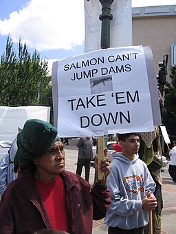
During the 2002 fish kill in the Klamath River, an estimated 30,000 to 70,000 salmon died when the U.S. Bureau of Reclamation diverted water to farms instead of letting it flow downstream. This catastrophic event catalyzed a movement to remove four dams that had choked the river for nearly a century.
Now, that decades-long tribal-led movement has finally come to fruition. As of Oct. 5, the four lower Klamath hydroelectric dams have been fully removed from the river, freeing 676 kilometers (420 miles) of the river and its tributaries. This is the largest dam-removal project in history.
“This has been 20-plus years in the making, my entire life, and why I went to university, why I’m doing the degrees I’m doing now,” says Thompson, who is an artist, a restoration engineer for the Yurok Tribe and pursuing a Ph.D. in environmental studies at the University of California, Santa Cruz.
“I feel amazing,” Thompson tells Mongabay at the annual Yurok Salmon Festival in Klamath, California, in late August, just weeks before the river was freed. “I feel like the weight of all that concrete is lifted off my shoulders.”
A river dammed
The Klamath River stretches 423 km (263 mi) from its headwaters in southern Oregon to the Pacific Ocean just south of Crescent City, California. It was once the third-largest salmon-producing river in the contiguous U.S., sustaining tribes for centuries and later also supporting a thriving recreational and commercial fishing industry.
Six Klamath River dams were built by the California Oregon Power Company (now Portland, Oregon-based electric company PacifiCorp) in the 20th century. The four lower dams, built to generate hydroelectric power, were Copco No. 1, completed in 1918, followed by Copco No. 2 in 1925, the J.C. Boyle Dam in 1958, and Iron Gate Dam in 1964.
At the time, they were seen as marvels of engineering and progress, promising cheap electricity to fuel the region’s growth. Together, these four dams could generate 163 megawatts of electricity, enough to power roughly 70,000 homes and drive development in the remote territory.
However, the dams came at a tremendous cost to the river’s ecosystem and the Karuk, Yurok, Shasta, Klamath and Modoc tribes who have depended on its salmon since time immemorial.
In the decades after dam construction, the river’s once-thriving ecosystem began to collapse and salmon populations plummeted. In 1997, coho salmon (Oncorhynchus kisutch) in the Klamath were listed under the federal Endangered Species Act.
The life cycle of salmon is tied to the free flow of rivers. These fish are born in freshwater streams and migrate to the ocean, where they spend most of their adult lives, and then return to their natal streams to spawn and die. This journey, which can span thousands of miles, is crucial for the genetic diversity and resilience of salmon populations.
Dams disrupt this natural cycle by blocking access to spawning habitat, altering water temperatures, and degrading water quality. On the Klamath, salmon lost hundreds of miles of habitat. Worldwide, not just salmon, but many other migratory fish species such as trout, herring, eels and sea lamprey are blocked by dams.
Dead salmon floating in the Klamath River in 2002. An estimated 70,000 salmon died when PacifiCorp withheld water behind the Iron Gate Dam, sending it to farms instead of letting it flow downstream. Photo from Salmon kill photo archive.Ron Reed, a traditional Karuk fisherman and cultural fire practitioner uses a dip net to fish for salmon on the Klamath river in Karuk territory. Photo by Liz Kimbrough for Mongabay
“The dams were like a blockage in the river’s arteries. They stopped the flow of life, not just for the fish, but for our people too,” Ron Reed, a traditional Karuk fisherman and cultural fire practitioner, tells Mongabay. He recalls the stark decline in fish populations during his lifetime.
“As I grew up, the fish catching down here became almost nonexistent. At some points I was catching maybe 100 fish in a year,” Reed says. “At the time the Karuk Tribe had more than 3,000 members. That’s not enough for anything. Not even everybody gets a bite.”
Commercial and recreational fishing also took a hit over the years. “Back in the mid-1900s, the Klamath River was known as the single most revered fly-fishing river in California,” Mark Rockwell, vice president of conservation for the Montana-based NGO Fly Fishers International, which supported the dam removal efforts, said in a statement. “Fly fishers came from all over the U.S. and other countries to experience the historic fishery. All that was lost because of the dams and the damage & disease they brought to the river.”
For the tribes, the impact of the dams went beyond fish. The dams created large reservoirs that flooded ancestral lands and cultural sites, particularly village sites and important ceremonial areas of the Shasta Indian Nation in the upper Klamath.
Reed also shared memories of the dangers posed by the dams farther downstream in Karuk territory. “When I was growing up, we were not allowed to go to the river. Before Iron Gate Dam was put up [to control flows from the Copco dams] you had that surge when they made electricity and that fluctuation was up to 3 feet,” he said. “We were losing people along the river. There are stories of our people drowning.”
The movement to undam the Klamath
The fight to remove the four lower Klamath dams began in earnest in the early 2000s, led by the Yurok, Karuk and Klamath tribes. After the 2002 fish kill made national news, the campaign to remove the dams grew beyond a local issue into a national movement supported by environmental NGOs and pro-fishing groups in California and beyond, such as American Rivers, Ridges to Riffles Conservation Group, California Trout, Save California Salmon, and the Native Fish Society.
In 2004, Tribal members and their allies traveled to Scotland to protest Scottish Power, which owned the dams at the time. The Scottish people rallied in support of the protesters, and in 2005 Scottish Power transferred ownership back to PacifiCorp, a subsidiary of Warren Buffett’s Berkshire Hathaway Energy. Protesters then took their message to shareholder meetings in Omaha, Nebraska.
Those in favor of dam removal argued that dams had been catastrophic for the ecosystem. The lower dams provided no irrigation, drinking water or flood control. Electricity from the dams did not go directly to local residents but was channeled into the Pacific power grid, which powers homes as far north as Vancouver, British Colombia, and as far south as Baja California. And finally, it would cost more to bring the dams up to modern standards than to remove them.
On the other hand, residents of the Copco community stood to lose the Copco Reservoir, a lake used for recreation and a tourism draw for the area. Others feared loss of energy and water quality problems. The campaign to remove the Klamath dams faced numerous challenges, including entrenched economic interests, local opposition, and complex regulatory hurdles.
Dam removal advocates overcame these obstacles through persistent grassroots organizing, alliances between tribes and environmental groups, and media campaigns that brought national attention to the scientific evidence about the dams’ negative impacts on salmon populations and water quality.
But what really made a difference was proving that removing the dams would cost less than fixing them up.
PacifiCorp and its parent company, Berkshire Hathaway Energy, initially resisted removal, but gradually shifted their stance as the financial and regulatory landscape changed. The turning point came when advocates demonstrated that removal could cap PacifiCorp’s liability and potentially save ratepayers money in the long term.
In 2016, after much negotiation, PacifiCorp agreed to transfer the dams to the Klamath River Renewal Corporation (KRRC), a nonprofit organization created specifically to take ownership of the dams and oversee their removal. By agreeing to transfer the dams to KRRC, PacifiCorp found a way to get rid of money-losing properties while avoiding uncertain future costs and risks.
In 2022, the Federal Energy Regulatory Commission (FERC) approved the plan, paving the way for the largest-ever dam removal and river restoration project not just in the U.S., but in the world.
Ultimately, dam removal and river restoration came with a price tag of approximately $450 million, funded through a combination of surcharges on PacifiCorp customers and California state bond money. Although Pacificorp hasn’t provided an official cost estimate, they have said it would have cost a great deal more to keep the dams operating safely.
Removing mountains of concrete and earth
Removing four massive dams is no small feat. The process involved years of planning, environmental impact studies, and complex engineering work.
“Removing a dam is like performing open-heart surgery on the landscape,” says Dan Chase, a fisheries biologist with Resource Environmental Solutions (RES), the company contracted to handle the restoration work. “You have to be incredibly careful and precise, or you risk causing more harm than good.”
The physical removal of the dams began in mid-2023 and concluded in October 2024. It was a carefully orchestrated process that involved slowly draining reservoirs, demolishing concrete structures, scooping away the earthen dams, and managing the release of decades of accumulated sediment.
The removal of the dams occurred in a staggered sequence, beginning with the smallest dam and progressing to the larger ones. Copco 2, the smallest, was the first to be fully removed, with the process completed in October 2023.
This was followed by the initiation of drawdown (the controlled release of water) for the large reservoirs behind the three remaining dams, Iron Gate, J.C. Boyle and Copco 1, in January 2024.
The first step was to breach the dam (either with explosives or using existing openings) and lower the water level in the reservoir behind it. This was done gradually to minimize erosion and downstream damage. Contractors used special water tunnels and diversions to control water release.
Dam removal underway on the Iron Gate dam on Aug 15, 2024. Contractors diverted water during the removal process. Drone image by Liz Kimbrough for Mongabay.
Ren Brownell, the public information officer for KRRC, describes the day she watched the waters of the Iron Gate reservoir, tinged electric green from toxic algal blooms, drain in just 17 hours.
“It was like watching 10,000 years of geology in a matter of a week. [The sediment] washed away and eventually the Klamath River was revealed,” Brownell, who grew up in the area, tells Mongabay. “I end up looking back on that period as one of my favorite times on the project, because I got to watch a river come back to life and just reveal itself.”
Decades worth of sediment had accumulated behind the dams, most of which was washed downstream by the draining of the reservoirs. Although the river was extra muddy and turbid after each dam removal, experts view this as a positive sign of the ecosystem reclaiming its natural state.
The historic path of the Klamath river reemerges after the Iron Gate dam was removed and the reservoir drained. Native plants can be seen along the, planted by crews after the reservoir was drained. Photo by Liz Kimbrough for Mongabay.
With the water levels lowered, heavy machinery moved in to begin breaking apart the concrete structures. Kiewit, the contractor KRRC hired to complete the deconstruction elements of the project, used hydraulic hammers, explosives, and other specialized equipment to demolish the dams, piece by piece.
According to KRRC, the concrete was buried onsite and the earthen material was returned to nearby areas, ideally where it had been originally removed from to build the dams. Hazardous materials were hauled offsite to appropriate facilities and metals were recycled.
Restoring an ecosystem
RES, who is overseeing restoration, now faces the monumental task of restoring the river channel and the 890 hectares (2,200 acres) of land that were once submerged beneath reservoirs.
“It’s not enough to just take out the dams,” says Chase, the RES fish biologist. “We need to help jump-start the ecosystem’s recovery.”
This effort began years before the dams were removed. In 2019, crews of primarily Yurok tribal members began a massive effort to gather seeds from native plants in the surrounding areas, including oak trees, poppies and various grasses.
“We had crews out collecting native seeds, with close to 100 different species collected from the area that we then took to commercial nurseries to grow and harvest and grow out again to the point where we’re now in the neighborhood of 17 to 19 billion native seeds,” says David Meurer, director of community affairs for RES.
A combination of hand seeding and helicopter seeding occurred at all three major reservoir footprints: Copco 1, Iron Gate and J.C. Boyle. (The smaller Copco 2 dam had impounded just a narrow, rocky area that only needed to be reshaped, according to RES.) The first round of seeding served to stabilize the sediment and improve soil. RES says this was a success, though there have been some challenges and surprises, including some rogue horses.
“We did not expect a huge and ever-increasing herd of horses who obviously are going to prefer our forage, which is green and lush, to what they saw in the surrounding hillside,” Meurer says. To address this unwanted grazing, RES is installing a rather long and costly fence around the planted areas.
As the dams came down, crews also began restoring the natural river channel. RES worked with a Yurok construction company to help direct the stream back toward its historic alignment. The team is still fine-tuning the river’s path, using plane-mounted lidar laser imaging to map and guide their work.
Free-roaming horses graze on restoration plantings along the Klamath river. Before dam removal, this area was submerged by the Iron Gate reservoir. The piles of logs shown here will be placed along the river to guide the river path and create habitat. Photo by Liz Kimbrough for Mongabay
The return of the salmon
Down a gravel road in Northern California, through a thicket of willow trees, around big boulders, and over smooth cobbles, is the place the Karuk Tribe calls the center of the world. A massive wedge of stone, a mini-mountain, stands guard over a section of the Klamath River rife with riffles and rapids.
On the river’s edge, Reed sits atop a massive boulder, praying. A white bird traces slow circles overhead. It’s later summer, a season of ceremony for the tribes. The world renewal ceremony is tied to the upstream migration of salmon.
Reed, a tribal elder, hops spryly across boulders to the base of a small rapid. With practiced movements, he swoops the end of a traditional dip net, a 15-foot loop of willow tree branch with a net at the end, into the whitewater.
Karuk Tribal citizens Ron Reed and Sonny Mitchell catch the first fall chinook salmon of the on the Klamath river in late August. Photo by Liz Kimbrough for Mongabay.
Within seconds, a fat salmon thrashes in the net. Reed and Sonny Mitchell Jr., a Karuk fisheries technician, let out shouts of celebration. This was the first fall Chinook salmon (Oncorhynchus tshawytscha) of the season. They carry the fish back to a congratulatory crew and carefully clean it in a trickle of fresh water.
“We’re eating well tonight,” Mitchell says.
Because of their cultural and economic status, restoration efforts cater largely to the needs of the fish. As the physical landscape transforms post-dam removal, eyes are on the river’s iconic salmon.
“We’re already seeing positive changes,” Toz Soto, fisheries program manager for the Karuk Tribe, said, just weeks before the dam removal was complete. “Water temperatures are more natural, sediment is moving downstream as it should, and we expect fish to start to explore areas they haven’t been able to reach in generations.”
This expectation has already become a reality. According to the Oregon Department of Fish and Wildlife, “On October 16, a fall-run Chinook salmon was identified by ODFW’s fish biologists in a tributary to the Klamath River above the former J.C. Boyle Dam, becoming the first anadromous fish to return to the Klamath Basin in Oregon since 1912 when the first of four hydroelectric dams was constructed, blocking migration.”
And a post by Swiftwater films, the official documentary crew for the project stated, “The first chinook salmon in over 60 years are officially spawning above the former Iron Gate dam on the Klamath, just two weeks after construction wrapped on dam removal…The fish are bright, strong and beautiful. What an incredible few days and a testament to the resilience of salmon.”
Sonny Mitchell Jr., a Karuk fisheries technician, holds the first fall chinook salmon of the year caught by the tribe. Photo by Liz Kimbrough for Mongabay.
To improve salmon habitat, the RES team is adding structures to the river and its tributaries, such as fallen trees, to create pools and riffles the salmon require for spawning. They’re also installing what they call “beaver dam analogs,” structures of wood or rock pounded in along streams to slow the water down and catch sediment.
The removal of the Klamath dams will help many types of fish, says Shari Witmore, a fisheries biologist with the National Oceanic and Atmospheric Administration (NOAA), who is studying salmon and other fish in the river, told Mongabay. The coho salmon, which are threatened with extinction, will gain about 122 km (76 mi) of river to live in. The project might also bring back spring Chinook salmon, which used to be common in the upper river but have nearly disappeared.
“What we’ve seen in other dam removals is that it takes about three to four [salmon] generations for salmon populations to become sustainable,” Witmore says. “And so for Chinook salmon, that’s 15 to 20 years, and for coho salmon, that’s six to 12 years.”
Pacific lamprey (Entosphenus tridentatus), another culturally important species for the tribes, and steelhead (O. mykiss irideus) will gain access to an additional 644 km (400 mi) of river. These fish can swim in faster-moving water than salmon. With more places to live and breed, all these fish species should have a better chance of survival.
And, of course, the whole ecosystem will benefit, says Chase of RES. “We have northwestern pond turtle. We have freshwater mussels. There’s beaver out there. We’ve been seeing river otter foraging … it goes on and on.”
Yurok tribal members and others fish at the mouth of the Klamath River. Commercial salmon fishing was suspended this year due to low numbers, but scientists predict salmon populations will rebound in about a decade. Photo by Liz Kimbrough for Mongabay.
Tribal knowledge and collaboration
The restoration of the Klamath River has been aided by tribal knowledge, sometimes referred to as traditional ecological knowledge (TEK) or, as Reed calls it, “place-based Indigenous science.”
“Certainly, the place-based knowledge component has been vital to us,” Chase says. “Thinking about the species of plants to use, where they’re occurring on the landscape, what species are culturally significant and important that need to be included. That’s been an element of refining and improving our restoration work.”
On the fisheries side, Chase says, the tribes have shared an immense amount of information with the RES team on how fish move through the landscape, the habitats they use, and the ways the different life stages respond to various environmental factors.
One example is related to off-channel habitats, places off the main river stem where fish can go in the winters when stream flow is faster and in the warm summer when cover and food are critical. Tribal knowledge about how to create and enhance these features, and how fish interact with them, has helped RES to restore historic salmon habitats.
Healing rivers, healing people
“The decline of salmon has been linked to higher rates of diabetes and heart disease in our communities,” says Thompson, the Karuk and Yurok restoration engineer and Ph.D. student. “Their return is quite literally a matter of life and death for us.”
The removal of the Klamath dams is a step toward healing historical wounds inflicted on the Native American tribes of the region through decades of genocide and colonialism, according to Thompson and Reed.
However, the fight to remove the dams has taken a toll on those involved. Reed speaks candidly about the mental health challenges he and others have faced during the long struggle.
“I almost lost my family. You’re gone trying to fix the world. I’m going to Scotland. I’m going to wherever, whenever, however. It’s hustle, hustle, hustle. Meanwhile, my wife’s home with six children.” Eventually, he says, “I broke down, suffered depression … I just happened to have a good, strong family that allowed me to kind of come out of it.”
Reed and hundreds of others persevered. “We’re not just fighting for ourselves,” Reed says. “We’re fighting for our children, our grandchildren, and the salmon themselves.”
“These salmon were taken care of by my ancestors, who I had never met and never had contact with myself,” Thompson says. “The salmon are like love letters sent into the future where the love and effort put into the salmon were done so that I could have a good and healthy life.”
Challenges remain
For the Klamath region, the challenges are far from over. Climate change, wildfires, and the legacy of more than a century of colonialism and ecological disruption still pose significant threats.
“There’s been so much degradation over the last 100-plus years from agriculture, forestry, water diversion and grazing,” says Mark Buettner, director of the Klamath Tribe’s Ambodat Department, which is responsible for aquatic resource management in the Upper Klamath Basin.
There are still two smaller dams in the upper Klamath River in Oregon: the Keno and Link River dams. These aren’t hydropower dams, unlike the four that were removed; they provide flood control and water for agriculture, and there’s currently no plan to remove them.
“I want to emphasize that we’re happy that salmon will be back, but we’re not really ready for them,” Buettner adds. “Sure, the fish have free access to the upper basin, but the upper basin habitats aren’t optimal. Young fish could be diverted into irrigation diversions. The Keno dam needs a new fish ladder.”
As I pass through Karuk territory in late August, traveling west toward the ocean, the air is heavy with smoke and fire crews pass regularly in their trucks, serving as a stark reminder of the work that still lies ahead. This includes addressing more than 150 years of colonial fire suppression practices, Reed says.
A sign warns of high fire risk near the Klamath river in late August 2024. More than a century of colonial fire suppression practices, along with climate change has made fires more frequent and severe in the U.S. West. Photo by Liz Kimbrough for Mongabay.As the Klamath River flows by, a wildfire burns in the distance, near Orleans, California on August 18, 2024. This is was just one of many fires burning in the region that day. Photo by Liz Kimbrough for Mongabay.
“When settlers first arrived in the Klamath region of what is now Northern California, they found forests with enormous trees, wooden homes and structures, acorn orchards, abundant plants, berries, fish, wildlife and clean water. All of it was made possible by Indigenous peoples’ frequent use of fire on the landscape,” Russel Attebery, chair of the Karuk Tribe, writes in a opinion piece for news outlet CalMatters. “California is not just fire-adapted, it is fire dependent.”
However, these controlled or cultural burns were outlawed in 1850 and are still “unjustly criminalized,” Attebery writes. The lack of prescribed burns, coupled with warmer and drier conditions from climate change, has led to more severe and frequent wildfires.
Wildfires are taking a toll on the Klamath River. Debris flow from last year’s McKinney Fire killed thousands of fish. Fires can heat up the river, making it too warm for cold-water fish like salmon. They also send silt and ash into the water, which can choke fish and smother their eggs. Sometimes, the erosion from fires even changes the river’s path. The ecosystem evolved with fire, but not at the frequency and severity of modern fires.
Reed and other traditional fire practitioners are being asked by academics and fire-management agencies to advise on traditional burning practices, and restore balance.
The irony of Native peoples being asked to consult on how to restore the land that was stolen from them isn’t lost on Reed. “I think we’re leading the nation with teaching cultural fire, through a faith-based process and hopefully this co-production of knowledge,” he says. But, he adds, “it’s kind of like, OK, they took our gold, they took our timber, they took everything, and they’re still taking our knowledge.”
Karuk Tribal members Ron Reed and Sonny Mitchell in “the center of the world” by the Klamath River. The air is smokey from nearby forest fires. As a cultural fire practitioner, Reed has been asked to teach and share traditional knowledge in academia and with government agencies but says Indigenous people are seldom justly compensated for their knowledge. Photo by Liz Kimbrough for Mongabay.
A cautionary tale
Many of the people I speak to cast the story of the Klamath dams as one of hope, but also as a cautionary tale for regions around the world considering large-scale dam projects.
While dams can provide benefits such as hydropower and water storage, they also levy significant environmental and social costs. Moreover, all dams have a finite lifespan, and their eventual removal is an expensive and complex process that planners often ignore.
“Dams were never meant to be pyramids,” says Ann Willis, California director of the NGO American Rivers. “They’re just infrastructure, and eventually, infrastructure ages. You can either be proactive about repairing, retrofitting or removing it, or you can deal with the far greater costs of a catastrophic failure after it happens. But there’s no question that one day it will fail.”
In many parts of the world, large dam projects are still being proposed and constructed. The lessons from the Klamath suggest these projects should be approached with caution, with full consideration given to long-term environmental and social impacts, as well as the inevitable costs of decommissioning at the end of the dam’s lifespan.
Site of the J.C. Boyle dam in Oregon after dam removal. Drone photo by Mongabay.
“No single agency is responsible for removing a dam, and [there’s] no requirement for dam owners to save funds for its removal,” Willis says. “The process of removing obsolete, disintegrating dams can take decades while people navigate a web of bureaucracy and look for funding. As time goes on, the risk of failure increases, which is incredibly dangerous as most dams would cause significant loss of human life and economic damage if they failed.”
As of February 2024, more than 2,000 dams have been removed across the U.S., most of them in the past 25 years, according to American Rivers. But more than 92,000 remain standing. Willis says she hopes the success of the Klamath dams’ removal and restoration project can serve as a blueprint for similar efforts around the world.
“The Klamath is significant not only because it is the biggest dam removal and river restoration effort in history, but because it shows that we can work towards righting historic wrongs and make big, bold dreams a reality for our rivers and communities,” Willis says. “Dam removal is the best way to bring a river back to life.”
Ren Brownell, public information officer for Klamath River Renewal Corporation, stands over the Copco 1 dam removal site. KRRC was formed to oversee the dam removal process. Photo by Liz Kimbrough for Mongabay.
‘Anything is possible now’
Amid the world’s tallest trees, where the Klamath River meets the Pacific Ocean, the annual Yurok Salmon Festival is in full swing when I arrive. On the main street, outside the Yurok Tribal Headquarters in the town of Klamath, California, dozens of booths are selling arts and crafts. There’s music, dancing, games, and a palpable sense of joy in the air.
But something’s missing this year: The salmon. Due to low numbers, both tribal and commercial fishing have been suspended this year.
Despite this absence, attendees express hope and a sense that change is coming. “We are delighted about the dam removal and hope for the return of the salmon,” says Yurok artist Paula Carrol. “We are salmon people. Without salmon, who are we?”
“This is still a celebration,” Thompson says, “and anything is possible now.”
A parade rolls through the town of Klamath, California during the annual Yurok Salmon Festival. This year, there was no salmon. Still, many attendees were hopeful for the salmons’ renewal post dam removal. Photo by Liz Kimbrough for Mongabay.
Liz Kimbrough is a staff writer for Mongabay and holds a Ph.D. in ecology and evolutionary biology from Tulane University, where she studied the microbiomes of trees. View more of her reporting here.
Editor’s note: For capitalism, “renewable” energy is a transition to green(greed) colonialism. Splinter colonization is still the policy of the day, divide and conquer the masses and corrupting local elites with bribery.
Capitalists benefit from business-friendly legal doctrines and a uniform regulatory system. They do not have to contend with patchwork prohibitions and restrictions enforced by sovereign communities that require FPIC and put their sovereignty into practice by persuasion or physical force, refusing obedience and cooperation. No justice, no peace, so the guerrillas will keep investors away.
“Municipalities are the white man’s reservations. The only difference is, we know we’re on reservations.” – Debra White Plume (Wioweya Najin Win).
People of the global north must look upstream to the damage they cause to communities whose resources are being extracted by outsourcing diminished health and welfare externalities associated with alternative forms of energy.
The Philippine government has approved 99 hydropower projects in the mountainous Cordillera region, part of a broader plan to rely on renewable energy sources for 35% of the country’s power by 2030.
The planned projects are dividing rural communities between those who believe the dams will bring in jobs and money and those who fear damage to water sources and cultural sites.
The Cordillera region, home to many Indigenous groups, has a deep history of activism against dams.
It’s also heavily militarized as one of the last bastions of an armed communist insurgency — a circumstance state security forces are apparently exploiting to coerce communities into compliance.
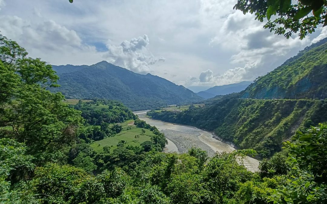
KALINGA, Philippines — On the mountainsides flanking the mighty Chico River in the northern Philippines’ Kalinga province, residents of once tight-knit villages have drifted apart in recent years. Hearty greetings between neighbors tending to farmlands have been replaced with avoidant looks or glowering stares.
“We don’t talk much like before,” says Gohn Dangoy, a 59-year-old farmer of the Naneng tribe in Kalinga’s Tabuk city. “If we do, we argue. Families and friends alike are at odds.” He says the “deep division” started because of the proposed dam on the Chico River.
West of Tabuk, locals in the municipality of Balbalan live in fear of the military operations that began around the same time the hydropower projects rolled into town.
They remember the first of the bombings happening in March 2023, as they were sound asleep on the night following their annual Manchachatong festival. Eufemia Bog-as, 30, recalls jumping from her bed at around 2 a.m. “It was like an earthquake. I heard a big boom six times. I went outside and the sky was covered with smoke,” she tells Mongabay. The government and military said they were targeting armed rebels, who were supposedly stirring up opposition against the dams.
“They told us, it’s because we’re against development,” Bog-as says.
Kalinga is one of six provinces in the northern and mountainous Cordillera region, populated by the Indigenous Igorot people. For more than 50 years, the government has been in conflict with armed communist guerrillas in the countryside. During that time, the military has often set up posts in rural villages to stifle dissent and support for the rebels.
Now, the government is eyeing the resource-rich region for a bevy of renewable energy initiatives.
A pivot to renewable energy by the Philippine government has led to a wave of hyrdoprojects projects across the Cordillera region. Image by Andrés Alegría / Mongabay.
Since 2015, the Department of Energy has greenlit 99 hydropower projects in the region, with total combined generating capacity of more than 4,000 megawatts. Of these, 52 are listed by their proponents as being in the development stage, 32 in pre-development, and 15 already operating commercially.
At every stage of development, the hydropower projects are breeding conflict and fracturing communities between those who favor them for ushering in modernity, and those who resent the potential damage to farms, burial grounds and water sources. Moreover, experts believe that the staggering amount of projects threatens to drastically reshape the region’s hydrogeography and economy for the worse. Throughout the Cordillera mountains, Igorot communities opposing the dams are frequently reporting militarization and even aerial bombings close to pasturelands and villages.
Both national and local governments have firmly backed the spate of projects.
President Ferdinand Marcos Jr. has styled himself as something of a climate champion. In his 2023 state-of-the-nation address, he hyped his administration for “aggressively promoting renewables so that it provides a 35% share in the power mix by 2030.”
In the same speech this year, Marcos spoke of having approved projects with a combined more than 3 trillion pesos ($54 billion) in investments for four priority sectors, including renewable energy. He called it a “crucial step” in addressing climate change.
To that end, the Cordillera region is similarly crucial for the government’s renewables pivot. The region hosts the headwaters of 13 major river systems and can harness around 30% of the country’s hydropower potential, six times more than what the Philippines makes use of at present.
And in 2022, the Cordillera regional council announced plans to fast-track renewable energy projects. For local communities and activists, this raises the question of whether these changes jeopardize the natural landscape and livelihoods in one of the country’s most resource-rich and culturally diverse regions.
Dam disagreements
In the 1970s, Kalinga’s Indigenous communities, led by Macli-ing Dulag, now a national icon, famously resisted construction of a huge dam on the Chico River. Dulag was killed by state forces in 1980, but the project was shelved and the struggle blossomed into a discourse on safeguarding ancestral domains.
Since then, just a single 1-MW micro dam has been built in Kalinga, and its operations were suspended in 2021 after farmers complained of decreased water flow for irrigation. Now, however, the province is the proposed site of 19 hydropower projects across its rivers, with the famous Chico among them.
Australian-owned JBD Water Power Inc. (JWPI) heads four of these planned projects, two each on the Saltan and Cal-oan rivers. The Saltan River projects are still in the consultation stage, while the villages along the Cal-oan River have registered opposing views to the projects there.
In March 2023 and August 2024, Mabaca village filed petitions with the National Commission for Indigenous Peoples (NCIP), registering its disapproval of the 45-MW Mabaca 2 Dam on Cal-oan.
The latest petition intends to stall the free, prior and informed consent (FPIC) process required for the project to commence. It asserts the river as part of the community’s ancestral domain, thus giving it “legitimate claims to the watershed.”
Only initial talks have taken place. However, local leaders say the NCIP is forceful about the project, planning 12 further consultations with reluctant villagers.
Village captain Barcelon Badin says he’s seen the project blueprints and fears the dam will compromise their already scarce food sources since it “will clearly drown our rice fields.”
But downstream in Buaya, the next village over, locals are ready to sign a memorandum of agreement, a major step toward securing FPIC, with JWPI for the 40-MW Buaya hydropower project.
Hydropower projects have met with differening receptions in Cordillera villages such as Balbalan, Mabaca and Buaya. Image by Andrés Alegría / Mongabay.
Jermito Jacinto, an elder of the Buaya’s Butud tribe, is now a JWPI consultant. He says the project offers jobs, cheaper electricity, scholarships for children, and several million pesos in annual revenue for local authorities.
“Cal-oan River is full of honey and sugar but we don’t know how to use it,” Jacinto tells Mongabay.
He chides the villages that continue to hold out, calling their aversion to development a “hangover” from rebel rhetoric. Buaya and Mabaca villages are squabbling over these projects, as the former seeks revenue while the latter says any disruption to any part of the river risks the fields of all.
Having examined other dams in the region, former Balbalan mayor Eric Gonayon disputes any promise of growth associated with the dams.
“They will not develop the roads, only use them to relocate us from our heritage for the benefit of foreigners and businesses,” he tells Mongabay.
He scoffs at the potential revenue the projects could generate, saying “It’s not even worth 1% of the resources they’ll extract from us. It’s like they’re giving us candy but taking the whole shop!”
The Cal-oan River, also known as Mabaca River, where Australian-owned JBD Water Power Inc. (JWPI) has two planned hydropower projects. Image by Michael Beltran.
The Department of Energy mandates that companies allot village officials 0.01 pesos per kilowatt-hour, roughly 0.09% of average electricity sales.
Farther east in the provincial capital, Tabuk, the Karayan Hydropower Corporation, with ties to Singaporean investors, has secured memorandums of agreement with the three affected tribes this year for the 52-MW Karayan Dam on the Chico River.
Various tribal representatives allege the FPIC process was fraught with irregularities including bribery, withholding information, and excluding anyone against the dam from consultations.
Members of the Naneng tribe, who live in an area recognized by the province as a heritage village, say the dam will raise waters, drowning their coffee and rice fields and their ancestral burial sites.
“The ones who said yes were either bribed or unaffected!” says Dangoy, the farmer in Tabuk, who has rejected any financial assistance from the company in exchange for their consent. “What happens to our ‘rest in peace’ if we lose our tombs? We won’t replace that with a chance to be employees at the dam. The company won’t give jobs to all us farmers.”
Farmer Gohn Dangoy, of the Naneng tribe, says proposed dams have already caused deep divisions in his community. Image by Michael Beltran.
The NCIP has denied any wrongdoing, stating publicly that it consulted with all affected residents.
In Bagumbayan, one of the affected areas, village captain Andrew Cos-agom, says the dam’s critics won’t listen to reason. He swears by the project because it was twice surveyed by the city government and a third party and both gave assurances there would be minimal changes to the villages.
“It’s just a minority opposing the dam,” Cos-agom tells Mongabay.
However, Dominic Sugguiyao, the Kalinga provincial government’s environment and natural resources officer, refutes this. He says the surveys, which haven’t been made public, show that erosion and submersion are a distinct possibility. Sugguiyao says “misinformed politicians” are too blinded by the prospect of collecting taxes from these projects to see the negative impacts.
Because the Chico River is such a vital water and irrigation source, Sugguiyao says, the dam could inflict massive harm through siltation. “The fish and eels won’t be able to swim upstream!” he says.
Sugguiyao accuses the NCIP of brokering agreements with local communities on behalf of the companies and officials as though it were a one-sided middleman. “They just want to make money. Even without a consensus, they’ll make it seem like there is one,” he says.
When Mongabay raised these points with the NCIP’s regional office, it responded that “We would give no comments considering that issues are still being resolved.”
A man in Kalinga Province wears a shirt reading “No to Dam.” Image by Michael Beltran.
On the whole
Ariel Fronda, head of the Department of Energy’s hydropower division, says the surge in hydro projects is a good sign, a step away from fossil fuels and toward “energy self-reliance.”
The department has been tasked with speeding up project approvals with the help of a 2019 law, known as EVOSS (Energy Virtual One-Stop Shop), which guarantees that developers with a signed contract will be awarded approval in just 30 days. The law also enjoins the NCIP to standardize the release of FPIC approval in 105 days.
Additionally, the department updated its awarding and project guidelines in June, urging officials to troubleshoot complications for developers. Fronda tells Mongabay that he personally visited Kalinga earlier this year, speaking to officials about streamlining projects to meet their 2030 targets.
Fronda says not everything has gone according to plan, citing snags in obtaining community consent and political approval as the main obstacles — such as “when an elected official endorses a project, then, after elections, is replaced by someone who doesn’t.”
Fronda says the state must persist in explaining the benefits of hydropower. “We’ll save money with cheaper electricity!” he says.
Jose Antonio Montalban, an environmental and sanitation expert with the group Pro-People Engineers and Leaders (Propel), says pushing so many projects in such a small geographic area is “alarming.”
“It could have severe impacts on the Cordillera’s ecology and communities; altering basic features too quickly without understanding the area’s carrying capacity,” he says.
Abruptly altering rivers can choke water flows at several junctures, which Montalban says compromises supplies to communities that depend on them daily. “All these projects are intended to detain water,” he says.
Montalban adds that flash floods could become increasingly common during typhoon seasons, when dams have to abruptly release their load.
Lulu Gimenez, of the Cordillera People’s Alliance, raises concerns about the impact to food sources. “What about all the farms that depend on irrigation sources? They’ll either disappear or decrease their yield,” she says.
Rosario Guzman, research head at the Ibon Foundation, an economic think tank, calls into question the Department of Energy’s promise of cheaper electricity. The Philippine power sector is fully privatized, and because of this big businesses will reap the main benefits, Guzman says.
“Energy is a natural monopoly and demand for it is inelastic. By this nature, opening it up to other players in the guise of getting the best price that competition brings will only result in a monopoly price,” Guzman tells Mongabay.
Relying on renewables for more accessible energy will only work through “strong state intervention,” which will “redound to cheaper electricity and service and cheaper costs of production and commodities,” they add.
Locally, Sugguiyao laments how projects like the Karayan Dam will end the livelihoods of those who quarry sand and gravel. He says the industry is worth billions of pesos and its loss will “cost the locals millions.”
Residents of villages close to the Chico River meet to discuss plans to dam the river for hydroelectricity. Image by Michael Beltran.
Bombs follow
Since 2022, civil society groups have documented bombings and permanent military presence close to communities opposed to various renewable energy and mining projects.
Caselle Ton, of the Cordillera Human Rights Alliance (CHRA), brands the soldiers “investment defense forces,” adding that the heightened militarization is intended to “terrorize and coerce communities into accepting the projects.”
In March 2023, the military dropped bombs on Balbalan on two separate days, supposedly targeting armed guerrillas in the area. The CHRA documented bombs dropped on the provinces of Abra and Ilocos Sur on the same day in April this year. The latest bombs fell in June, in Balbalan once again.
In Abra, peasant and antimining leader Antonio Diwayan was killed in October 2023 by soldiers who claimed he was a guerrilla. The military also labeled a slew of prominent antimining and antihydropower activists as terrorists.
In October 2022, the military described Cordillera as the “last bastion” of a decades-long insurgency in the Philippines.
Kalinga Governor James Edduba likewise called on the entire region in August last year to support the efforts of the troops to weed out dissent. “Only peace and order will give us hope and development. If we have peace in our communities, the investors will surely come to Kalinga,” he said.
However, for Bog-as, the Balbalan resident and witness to the municipality’s bombings, the problem is the military makes no distinction between civilian dissent and insurgent activity.
“We hear it from the soldiers themselves, they blame us progressives who are keeping them here. Because we don’t want their dams or mines,” she says.
Johnny a farmer in Balbalan who asked to use a pseudonym for his safety, describes how the military’s once occasional presence turned permanent since the hydropower project was proposed.
Speaking in the Ilocano language, Johnny tells Mongabay: “The soldiers hold monthly and quarterly meetings. They force farmers’ associations to admit we’re supporting the guerrillas so that we can ‘clear our names.’ If we agree, it’s like we’re accepting their accusations. But we just want to fight for our community.”
Johnny says there are undoubtedly some rebels in the region, but the military paints civilians with the same brush. He also tells of how roving soldiers have disrupted their work in the fields.
“We don’t have any freedom to visit our fields. Children and adults alike would run away at the sight of a soldier!” he says.
The Philippine government’s continued press for renewables is causing friction among the villages of one of its most resource-rich regions. If all goes according to the state’s fast-tracking, Cordillera might never be the same.
Banner Chico River in Kalinga Province by Michael Beltran.
Editor’s note: We wrote this article to give you a historical and current background of how people of the Philippines work relentlessly against dam constructions. It is a summary of the book Mapping Anti-Dam Movements: The Politics of Water Reservoir Construction and Hydropower Development Projects in the Philippines by Fernan Talamayan of the National Yang Ming Chiao Tung University.
The Filipinos, of which some of them are DGR allies, bravely try to protect water and land, even though the military persecutes and sometimes kills them for doing this.
A few years ago two DGR members went to the Philippines to exchange training and struggle methods. Since then the connection has developped into an ongoing solidarity, where we are able through donations by readers like you to support the allies’ activism and work together in grassroot projects. DGR Asia Pacific Facebook page: https://www.facebook.com/dgrasiapacific/
By Mary Ann Jasper and Benja Weller
The people of the Philippines Archipelago are known as one of the world’s “most vibrant and advanced” multicultural society. They know how to organize in different affinity groups such as youth groups, workers alliances, and indigenous women’s groups, and how to build a culture of community and resistance to engage in important issues that the government fails to address.
There’s been more research done on the anti-mining movement in the Philippines, and less research on the anti-dam movement. But dam building is as relevant, and impacts as many local people, as mining projects do. National organisations such as the Haribon Foundation, Infrawatch PH and the Philippine Movement for Climate Change are also involved in helping the anti-dam movement.
Development means less indigenous land
Most regions affected by dam building are indigenous ancestral lands around the Manila metro area, because the country’s capital suffers chronic water shortages.
The indigenous peoples in the Philippines are the most marginalized people regarding health care, education, and income. This dates back to the late 19th century where the Spanish colonialists, on the basis of a new law, took away the land of indigenous peoples.
The existing Philippine law should protect indigenous peoples with it’s “Freedom, Prior and Informed Consent” policy and “The indigenous peoples rights act of 1997”. Instead research of Fernan Talamayan shows that these rights are being violated across the country. The Philippine government supports hydro power dam projects under the declaration of “development” and “clean energy” in order to purportedly create more jobs and solve the energy crisis.
“Red-tagging” as a method to silence people
In announcing the construction of the New Centennial Water Source Kaliwa Dam 2019, President Duterte pointed out that his government will push infrastructure projects at the cost of indigenous and environmental concerns:
“Let me be very clear to the citizens. You have every right to protest [infrastructure development] if it places your life in jeopardy, but if the safeguards are there between your concerns and the crisis that you’re trying to avoid, I will use the extraordinary powers of presidency.”
In other words, he sees no alternative for the water crisis other than dam building, whereas the indigenous peoples aim for restoring the true source of fresh water: healthy forests and watersheds.
The government uses a method called “red-tagging”, where it willfully accuses the most influential members in the anti-dam movement of being supporters of the New People’s Army (NPA), an armed wing of the Philippine Communist Party. That gives the military a mandate to surveille, harass and even kill these innocent local people.
These extrajudicial killings and other forms of state violence can weaken or strengthen anti-dam movements. While they can intensify the popular call for justice, they are also used to directly intimidate indigenous communities and force them to sell their lands to the government.
Stopping the Laiban dam
The Philippine state, meanwhile, employs divide and conquer tactics to manipulate local people into voting for the dam building by using shady voting methods which can cause division between the community members.
But if the protests stay strong, then the government’s dam-building plans can be stopped, as we see in the case of the Laiban dam project: The pressure of mobilization of the opposition consisting of religious groups, farmers, local environmental justice organizations, fisherfolk, local scientists and professionals stopped the construction of this dam in 2019.
A Metropolitan Waterworks and Sewerage System (MWSS) commented on the halt of the project, saying that “Laiban is out, insofar as this administration is concerned, because of the social engineering nightmare that we’ll encounter in resettling 4800 families”.
Nonetheless the success of the opposing groups was overshadowed by several extrajudicial killings of engaged activists and indigenous peoples who the Philippine military harrassed prior to their murders.
No livelihood nor income when resettling
The same story of state-sponsored violence continues in other anti-dam construction projects.
A local group called Peasant Movement to Free the Agno (TIMMAWA), against the construction of the San Roque Dam, which several national and international environmental justice organizations supported, had a leader called Jose Doton or Apo Jose. He received death threats and was surveilled and “red-tagged” by the Armed Forces of the Philippines (AFP) as a “communist sympathizer and a terrorist” before he was killed on May 16th 2006 near his home in San Nicholas, Pangasinan in northern Luzon.
Even when such extreme methods aren’t being used, indigenous peoples are paid to leave their ancestral land – but these resettlements under the Philippine law to other locations don’t turn out as successful as promised by the government.
One member of the Ibaloi people, who had to leave their land to make way for the San Roque Multipurpose Project, says in an Interview by Imhof:
“Before we moved, we were far better off. We had smaller houses but we had sources of livelihood. We could eat, grow vegetables, do gold panning. Here we need money to survive, but we have no source of income.”
The consequences of the Kaliwa Dam in 2019, where indigenous peoples lost their sacred burial sites and fishing and hunting grounds, led to the destruction of their culture and source of livelihoods in such a way that future generations may not be able to survive.
Communities mobilize against San Roque dam
The dam in the Pangasinan Province in northern Luzon stopped the natural overflow by the Agno River which was a traditional method used by farmers of San Nicolas to irrigate their fields. When the region is struck by strong typhoons, as happens frequently in the Philippines, the dam needs to release excess water which causes major flooding. In 2009 the release of excess water killed 57 people and destroyed crops and infrastructure worth billions of dollars.
It is no surprise therefore that local communities accompanied the building of the San Roque dam on the same river by huge protests: They filed lawsuits, engaged in judicial activism and media-based activism, sent letters and petitions to government officials, and mobilized public campaigns and street protests.
Philippine’s wildlife needs rivers
The survival of endemic wildlife is also in danger, as the planners want to build the dam within the National Wildlife Sanctuary (NPWS) and would directly impact 96 endemic species. Among those are the endangered Raflessia Manillana corpse flower, the Philippine mahogany and the endangered Philippine eagle. When dams are being constructed, entire ecosystems of rivers collapse and rainforests are destroyed, causing the loss of countless individual animals and species.
Despite all the threats and repression that local people have to endure, their opposition against dam building stays strong. When the solution of the government to energy crises in the Philippines is “development”, environmentalists and indigenous peoples ask, “development for whom?” and do everything in their power to keep protecting the livelihoods and rich ecosystems all of the Philippines depends upon.
The population in the Philippines is among the fastest growing in the world and consequently the Philippine government faces an enormous challenge as to whether it can provide for its human population without obliterating the environment that provides the basis of life.
Here you can find the above mentioned book, it’s worthwhile to read:
Editor’s note: Dams change the way rivers function and they impact water quality. Slow-moving or still artificial lakes heat up. This results in abnormal temperature fluctuations which affect sensitive species and lead to algal blooms and decreased oxygen levels. Organic materials build up behind dams and start to produce the perfect environment for carbon dioxide and methane producing microbes. Particularly, migratory species are badly affected by the presence of dams.
Although dams are being taken down in Europe and the US because people have begun to realize the dam-age they do to ecosystems, they are not coming down fast enough. Additionally, new ones continue to be built. At this point in the human caused ecological collapse of the planet’s life support systems, it would be best to leave dam building to the beavers.
The 1999 demolition of the Edwards Dam on Maine’s Kennebec River set off a wave of dam removals across the United States. Since then some 1,200 dams have come down to help restore rivers and aquatic animals, improve water quality, and boost public safety — among other benefits.
Across the Atlantic, European nations have been busy removing thousands of river barriers, too. But until recently the efforts have gone largely unnoticed, even among experts.
Pao Fernández Garrido can attest to that.
An engineer and expert in ecosystem restoration from Spain, Fernández Garrido was finishing her master’s thesis in 2012 when she attend a dam-removal training in Massachusetts that was part of a conference on fish passage.
She was floored to learn about the United States’ widespread dam-removal efforts and returned to Europe determined to learn what was happening with dam removals on the continent — and to be a part of the action.
So did Herman Wanningen, a freshwater consultant from the Netherlands, who also attended the conference. Fernández Garrido joined him when he founded the World Fish Migration Foundation in 2014. Soon after they helped form a coalition organization called Dam Removal Europe that also includes European Rivers Network, WWF, Rewilding Europe, the Rivers Trust, Wetlands International and the Nature Conservancy.
One of the first things Fernández Garrido and her colleagues wanted to know was the extent of river fragmentation on the continent. That wasn’t easy: While the United States has an exhaustive inventory of its 90,000 dams, not every European country, they learned, had collected similar data.
At the time not much was known beyond the fact that Europe had 7,000 large dams. But as their project to map river barriers, known as AMBER, got underway, they learned the on-the-ground reality included many smaller dams and other barriers — at least 1.2 million river barriers in 36 European countries.
Fernández Garrido and her colleagues spent more than three years on research, including river surveys in 26 countries, to gather the more robust data. Their results, published in Nature in 2020, found that on average river barriers occur almost every half mile.
Two-thirds of these barriers are under seven feet tall, but small doesn’t mean insignificant. Low-head dams and smaller obstructions like weirs and sluices can still block the movement of some fish, as well as aquatic plants, invertebrates, and the flow of sediment and nutrients.
Many of the dams — around 150,000 — are also obsolete and no longer provide any beneficial functions.
The good news, though, is that they also found that 4,000 European river barriers had already come down in the previous 20 years, with France, Finland, Sweden, Spain and the United Kingdom being the most active.
These efforts, though, had largely flown under the radar.
“Nobody was talking about these, nobody,” says Fernández Garrido. “The United States is celebrating that it has removed 1,200 and nobody’s celebrating in Europe because nobody knows.”
That’s changed as they continued with their work to compile research, organize supporters across the continent, and push policymakers for action.
In 2019 the researchers delivered a report on case studies of dam removals and their benefits to the European Commission. The following year the World Fish Migration Foundation published the first-ever Living Planet Index on the global state of migratory fish. It found that migratory freshwater fish populations in Europe had dropped 93% since 1970, much higher than the already dismal global average of 76%.
The cumulative weight of those findings may have had a big impact on policy.
“For the first time ever in history, it stated that we should free at least 25,000 kilometers (15,500 miles) of river in Europe from barriers by 2030,” says Fernández Garrido.
While that was welcome news, it was still only a guideline — not legally binding.
In May 2022, however, the commission followed up with a proposal called the EU Nature Restoration Law. “In this law, they say we must start removing dams,” she says. And the proposed language calls for restoring 15,500 miles of river to a “free-flowing state by 2030.”
The European Parliament will need to ratify the law in the next couple of years. “In the meantime politicians could work to weaken it,” she says. “That’s why environmental groups are working hard to keep it strong.”
On the ground, the work to restore free-flowing rivers continues.
Last year 239 river barriers were removed in 17 European countries, including more than 100 in Spain. Finland is in the process of removing three hydroelectric dams on the Hiitolanjoki River, which will aid salmon populations. And France is home to the tallest dam removal on the continent yet, the 118-foot Vezins Dam on the Sélune River in Normandy, which was removed in 2020. Demolition began this summer on a second dam on the river, La Roche Qui Boit, which will allow the Sélune to run free for the first time in 100 years. Migratory fish populations like salmon are expected to return, and the dam removals will also reduce toxic algae that pooled in the warm waters of the reservoirs during summer.
Some of this work — and more — is showcased in a new documentary, #DamBusters, by director Francisco Campos-Lopez of Magen Entertainment. The film follows Fernández Garrido across Europe as she meets dam-removal heroes in Spain, France, Estonia, Lithuania and Finland.
“Restoring nature is probably the job of our time, our generation,” she says in the film.
“Construction to remove Centreville Dam” by U. S. Fish and Wildlife Service – Northeast Region is marked with Public Domain Mark 1.0.
But it’s a process that will also take time.
“There are some river systems, like for example in North America, where the benefits of dam removal are shocking and so amazing because that river system was only blocked for only 100 years,” she tells The Revelator. “But when you are talking about recovering our river systems in Europe that have been controlled and mismanaged for 500 years, 600 years, 1,000 years, we have to be cautious about what we expect.”
But even if ecological restoration comes more gradually, political movement has been swift.
“The progress since we started in 2016 until now — having policies proposed at the European level — it’s amazing,” Fernández Garrido says. “It’s really an achievement.”
The combination of research, policy reports, political pressure and movement-building have kickstarted a river restoration effort that shows no signs of slowing down — and could be a model for other regions.


 A pivot to renewable energy by the Philippine government has led to a wave of hyrdoprojects projects across the Cordillera region. Image by Andrés Alegría / Mongabay.
 Hydropower projects have met with differening receptions in Cordillera villages such as Balbalan, Mabaca and Buaya. Image by Andrés Alegría / Mongabay.
 The Cal-oan River, also known as Mabaca River, where Australian-owned JBD Water Power Inc. (JWPI) has two planned hydropower projects. Image by Michael Beltran.
 Farmer Gohn Dangoy, of the Naneng tribe, says proposed dams have already caused deep divisions in his community. Image by Michael Beltran.
 A man in Kalinga Province wears a shirt reading “No to Dam.” Image by Michael Beltran.
 Residents of villages close to the Chico River meet to discuss plans to dam the river for hydroelectricity. Image by Michael Beltran.
