Editor’s note: The Ambler road is being planned in Alaska to connect the Dalton Highway with the Ambler Mining District. It will cross the Arctic National Park, state lands and native lands. The road in itself poses many threats to the wildlife which is described in the following piece. Many stakeholders are involved in this project, some of them support it and some of them oppose it. Proponents include the Congressional delegates from Alaska and native tribes who hope to benefit from the added jobs in their economy. Those who oppose it are the native groups whose subsistence hunting and gathering is threatened by the road and conservationists.
As George Wuerthner mentions in this piece, for a long time, the mining project was not feasible economically, and thus the area was protected from extraction. As we are extracting the last remaining fossil fuels, mining sites like these, which were too expensive in the past, become more necessary for the so called energy transition. We can expect this trend to grow in the future. As fossil fuels peak, there will be more and more extraction of these last remaining pockets of minerals. This mining prospect in Alaska is just another example of this.
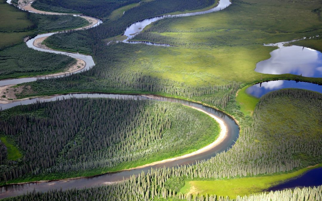
While much conservation and political attention have focused on whether to allow oil development in the Arctic National Wildlife Refuge, another project, the Ambler Mining Project, and road construction proposal may pose even greater threats to the Arctic’s wildlife and wildlands. Despite this threat, The Ambler project has thus far received far less attention from the media, politicians and conservation organizations.
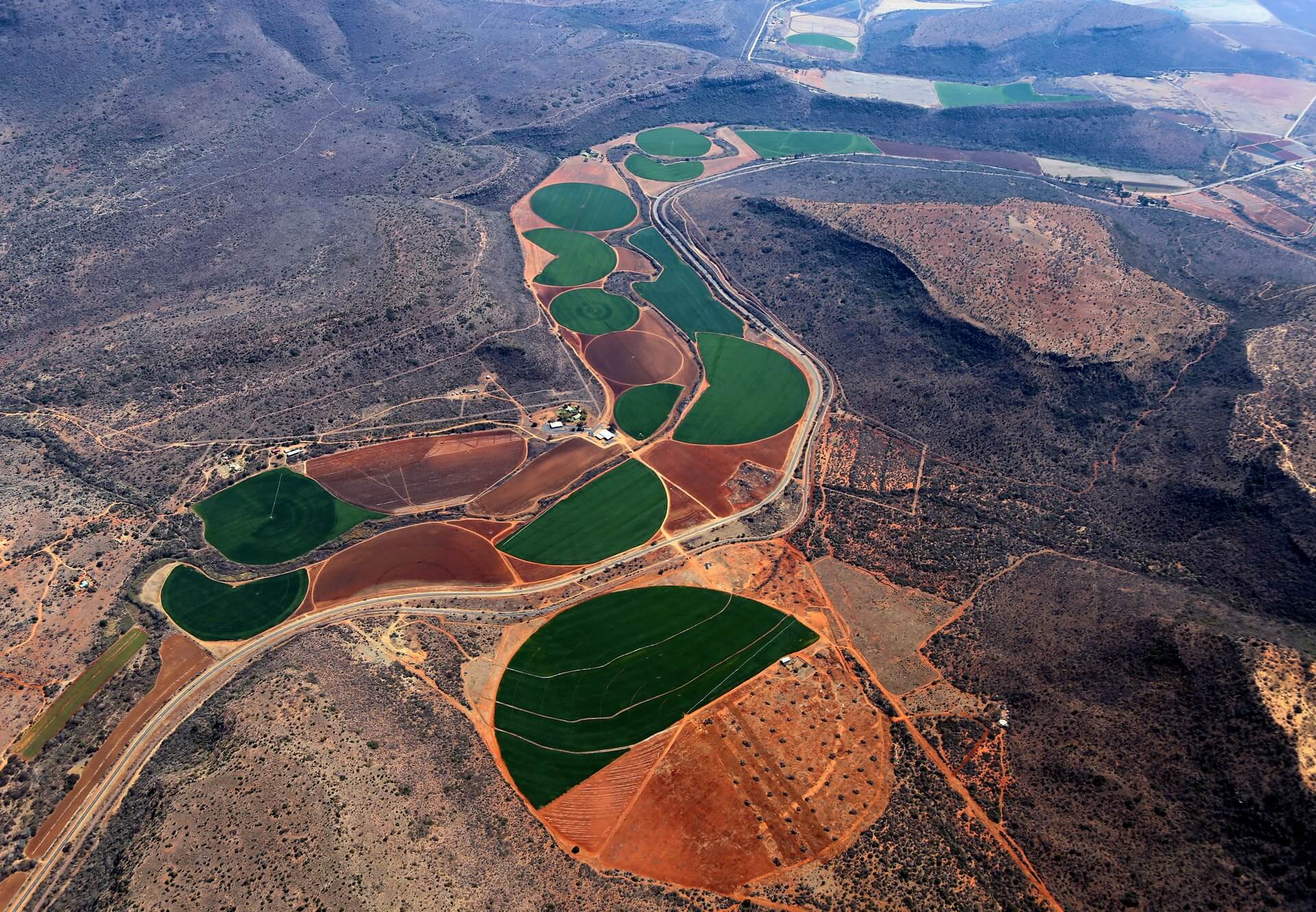
The proposed 211-mile Ambler Road would connect the Dalton Highway (pipeline haul road) with the Ambler Mining District in the western Brooks Range. The ore belt that stretches for 200 miles contains copper, cobalt, lead, and zinc and could be one of the most valuable deposits in the world, especially as people turn to electric vehicles.
There is new interest in encouraging the US development of critical minerals and energy, and the Ambler Mining proposal benefits from this push for US sources of minerals.
Although these deposits have been well-known for decades, the cost of mining, smelting, and transportation has precluded development. (I knew about the ore deposits in the 1970s when I lived and worked along the Kobuk River).
Years ago, I taught a class on Alaskan Environmental Politics. I emphasized that Alaska has more oil, coal, minerals, and even forests than most other parts of the United States. Many of these resources remain undeveloped because of the harsh climate, remote locations, and lack of access.
There are, for instance, substantial forest resources in Southeast Alaska. Still, they cannot be cut and transported without government subsidies because it’s cheaper to log trees in Oregon or Washington.
The Prudhoe Bay oil fields were the world’s 10th most significant oil reserves, and the other nine were in the Middle East. The Prudhoe Bay oil fields would have remained undeveloped had it not been for the construction of the Alaskan Oil Pipeline, which made these oil reserves economic to develop.
The Ambler Mineral deposits are considered “world-class.” Getting a road to the Ambler Deposits is the first step in making mining operations profitable. The Bureau of Land Managment (BLM) and the Corps of Engineers under the Trump Administration approved the road plan in 2020, and officials agreed to issue a 50-year right-of-way for the Alaska Industrial Development and Export Authority, the state public corporation working to develop the project.
However, the Biden Administration halted the road project while a Supplemental EIS process mandated by the courts was completed. However, my sources in Alaska suggest this may be for show. The comment period ended on November 4th, and the BLM review will likely be published sometime in the new year.
If you want to understand politics, all you have to do is follow the money.
The mining claims are owned mainly by local Iñupiat people living in NW Alaska coast and inland along the Kobuk River, represented by NANA corporation. They also operate the Red Dog Zinc mine, one of Alaska’s most significant mining and polluted sites.
During the land selection process created by the Alaska Native Claims Settlement Act (ANCSA), native people targeted the lands with valuable known mineralization or fossil fuel resources.
In the case of the Ambler mines, NANA shareholders are likely to be employed during road construction and mining operations.
One study estimates that 20% of all construction jobs will be held by local villagers, providing significant money input into these rural villages. NANA corporate leaders likely believe they are working in the best interests of their constituency.
In addition to NANA and some residents who would benefit from jobs and royalty payments, the road is also supported by the state of Alaska. The Alaska Industrial Development and Export Authority (AIDEA) would own Ambler Road.
Alaska’s Congressional Delegation, including newly elected half-Native Democrat Mary Peltrola and Republican Senator Lisa Murkowski, support the road and mining proposal. Peltrola has also joined her Republican counterparts in the Senate to support oil development in the Naval Petroleum Reserve.
The road, if built, would likely lead to road sprawl and the expansion of development in the region, including perhaps oil development in the Naval Petroleum Reserve to the north of the Brooks Range.
Although the supporters point out that the road would be a private road only accessible to industrial use, opponents point out that the same claim was made about the Pipeline Haul Road. However, in 1994 the state opened the Pipeline Road (Dalton Highway) for unrestricted, public use.
Opposition to the road comes from Tanana Chiefs and other Athabascan Indians living along the Koyukuk River and tributaries. The Athabascan would gain no advantage to a road except perhaps for more accessible and cheaper shipment of supplies. But they fear the road would disrupt subsistence hunting and gathering.
The Athabascans are not necessarily opposed to mining or oil development themselves. Doyon Native Corporation, which represents the Athabascan people of the Yukon Basin, during the land selection process of the Alaskan Native Claims Settlement Act has specifically targeted mineralized lands. Today, they have several active mining operations. However, Doyon has neither endorsed or opposed the Ambler Road and mining projects.
However, Doyon has proposed alternative road access to the Ambler district from Nome.
So, in essence, the road is pitting one ethnic native group against another.
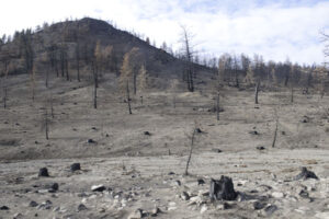
In addition to opposition from some native people, many conservationists also oppose the road. The Ambler Road, if built, would cross the Gates of the Arctic National Park and Preserve and numerous other protected areas like the Kobuk Wild and Scenic Rivers.
The National Park Service did an excellent review of the potential impacts of the road on wetlands, water quality, fish, wildlife, subsistence, and recreational impacts on the park that applies to the total road mileage.
Conservationists and native people opposed to the mine have produced a good video about how the road would impact the Arctic:
An environmental review by the BLM in 2020 found that the road would impact salmon, caribou, and other wildlife.
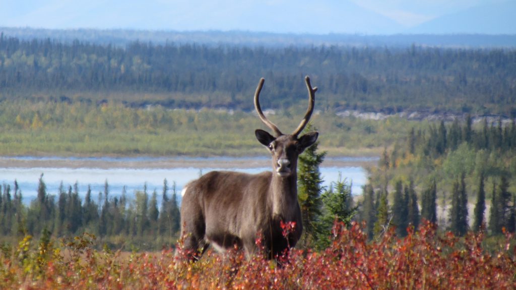
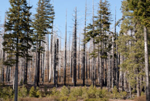
Roads can be semi-permeable barriers, and although crossing such obstacles is possible, caribou may shift or entirely abandon their seasonal habitat. The disturbance and activity along the road and mining operations are likely to affect caribou in other ways. Studies have shown that caribou may travel up to 9.3 miles to avoid roads and 11.2 miles to avoid settlements.
Thousands of caribou like this one traditionally cross the Kobuk River near Onion Portage in the fall. Accessibility statement: Single caribou looks directly at the camera surrounded by red shrubs, with river and forest in background.
For instance, a study of the Native-owned Red Dog Mine Industrial Access road north of Kotzebue found that just four vehicles an hour affected the migration of 30% of collared caribou, or approximately 72,000 individuals of the 2017 population estimates.
Linear features like roads also are used by predators like wolves. This can increase predator influence on prey like caribou. Roads and seismic lines in Alberta have led to increased predation on woodland caribou.
It also does not take much imagination to see that this road will eventually be extended to the coast by Kotzebue, fragmenting the entire western Brooks Range’s ecosystems.
Nevertheless, the road’s construction was approved by the Trump administration. However, the Biden Administration has ordered the Bureau of Land Management to reevaluate the Environmental Review.
The BLM accepted comments until November 4th. Whether the BLM review changes the decision to move forward with the road remains to be seen.
But my sources in Alaska say that the Biden Administration is likely to approve the road to help Alaskan politicians, perhaps with stricter regulations designed to address environmental concerns. The Biden Administration doesn’t want to oppose new Democratic Congressional Representative Mary Petrola who is a supporter of the mine road. Murkowsi was critical to Democrats in voting to convict Donald Trump for his role in the Jan. 6th insurrection, was one of three GOP to vote for nomination of Judge Ketanji Brown Jackson and she was the only GOP member to support the Voting Rights Bill. Biden does not want to alienate her potential support for other Democratic agenda votes.
I can’t emphasize enough that this road is one of the biggest threats to the Arctic’s wildlands and wildlife. It is bigger than just the development impacts that may result from the Ambler Mining operations. I have no doubts that the road, if built, will eventually make other mineral and oil, and gas sources economically viable to develop.
George Wuerthner is a professional photographer, writer, and ecologist. He has written more than three dozen books on natural history and other environmental topics. He is currently the Ed of Public Lands Media. Wuerthner has visited hundreds of mountain ranges around the West, more than 400 wilderness areas, more than 200 national park units, and every national forest west of the Mississippi. Listen to Derrick Jensen’s latest interview with George Wuerthner.
In a recent May 29 Bend Bulletin article, Senator Merkley asserted he “wants to boost spending on forest management by $1 billion annually through work, such as thinning and prescribed burning, to reduce the prospects of catastrophic wildfires.”
An unexamined assumption is that thinning/logging work significantly reduces the pejoratively named “catastrophic” fires.
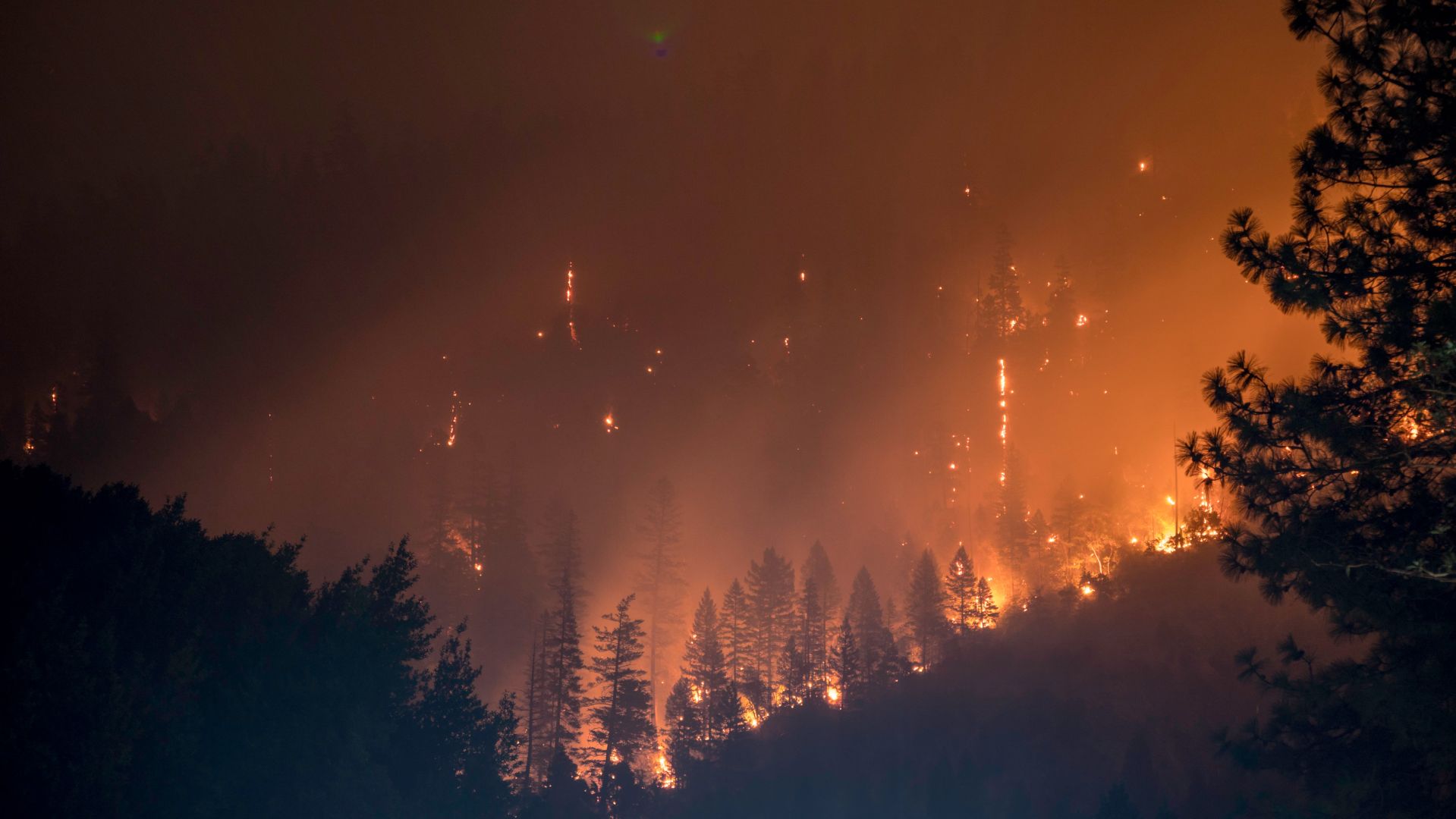
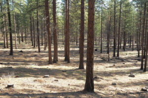
The Holiday Farm Fire burned the western slopes of the Cascades driven by extreme fire weather conditions, including high winds, charred acres of clearcuts, and other “fuel reductions.” Photo George Wuerthner.
Despite assertions from the Forest Service and others who will gain financially from inflated budgets to log our forests, one needs to ask if “fuel reductions” work to halt wildfires when burning under extreme fire weather conditions. That qualifier is important. All large blazes, like those that charred the western Cascades last Labor Day, burn swiftly through logged sites and other “fuel reductions.”
All such blazes occur under drought conditions, high temps, low humidity, and high winds. Thinning/logging and prescribed fires will not significantly preclude large blazes burning under extreme fire weather conditions.
This fire in the Scratchgravel Hills by Helena, Montana, driven by 50 mph, burned through this forest that had been thinned just six months prior to the blaze. Photo George Wuerthner.
I have traveled extensively around the West to view the aftermath of the largest fires, and every single one occurred during extreme fire weather conditions. Nothing, including thinning, logging, and prescribed burns, works to contain such fires when you have these conditions. I know of no exceptions.
Such blazes are only contained when the weather conditions change. Logging does not change the weather.
When it “appears” that fuel reductions worked under extreme conditions, you need to examine the actual burn circumstances during the blaze—the intensity of fire changes hour by hour.
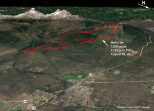
Proponents of forest thinning, including Merkley, suggest previous thinning projects saved Sisters, Oregon from the 2017 Milli Fire that burned within 2-3 miles of town. Yet if you read the Fire Incident Report carefully, such conclusions are questionable.
Thinned ponderosa pine stand near Sisters, Oregon, has resulted in a mono-culture of nearly even-aged forest that degrades the forest ecosystem and doesn’t stop fires burning under extreme fire weather. Thinning kills trees to preclude natural processes from killing trees. Photo George Wuerthner.
The Milli Fire burned through two previous burns (Pole Creek and Black Crater), presumably “fuel reductions.” It also burned through some thinned stands before thinning “saved” Sisters.
The red outline shows the wind-driven effect of the Milli Fire. A change in wind direction “saved” Sisters—photo USFS.
What happened is that the wind that had been moving the fire towards Sisters shifted, pushing the fire west and north into lava fields in the Three Sisters Wilderness.
Did thinning save Sisters? Maybe? However, a more nuanced analysis might conclude that a change in weather patterns is what “saved” Sisters.
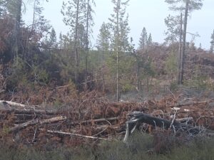
Worse for our communities is that the Forest Service is “selling” a myth. Thinning/logging has been shown to increase fire spread. Thinning opens the forest to more wind penetration and more soil drying—both factors are conducive to fire spread during extreme fire weather.
Logging/thinning on the Deschutes NF leaves many fine fuels on the ground, often exacerbating fire spread. Photo George Wuerthner.
What burns in wildfires are the fine fuels: grass, shrubs, pine needles, small trees, and so forth. Large trees that thinning removes typically do not burn. That is why we have “snags” after a severe fire.
While thinning and prescribed burning treatments might lower fire intensity briefly immediately after the treatment, the chances that a fire will encounter a treatment is extremely rare.
Ironically, fuel reduction often increases the percentage of fine fuels on a site, ensuring that a blaze can readily spread if driven by high winds.
Ignored in the race to log our forests is that high severity fires are essential to healthy forest ecosystems. The biodiversity they produce often exceeds what is found in “green forests.”
Snags are critical to a healthy forest ecosystem. This is a sign of forest “health.” Photo George Wuerthner.
So the “story” the FS sells that thinning is “improving” forest health is another inaccurate statement. Dead trees resulting from fires, bark beetles, and other natural factors are critical to healthy forest ecosystems.
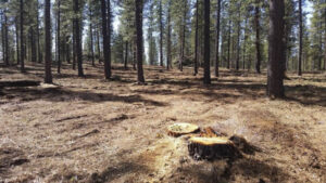
A sanitized forest stand (restoration) on the Deschutes NF, Oregon. Note the lack of small trees, lack of species diversity, lack of snags, down wood, and even shrubs. Photo George Wuerthner.
Thinning/logging is not benign. There are many impacts to the forest ecosystem from “restoration,” “fuel reductions,” and other euphemisms used to justify commercial logging. These include the spread of weeds, sedimentation in streams from logging roads, displacement of sensitive wildlife, loss of biomass, and loss of carbon storage.
Ultimately, we must deal with the GHG emissions that drive climate change, increasing drought, variable weather, and the conditions that favor large blazes.
In the meantime, increasing thinning and prescribed burning, except in the immediate area around communities, does little to protect homes. A much better way to spend scarce funds is to assist communities and homeowners in reducing the flammability of homes, burying power lines, and precluding new home construction in fire-prone areas.
In this piece, originally published in Counterpunch, George Wuerthner examines previous successful conservation movements, and describes what we can learn from them.
We do not want those whose first impulse is to compromise. We want no straddlers, for, in the past, they have surrendered too much good wilderness and primeval areas which should never have been lost.
– Bob Marshall on the founding of the Wilderness Society
There is an unfortunate tendency on the part of conservationists to forget or ignore history. A greater appreciation of past conservation victories as well as defeats can inform current efforts. In far too many cases, there is a tendency to believe that it is necessary to appease local interests typically by agreeing to weakened protections or resource giveaways to garner the required political support for a successful conservation effort. However, this fails to consider that in nearly all cases where effective protective measures are enacted, it has been done over almost uniform local opposition.
In those instances where local opposition to a conservation measure is mild or does not exist, it probably means the proposal will be ineffective or worse—even set real conservation backward.
Nevertheless, many environmentalists now believe that due to regional parochialism and lack of historical context, significant compromises are necessary to win approval for new conservation initiatives.
These compromises demonstrate a failure to learn the lessons from conservation history. In particular, it is striking that in today’s era of greater environmental awareness, many environmentalists are willing to propose compromises that offer far weaker protections for our public lands heritage than what was accomplished decades ago, when resource extraction industries had a much greater influence over local and regional economies.
LESSON ONE: Nearly all worthwhile conservation successes were established over strong local objections. This opposition is not surprising. Current land users have a vested interest in maintaining the status quo. Though environmental protection has been shown repeatedly to provide long term economic and social benefits to regions, those who benefit are often different from those who have a vested interest in maintaining the status quo. We nearly always hear that protection will ruin the local economy.
Thus Yellowstone National Park was created by Congress mainly over the opposition of locals in Montana Territory, who wanted the park to remain open to homesteading, logging, and ranching. Indeed, annually for twenty years after establishing the park, Montana’s Congressional representatives introduced bills into Congress to undesignate the park. Fortunately, due to strong support for the park from the “dreaded eastern establishment,” these efforts did not succeed.
Similarly, when Franklin Roosevelt established Grand Teton National Monument in 1943, Jackson’s local leaders declared that Jackson would become a “ghost town,” and Wyoming’s Congressional delegation introduced a bill to eliminate the park. The bill successfully passed both branches of Congress. The monument only survived because Franklin Roosevelt vetoed the bill.
Early efforts to create a park in the Olympic Mountains with the first park bill were introduced in 1904—a statement that was vigorously opposed by local timber interests. Teddy Roosevelt responded and established the Olympic National Monument in 1907 and put vast tracts of virgin timber off-limits to logging when logging was king.
Nevertheless, opposition from logging interests continued. However, in 1938 outside interests lead to the establishment of Olympic National Park. In the long run, the park’s creation has been shown to have substantial long-term benefits to the residents of the Olympic Peninsula. However, those who made their living by cutting down the Olympic Peninsula trees are not necessarily the same people who are now making a living from the park’s scenic, ecological, and tourism values.
LESSON TWO: Don’t assume all locals are opposed. Typically the most vocal opponents are those with the largest vested interest in maintaining the status quo. There may even be a “silent majority” that is at least neutral or mildly supportive of your proposal, but they are not the ones who control the local politics. However, whether one or many local supporters, nearly all successful conservation efforts rely upon outside leadership to issue a state or national concern. And there is usually some visionary (or group of visionaries) that led this national campaign ala John Muir (Yosemite), David Brower (Dinosaur), Bob Marshall (Gates of the Arctic), Olaus Murie (Arctic Wildlife Refuge), Willard Van Name, Rosalie Edge, and Irving Brant (Olympic), George Dorr (Acadia), etc.
LESSON THREE: Creating and generating the political case for strong conservation protection, as opposed to more limited or weak gains, often takes a while, sometimes a long time. For instance, in the 1930s, Bob Marshall publicly called for protecting all of the Brooks Range north of the Yukon River as a national park. It took until the 1980s for his vision to become a reality. Look at a map of northern Alaska. You will see that nearly the entire Brooks Range is now in some protected status between national wildlife refuges, national preserves, and national parks.
LESSON FOUR: Pragmatists, in the end, leave messes for future generations to clean up. Capitulating to local interests with half-baked compromises in the interest of expediency typically produces uneven results. Either they do not adequately protect the land or create enormous headaches for future conservationists to undue often at a significant political and economic expense.
For instance, when the national forest system was first established, the lands were protected from commercial uses, much like our current national parks. However, in 1905, Gifford Pinchot proposed expanding this system of national forest reserves into national forests, opposition to the forest system from mining companies who wished to use timber from national forests for mining timbers and other mine construction lead to a compromise that permitted commercial logging. Some conservationists like John Muir were opposed to this compromise, but they lost in their efforts. Others felt that a compromise was needed, and besides, it was reasoned such a compromise would be harmless because most of the best timber was outside of the forest preserves and on private lands. No one could imagine there would be much demand for logging on national forest lands.
A similar compromise was also made regarding commercial livestock grazing to win over western ranchers. So commercial logging and ranching were put in place to neutralize western opposition to the forests—but we are still paying the price for that decision today.
Another example is Lake Tahoe—the gem of the Sierras. Initially, there was a movement to protect the lake as a national park. But in the interest of expediency and due to local opposition that wanted to log the great pine forests surrounding the lake, the park proposal was dropped in favor of national forest status. Today many of the problems that plague the Tahoe basin, including water quality decline, are a consequence of this decision, including the abundance of private lands (which could be settled within national forests but not parks).
Point Reyes National Seashore represents another example. The park was created by the purchase of private ranchlands on the Point Reyes Peninsula. As a compromise, any rancher that wanted to remain on their former property and continue ranching/farming was given a 25 year grace period, after which they would be required to leave the property. Almost immediately, the ranchers began to lobby to extend the grace period. Today, fifty years later, they are still operating on the public lands and damaging the water, wildlife, and plant life of the peninsula. Had the Park Service and Congress done what any other property owner does upon purchasing land, which is to pay for the land and have the former owners leave, we would not be facing the prospect of another 20 years of livestock production on these parklands.
We’ll never know whether these compromises were necessary. One could argue that we would not have any national forests today if we had not made such compromises, but this is mostly conjectures. National support for parks and other preserves was very high, and it is likely national forests without logging and grazing would have won Congressional approval.
LESSON FIVE: Over time, most locals view conservation areas as an asset and source of pride. This change typically takes a couple of decades, but I know of no exceptions. Despite this realization that any particular park, wilderness, etc. is overall a benefit to the local and regional society does not typically result in local support for new conservation proposals as they come along. In other words, though people in Montana have grown to love Yellowstone National Park, there was still stiff local opposition to new wilderness areas adjacent to Yellowstone National Park like the Absaroka Beartooth Wilderness when it was created in 1978.
To illustrate one example, I will highlight the chief milestones along the way towards today’s Grand Canyon National Park.
GRAND CANYON
1882. Senator Harrison (later president) introduces three proposals for a Grand Canyon National Park into Congress without success.
1883. Harrison, elected president, creates 15 forest preserves, including one surrounding the Grand Canyon.
1898. Coconino County Board of Supervisors passes resolution opposing new forest preserve—and attempts to have protections lifted.
1903. Teddy Roosevelt visits the canyon.
1906. Roosevelt signs a bill to create a large game range at canyon again over local opposition.
1908. Roosevelt asks his attorney general whether there was any limit on the size of areas that could be protected using the recently passed Antiquities Act (1906). The Act was created to protect “small” sites like Indian ruins. However, according to the attorney general, no size limit exists—so Roosevelt uses the Antiquities Act to create a million-acre Grand Canyon National Monument.
Residents in Arizona were outraged. Arizona’s congressional delegation succeeded in blocking all funding for the implementation of monument protection. They sued the federal government and went all the way to the Supreme Court. They argued that Roosevelt exceeded his powers and the original intention of the Antiquities Act. Supreme Court upholds the use of the Antiquities Act, and Grand Canyon National Monument remains.
Failing to eliminate the monument, opponents took a new tact—like Healthy Forests Initiative—they used the conservationists’ language to hide their real intent—to undercut protection. Knowing the national popular support for parks, in 1917, Arizona Senator Henry Ashurst introduced a bill to make the Grand Canyon a national park.
1919. Grand Canyon NP was signed into law—but freed up much of the valuable mining, timber, and grazing lands to satisfy local interests. The bill removed monument and park protection to grazing and timberlands, reducing the overall acreage protected by the national monument by 2/3!
1927. Growing popular support for parks and the Grand Canyon lead to the expansion of Park boundaries to 646,000 acres.
1932 Herbert Hoover declared a new Grand Canyon NM to protect an additional 273,000 more acres surrounding the existing national park.
1969. Marble Canyon NM was created.
1975. Grand Canyon Enlargement Act adds Marble Canyon and Grand Canyon NM to the existing Grand Canyon National Park. Creating a park of 1.1 million acres that finally equals in size the original national monument that Roosevelt had protected in 1908.
1979. UNESCO declares Grand Canyon, an official World Heritage Site.
In the 1990s, when federal budget issues threatened to close the park to visitors, the state of Arizona offered to pay rangers salaries to keep the park open—illustrating the complete change in attitude that now prevails.
2000 President Clinton designates just over 1 million acres as the Grand Canyon-Parashant National Monument to protect much of the North Rim region of the canyon over locals’ objection. I predict that someday these lands will be added to Grand Canyon National Park.
Conclusion
The most important lesson is not to be discouraged when local people do not widely hold your idea for conservation protection. This should not prompt an immediate compromise to whatever legislation or goal you are pursuing. Instead, stick to the plan, and in many instances, you will prevail. Try to neutralize local opposition, but generate outside support if possible, make the issue a state or national issue.
For instance, it was downstate supporters in New York City that provided the political muscle to create the Adirondack State Park over residents’ objections. This park, now 6 million acres in size, has a clause that prohibits all logging on state lands. If early park advocates had tried to mollify locals to accept park establishment, there would have undoubtedly been logging permitted in the new park. Instead, park supporters successfully rallied people from outside the region to help create the wilderness park we have today.
All legislation is compromise, but don’t be the one to do the compromising—that’s the job of Congress. Make your best case for the best protection. If you don’t achieve that goal in any particular legislation, you can decide to oppose it and attempt to stop it or accept it with compromises. For instance, if you want all the roadless country in a particular area designated as wilderness, propose it all as wilderness and make your best case to save it all. If Congress cuts that in half, you have still successfully made the case that all the roadless lands are qualified for wilderness, and you can always try to enact more protective legislation in the future for these lands. However, if in attempting to secure local support, you automatically say or accept the notion that some of these roadless lands are ecologically unimportant or are throw away lands that can be developed; you have lost your moral authority to fight for protection later.
When and where you compromise affects the outcome, not only current issues but shaped future expectations. Thus a long-term vision should always be kept in mind.
George Wuerthner has published 36 books including Wildfire: A Century of Failed Forest Policy. He serves on the board of the Western Watersheds Project. You can read the original article here.
All around the world, irrigation for agriculture is taking massive amounts of water from rivers, in many cases leaving them almost or entirely dry. This article comes from central Oregon, where 90% of human water use is for agriculture.
Low Flows Due to Irrigation Destroying Deschutes River
The recent article “Low Flows On Deschutes” highlights why irrigation is a significant threat to our river’s ecological integrity.
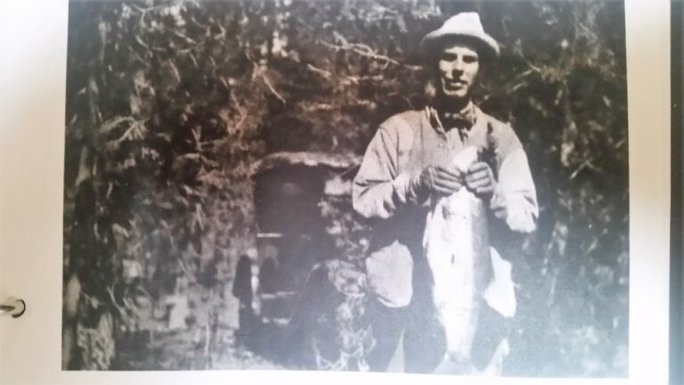
According to the report, flows on a portion of the Deschutes dropped to 60 CFS leaving many parts of the river channel dry. To put this into perspective, historically, before irrigators took our water from us, the river ran at 1000-1200 CFS year-round. As a spring-fed river, the Deschutes supported outstanding fisheries.
Huge trout caught out of the Deschutes near the turn of the century before irrigation destroyed the river.
This tragedy continues because the public is not standing up for its rights. We, the people, own the water in the river, not the irrigators. We allow the irrigators to take water from the river without any compensation to the public, and regardless of the damage done to aquatic ecosystems. This system was devised by irrigators to serve irrigators a century ago.
Isn’t it time for us to enter the modern age? Using water in the desert to grow hay for livestock is just a crazy waste of a valuable resource. Keeping water in the river would provide for greater recreational use. And maintaining viable flows would protect aquatic life like spotted frogs, trout, and salmon, not to mention all the other water-dependent species like eagles, mink, otter, and the rest.
Despite the claims to “water rights” the actual water in all state rivers belongs to Oregon citizens as affirmed by the Oregon Supreme Court.
“All water within the state from all sources of water supply belongs to the public,” including ground water. The Act allows for instream water rights for public uses, and public uses include but are not limited to recreation, “conservation, maintenance and enhancement of aquatic and fish life, wildlife, fish and wildlife habitat and any other ecological values,” pollution abatement, and navigation. In addition, “public uses are beneficial uses,” but “[t]he recognition of an in-stream water right . .. shall not diminish the public’s rights.”
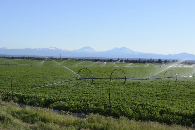
The majority of water removed from the Deschutes is used to grow irrigated pasture and hay for livestock not crops consumed directly by humans. Photo by George Wuerthner
Technically speaking, degrading the river by irrigation should be illegal since the public values are supposed to be given priority in any water allotments.
Maybe it made sense to dewater our rivers to promote Ag a century ago when there were fewer economic opportunities. However, today Ag contributes only to 1.3% of Deschutes County income.
One can make a case that the 1% are degrading our river that belongs to all citizens for their private profit.
It is time to modernize our approach to water use. Growing cow food in the desert is a senseless waste of a valuable resource—water. We need to put the welfare of the river ecosystem and all citizens first.
George Wuerthner is an ecologist and former hunting guide with a degree in wildlife biology.