My thoughts race with yesterday. My friend Max Wilbert and I left Park City, Utah in the pre-dawn bitter cold crossing the Wasatch Mountains that form the eastern edge of the Great Basin. The drive west from Salt Lake City on I-80 is disorienting. We began the journey with the radio on. We both became too frustrated by news of another politician refusing to accept refugees, so we turned the radio off to watch the land as we traveled.
Interstate 80 took us past the sites of some of the West’s most destructive extraction industries including Kennecott Copper’s Bingham Canyon Mine. The Oquirrh Mountains stand tall on the Salt Lake Valley’s west side, each peak a majestic testament to the forces of beauty who formed the Great Basin.
Each peak, save one.
With the destruction of the mountain peak and subsequent release of heavy metals, the Bingham Canyon mine is responsible for the deaths of countless migratory birds and their homes
The Bingham Canyon Mine – the continent’s largest open-pit copper mine impacting close to 80 square miles in the Salt Lake Valley – ripped one of the peaks off to disembowel copper from the land. Not far past the pit, stretches the mine’s smelting and tailings pond. The pond, which seems big enough to be called a lake, runs parallel to the Great Salt Lake, one of the Western Hemisphere’s most significant migratory bird habitats. At some places, tailings water sits merely yards from the Great Salt Lake. Mining activities and the tailings pond release selenium, copper, arsenic, lead, zinc, and cadmium into the Lake. With the destruction of the mountain peak and subsequent release of heavy metals, the Bingham Canyon mine is responsible for the deaths of countless migratory birds and their homes including wetlands, marshes, other freshwater wildlife habitats, and freshwater ponds.
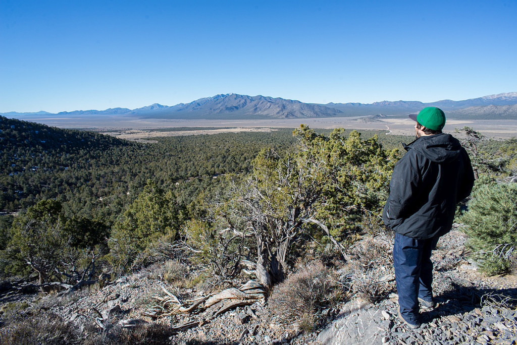
After we drove by the casinos in Wendover and the brothels in Ely, we spent the day on the southern slopes of Spruce Mountain walking through a pinyon-juniper forest clear-cut. We met up with biologist and Great Basin expert, Katie Fite, who narrated the history of environmental degradation in the region.
Today, after the travel, seeing the clear-cut, and hearing about the tragic history of the Great Basin, my head is reeling. I crave time and space. I crave simply to locate myself.
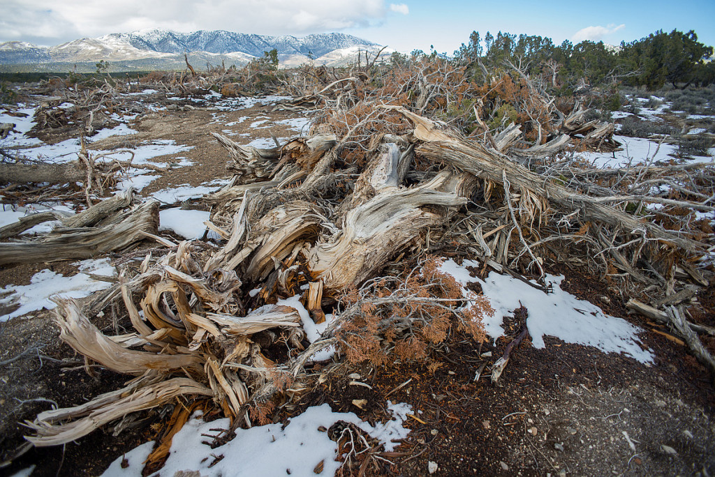
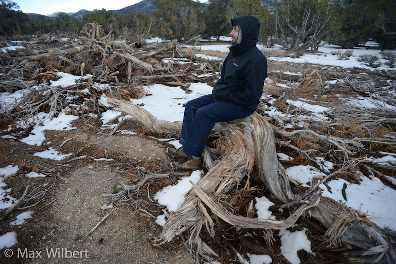
The trunk I lean against is the trunk of a tree lost in another clear-cut. I do not want to see clear-cuts anymore, so I face away from the carnage. Behind me are the scattered corpses of pinyon-pine and juniper. Many of these trees were two or three hundred years old and had watched countless of the Great Basin’s arid summers and bitter winters. The pinyon-pines had offered up their delicious nuts to birds like turkeys, Clark’s nutcrackers, Steller’s jays, scrub jays, and pinyon jays as well as wood rats, bears, deer and humans for centuries.
Cave Valley.
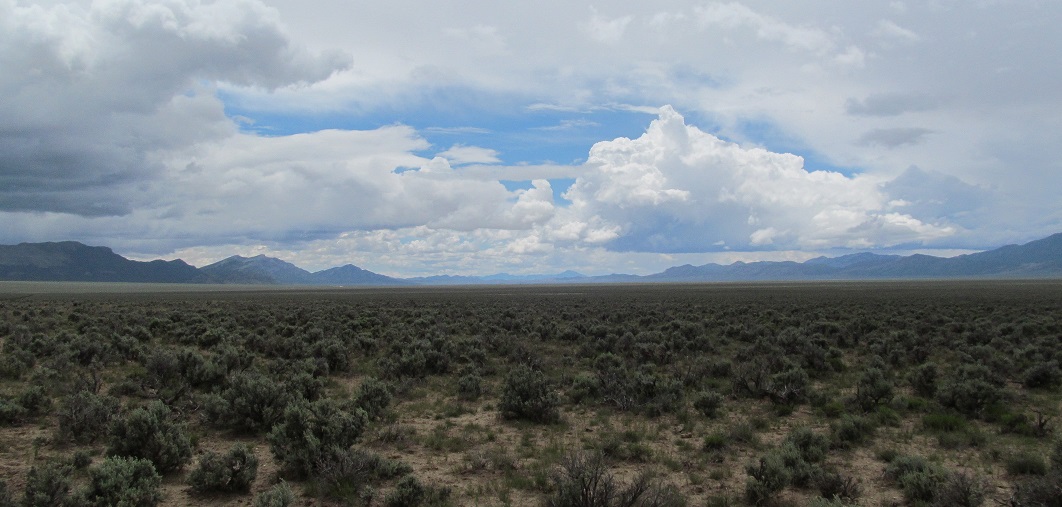
With my back turned to the clear-cut, the wide, clear sky, the drama tracing the sharp mountainsides, and the seemingly eternal evenness of the Cave Valley floor creates a vastness that overpowers any inclination I possess towards my own importance.
I am so small here.
I want to pray, but I hesitate because I wonder what relationship I have earned with life here to engage in sincere prayer. I wonder how I must appear to the trees. With my white skin, European genealogy, dark beard, and heavy boots, I must look like so many of the settlers who have damaged this valley before. Have these forests suffered too much trauma to welcome people who look like me? Surely, their most effective survival strategy must be to shut me out.
I want to ask this valley what I can do for life here. I remember that prayer need not involve asking for anything. I sink into the twigs and frost on the ground where I sit. I try to seep into the valley letting myself spill across the landscape.
I remember a strange sensation I experienced not long ago driving through Price, Utah – coal country. Driving parallel to a long stretch of train tracks, through dynamited rock formations, I thought of the Irish – my kin – who must have been involved in building the railroads that lacerate open lands across the West. I asked aloud about what it must have been like for a young Irishman, no older than me, who was asked by his family to leave home and seek work in America because they could no longer feed him. I asked how strange it must have been for him to stand on the docks at Cork wondering if he’d ever embrace his mother again. Then, to pause in the oppressive Utah sun considering the same embrace while digging graves for his friends after a dynamite accident – all in the course of a year.
I feel a sense of ancestral guilt here in Cave Valley knowing that those same railroads opened up Nevada’s remote places to the cattle and sheep grazing destroying the land. Even so, I want to ask this valley what I can do for life here. I remember that prayer need not involve asking for anything. I sink into the twigs and frost on the ground where I sit. I try to seep into the valley letting myself spill across the landscape. I wish the wind would carry me through the sage brush and up the slopes into the living pinyon-juniper forests. The wind stirs. Wind is an invisible being only coming close to being seen when it dries my eyes out, or dances with the trees.
The contrast of the wind’s chill and the sun’s warmth is a sensuous experience of the purest kind. I grow bold. I ask the valley what it wants me to know.
I ask the valley what it wants me to know. As the question forms in my consciousness, the blue wings of a pinyon jay catch my attention.
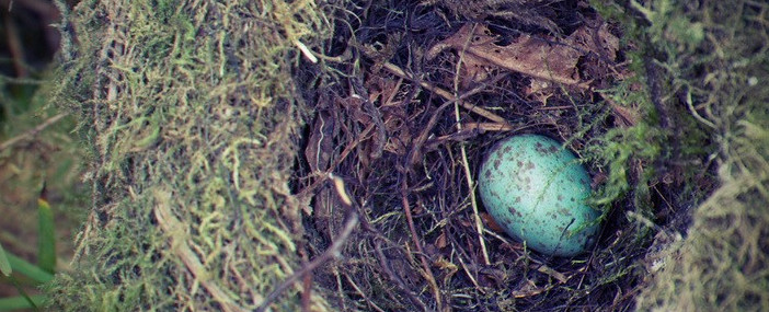
As the question forms in my consciousness, the blue wings of a pinyon jay catch my attention. The jay is flying swiftly through the clear-cut. She seems aware of her vulnerability with no cover in the void. She lands on a stump, searches around, and pulls up a pinyon pine cone. She shakes it and pecks at it with her beak, but finds no nuts. She pulls another cone up, and again finds no nuts. I watch her fly from stump to stump, felled trunk to felled trunk, and still she finds no nuts. Finally, the voices of my companions returning from their hike carry over the ridge line. The pinyon jay darts quickly across the open and back into the living forest finding refuge in standing pinyon pines and junipers.
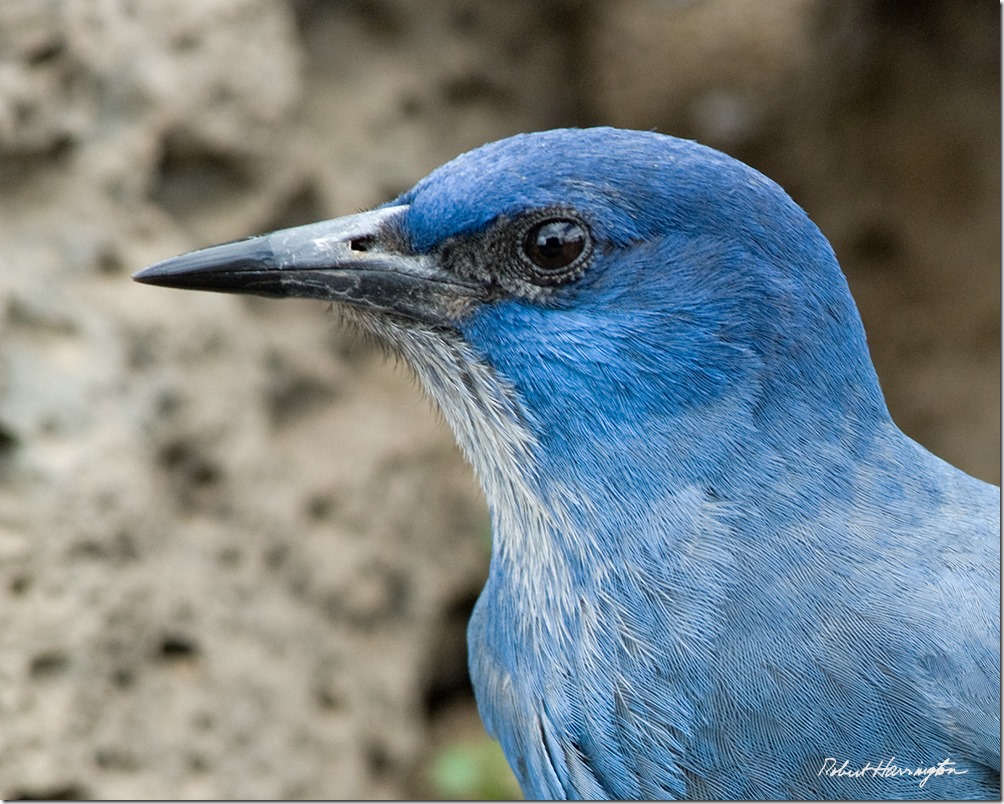
Pinyon Jay. Image by Robert Harrington.
I was asked by my friends to write about pinyon-juniper forests because they are being clear-cut by the Bureau of Land Management, but before I wrote about them, I knew I needed to visit the forests in an effort to understand what needs to be said. Of course, my prayer was answered. Life speaks in patterns. When a story-teller sits down to communicate her experiences in a manner that will make sense to her listeners, she may recognize those patterns and hear life speaking there.
My trip to pinyon-juniper forests in Nevada began with news of the refugee crisis. The journey continued past places where mining destroys the homes of migratory birds, fish, and so many others who depend on the precious-little freshwater near the Great Salt Lake. From there, I witnessed the ruins of pinyon-juniper forests. Not only are these forests populated with ancient, hardy trees who generously offer their pine nuts and juniper berries, but the forests are home to an estimated 450 species of vascular plants and over 150 vertebrate species. Birds live there. Wood rats live there. Deer live there. Elk live there. The Shoshones, the Goshutes, the Paiutes, all live there. All these non-humans and humans are made into refugees by the clear-cutting of pinyon-juniper forests just like the lone pinyon jay I was shown when I asked what I needed to know.
When we peer into the past with Earth’s memories, we see thousands of years of refugees. … Countless species call the world’s forests home, so when we witness deforestation, we are witnessing a refugee crisis.
The recent news on the refugee crisis encourages us to think only of boats filled with human refugees sinking on the way to Europe. These events are most tragic and the refugee crisis is by no means new nor is it limited to humans.
When we peer into the past with Earth’s memories, we see thousands of years of refugees. We see 80% of the world’s forest cover lost to deforestation. We see countless animals fleeing the thunk of axes as blades sink into the living flesh of trees. We see birds circling their young in nests built in quivering branches as we hear the hungry buzz of saws and the sickening crack and snap as trunks break. Countless species call the world’s forests home, so when we witness deforestation, we are witnessing a refugee crisis.
We see more than 75% of the topsoil that existed worldwide when Europeans first colonized North America is now gone. We watch as the plows rip through the skin of the land and the world’s forests to make way for the cultivation of annual crops. Subsistence farming is responsible for 46% of world deforestation, while commercial agriculture is responsible for 32%. Another way to say this is countless species have their homes destroyed so that one species – typically a grain – have a place to thrive.
Ripping metals from the earth creates refugees out of those who call the ground and dark subterranean regions home.
We see 60% of the world’s major rivers fragmented by dams and diversions (PDF). Some of the world’s greatest rivers such as the Nile, the Indus, and the Colorado no longer flow to the sea. For aquatic life, a dam is often an impenetrable wall. We see salmon wanting to return to their spawning beds, wanting to return home, so badly they batter their heads against concrete walls. They struggle so fiercely against the dams river water turns crimson with salmon blood. Dams isolate communities and keep non-humans from coming home as surely as the Berlin Wall of the Cold War separated Germans or the border fences in California, Arizona, and Texas alienate Americans, Mexicans, and indigenous peoples from each other.
While Earth remembers a refugee crisis thousands of years old, the Great Basin’s memories are full of relative peace characterized by humans like the Shoshone, Goshutes, and Paiutes among others living sustainably taking only as much as the land freely gave. It was the discovery of a great silver lode in Comstock, Nevada in the 1850s that brought European settlers en masse and started the refugee crisis in the Great Basin.
Ripping metals from the earth creates refugees out of those who call the ground and dark, subterranean regions home. Additionally, silver is extremely difficult to smelt requiring huge amounts of charcoal produced from burning huge amounts of local pinyon pines and junipers at high enough temperatures to separate silver from the stones it clings to so desperately.
Pinyon-juniper deforestation sends 150 vertebrate species fleeing from their cut homes while 450 plant species have no legs to run with.
I used Ronald Lanner’s statistic in my first essay on pinyon-juniper forests, “An Ancient Vision Disturbed,” but the quantity of trees destroyed for silver mining in Nevada is so staggering the statistic needs repeating. Lanner explains in his brilliant work, The Pinon Pine: A Natural and Cultural History: “A typical yield of pinyon pine was ten cords per acre, and a cord made about 30 bushels of charcoal. So, the furnaces of Eureka, working at capacity, could in a single day devour over 530 cords of pinyon, the produce of over 50 acres. An additional 20 acres a day were being cut to provide cordwood for the mills. After one year of major activity, the hills around Eureka were bare of trees for ten miles in every direction. By 1874, the wasteland extended twenty miles from town, and by 1878 the woodland was nowhere closer than fifty miles from Eureka.”
With the Great Basin experiencing over 50 acres of pinyon pine devoured by silver mining furnaces in Eureka per day, thousands of non-humans were made homeless by silver mining in Nevada each day, too.
Pinyon-juniper deforestation sends 150 vertebrate species fleeing from their cut homes while 450 plant species have no legs to run with. Ancient pinyon pine and juniper trees continue to grow their roots deeper and deeper into endangered ground. They’ve felt their kin cut and cut again. They’ve felt the jays fly away, the rabbits scamper into the brush, and the deer sprint from the axemen.
In the Great Basin, refugees beget refugees. European settlers who physically performed the most destructive job were in many cases refugees from war and economic crisis in their homelands.
European settlement brought populations of humans that the land simply could not support naturally. All those people had to eat. So, cattle grazing was introduced to the semi-arid lands of the Great Basin. It wasn’t long before cattle ate away native grasses and destructive, invasive grasses were imported to support cattle populations. The ranchers became jealous of pinyon-juniper forests and a new motivation for deforestation led to more of the forests being cleared.
In the Great Basin, refugees beget refugees. European settlers who physically performed the most destructive job were in many cases refugees from war and economic crisis in their homelands. My ancestors, the Irish, endured centuries of British domination and a wave of Irish fled starvation when the Great Famine struck Ireland a few years before the Great Basin was settled. Many Irish were involved in building railroads and in mining in Nevada. Richer European settlers – the mining bosses and ranch owners – possessed too much capital to be thought of as refugees in the traditional sense, but they demonstrated a certain spiritual disease produced by the belief that humans can safely take more from the land than the land freely gives.
Exploitation of the land initiates a cycle of violence that is pushing the world to near total collapse.
These European refugees forced the Great Basin’s indigenous peoples into becoming refugees in their own homelands. Lanner describes the violence visited up the Shoshone near Austin, Nevada. The mining and urban activities in the area quickly consumed huge tracts of pinyon-juniper forests which served as the Shoshones’ primary winter food source. With their food depleted, the Shoshones were forced to work for wages in the only two industries operating in Nevada: mining and ranching. “The more these food sources were destroyed, the more dependent the Indians became on wages; and the more they engaged in lumbering and ranching for white men, the more they destroyed their food sources. By the time the bubble burst in the 1880s and 1890s when the mining industry collapsed, the pinyon groves were gone, the valley grasslands were fenced for cattle, and much of the old culture was forsaken.”
As these memories should demonstrate, the exploitation of the land is the source of the oldest refugee crisis. Exploitation of the land initiates a cycle of violence that is pushing the world to near total collapse. Some human cultures have literally eaten themselves out of house and home and continue to require new lands to fuel their way of life. As wider and wider swaths of land are destroyed, communities are encountered that refuse to vacate their homes. But, those who exploit the land gain short term advantages over those who refuse to exploit. Those who refuse to exploit are forced from their homes or killed by weapons made possible by the exploitation of the land and their homes are devastated by technologies similarly made by possible by exploitation.
When the exploiters destroy the possibility of relationship in their minds, they destroy their possibility of belonging, spiritually, to the land. They become refugees.
Spiritual refugees flow from and are created by the land’s exploitation. Before the land, human, and non-human others can be exploited, the exploiters must convince themselves they are somehow superior to these others. The possibility of relationship between exploiter and exploited is forsaken.
The exploiters no longer view mountains as powerful beings patiently watching time pass over the land; mountains are viewed as simple piles of dirt. Animals are no longer treated like relatives capable of teaching humans great lessons; animals are treated like unthinking, unfeeling bags of meat. Rivers are no longer recognized as great dancers, twisting, turning, and writhing in their long beds; rivers are viewed as puddles of water to be drained for farming. When the exploiters destroy the possibility of relationship in their minds, they destroy their possibility of belonging, spiritually, to the land. They become refugees.
In living, and in dying, pinyon-juniper forests offer more to life than they took away. They do not exploit, they do not force others to be refugees. They stand, hardy and still, completely confident in their own belonging.
Pinyon pine and juniper trees are intimately familiar with the refugee crisis. Yet, they cannot flee for refuge themselves. They also offer a lesson for solving the refugee crisis. Pinyon-juniper forests, in simply existing, are inherently beneficent. By simply growing, they sequester carbon and aid in slowing climate change. By simply seeking to reproduce, they create food for countless others. When they die, naturally, their wood become homes for birds, rats, and other animals. In living, and in dying, pinyon-juniper forests offer more to life than they took away. They do not exploit, they do not force others to be refugees. They stand, hardy and still, completely confident in their own belonging.