Editor’s note: This is the latest installment from Will Falk as he follows the Colorado River from headwaters to delta, before heading to court to argue for the Colorado River to be recognized as having inherent rights. More details on the lawsuit are here. The index of dispatches is here.
To truly understand someone, you must begin at her birth. So, Michelle and I spent the last two days looking for the Colorado River’s headwaters in the cold and snow above La Poudre Pass on the north edge of Rocky Mountain National Park. The pass is accessible by Long Draw Road off of Colorado Highway 14. Long Draw Road is an unpaved, winding, pot-holed trek that takes you fourteen miles through pine and fir forests and past the frigid Long Draw Reservoir before ending abruptly in a willow’d flat.
We found the road covered in an inch of frosty mud which required slow speeds to avoid sliding into roadside ditches. The drive served as a preparatory period in our journey to the Colorado River’s beginnings. The road’s ruggedness and incessant bumps combined with sub-freezing temperatures to ask us if we were serious about seeing the Colorado River’s headwaters. I was worried that Michelle’s ’91 Toyota Previa might struggle up the pass, but the van continued to live up to the Previa model’s cult status.
Long Draw Road foreshadowed the violence we found at the river’s headwaters. Swathes of clearcut forests escorted the road to the pass. The Forest Service must be too lazy to remove single trees from the road as they fall because Forest Service employees had simply chainsawed every tree within fifty-yards to the left and right of the road. About 3 miles from the road’s end, we ran into a long, low dam trapping mountain run-off into Long Draw Reservoir. We expected to find wilderness in La Poudre Pass, so the dam felt like running into a wall in the dark.
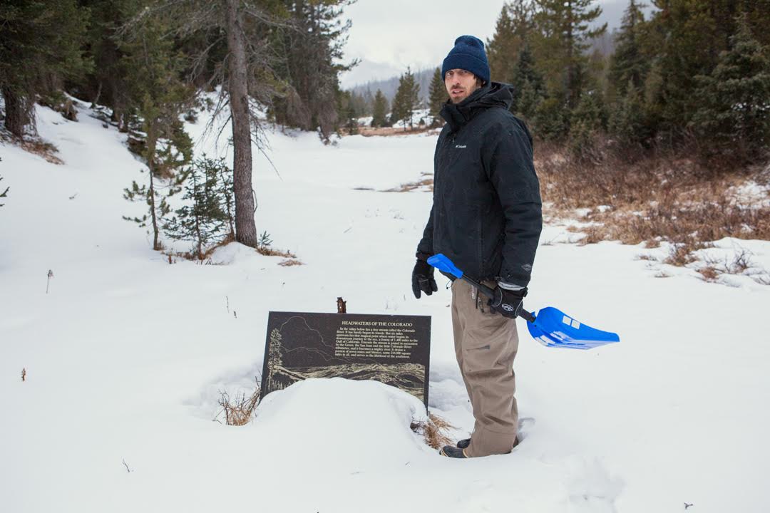
The clearcuts, dam, and reservoir are grievous wounds, but none of them are as bad as the Grand Ditch. We walked a quarter-mile from the end of Long Draw Road where we found a sign marking the location of the river’s headwaters. On our way to the sign, we crossed over a 30-feet deep and 30-feet wide ditch pushing water west to east. We were on the west side of the Continental Divide where water naturally flows west. We contemplated what black magic engineers employed to achieve this feat. The ditch was as conspicuous in La Poudre Pass as a scarred-over gouge on a human face.
The Grand Ditch was begun in the late 1880s and dug by mostly Japanese crews armed with hand tools and black powder. It was built to carry water, diverted from the Colorado River’s headwaters, east to growing cities on Colorado’s Front Range. Close to two feet of swift water ran through the ditch. We learned that even before melting snowpack forms the tiny mountain streams identifiable as the Colorado River’s origins, water is stolen from her. Pausing in a half-foot of powder, I wondered whether the water stored here would end up on a Fort Collins golf course or stirred by the fins of a Vaquita porpoise in the Gulf of California.
Study the Colorado River’s birth and you’ll learn she is born from a wild womb formed by heavy winter clouds, tall mountain peaks, and snowpack. But, she emerges from this womb immediately into exploitation. In La Poudre Pass, the young Colorado River tastes the violence that will follow her the rest of her life.
Editor’s note: This is the latest installment from Will Falk as he follows the Colorado River from headwaters to delta, before heading to court to argue for the Colorado River to be recognized as having inherent rights. More details on the lawsuit are here. The index of dispatches is here.
When I agreed to serve as a “next friend” to the Colorado River in a first-ever federal lawsuit seeking personhood and rights of nature for the river, I agreed to represent the river’s interests in court. On a general level, it’s not difficult to conceptualize the Colorado River’s interests: pollution kills the river’s inhabitants, climate change threatens the snowpack that provides much of the river’s water, and dams prevent the river from flowing to the sea in the Gulf of California.
We seek personhood for the Colorado River, however, and this entails personal relationship with her. Water is one of Life’s first vernaculars and the Colorado River speaks an ancient dialect. Snowpack murmurs in the melting sun. Rare desert rain runs off willow branches to ring across lazy pools. Streams running over dappled stones sing treble while distant falls take the bass.
Personal relationship requires that you learn who the other is. Our first day in court is scheduled for Tuesday, November 14, at 10 AM [you’re invited to attend]. So, I will spend the next few weeks leading up to the court date traveling with the river, sleeping on her banks, and listening. I will ask the Colorado River who she is, and then, if she’ll tell me, I’ll ask her what she needs.
When I arrive at the United States District Court in Denver, I hope to bring the Colorado River’s answer.
(I’ll post notes from the road. And, I’m excited to be meeting up with the brilliant photographer Michelle McCarron soon.)
The Rights of Nature movement has arrived in the United States! On September 25, Deep Green Resistance, with noted civil rights attorney Jason Flores-Williams, filed a first-in-the-nation lawsuit – Colorado River v. Colorado – seeking personhood for the Colorado River and recognition of the river’s rights to exist, flourish, regenerate, and naturally evolve in the United States District Court, District of Denver. While courts in India, New Zealand, and Ecuador have granted rights to ecosytems, this lawsuit represents the first Rights of Nature action ever brought before a federal court. If the case succeeds, the natural world will gain a powerful new tool in the struggle to stop corporate exploitation.
We invite everyone who loves the Colorado River and the natural world who gives us life to pack the courthouse with us. We want to send a strong message to the judge, the State of Colorado, and the nation that it’s time the American legal system honor the Rights of Nature. The first hearing in the case has been scheduled for Tuesday, November 14 at 10 AM (mountain):
Magistrate Judge Nina Y. Wang
Byron G. Rogers Courthouse C253
1929 Stout Street
Denver, CO 80294
This moment presents an opportunity to change the future of American environmental law while securing a foothold for the Rights of Nature movement in this country. Please join us in Denver to defend the Colorado River.
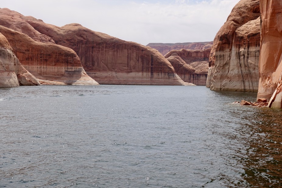
Featured image: Lake Powell, photographed April 12, 2017. The white ‘bathtub ring’ at the cliff base indicates how much higher the lake reached at its peak, nearly 100 feet above the current level. Patti Weeks
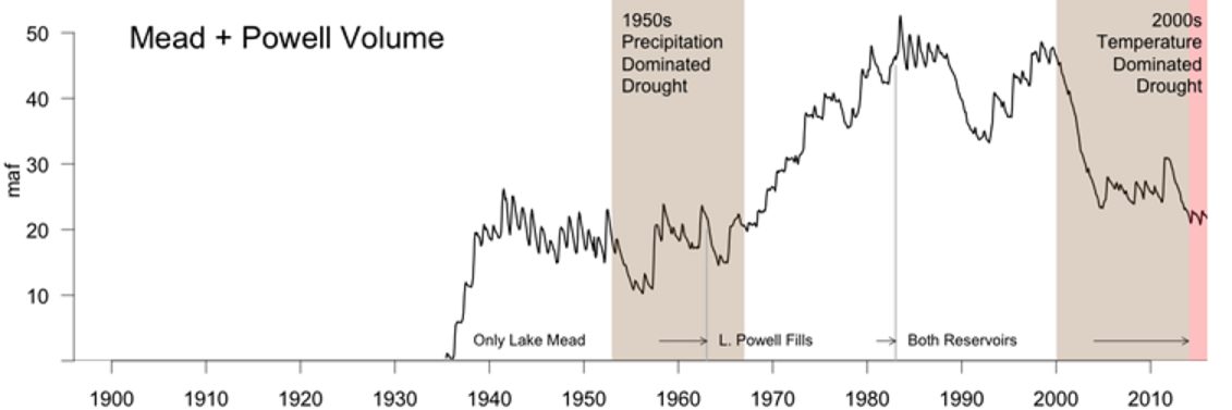
The nation’s two largest reservoirs, Lake Mead on the Arizona/Nevada border and Lake Powell on the Arizona/Utah border, were brim full in the year 2000. Four short years later, they had lost enough water to supply California its legally apportioned share of Colorado River water for more than five years. Now, 17 years later, they still have not recovered.
This ongoing, unprecedented event threatens water supplies to Los Angeles, San Diego, Phoenix, Tucson, Denver, Salt Lake City, Albuquerque and some of the most productive agricultural lands anywhere in the world. It is critical to understand what is causing it so water managers can make realistic water use and conservation plans.
While overuse has played a part, a significant portion of the reservoir decline is due to an ongoing drought, which started in 2000 and has led to substantial reductions in river flows. Most droughts are caused by a lack of precipitation. However, our published research shows that about one-third of the flow decline was likely due to higher temperatures in the Colorado River’s Upper Basin, which result from climate change.
This distinction matters because climate change is causing long-term warming that will continue for centuries. As the current “hot drought” shows, climate change-induced warming has the potential to make all droughts more serious, turning what would have been modest droughts into severe ones, and severe ones into unprecedented ones.
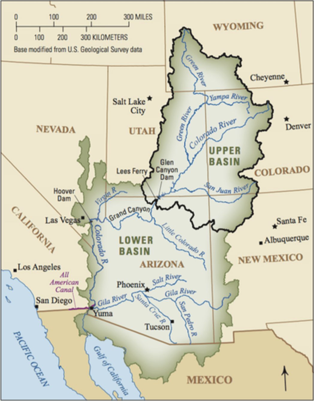
The Colorado River is about 1,400 miles long and flows through seven U.S. states and into Mexico. The Upper Colorado River Basin supplies approximately 90 percent of the water for the entire basin. It originates as rain and snow in the Rocky and Wasatch mountains. USGS
How climate change reduces river flow
In our study, we found the period from 2000 to 2014 is the worst 15-year drought since 1906, when official flow measurements began. During these years, annual flows in the Colorado River averaged 19 percent below the 20th-century average.
During a similar 15-year drought in the 1950s, annual flows declined by 18 percent. But during that drought, the region was drier: rainfall decreased by about 6 percent, compared to 4.5 percent between 2000 and 2014. Why, then, is the recent drought the most severe on record?
The answer is simple: higher temperatures. From 2000 to 2014, temperatures in the Upper Basin, where most of the runoff that feeds the Colorado River is produced, were 1.6 degrees Fahrenheit higher than the 20th-century average. This is why we call this event a hot drought. High temperatures continued in 2015 and 2016, as did less-than-average flows. Runoff in 2017 is expected to be above average, but this will only modestly improve reservoir volumes.
High temperatures affect river levels in many ways. Coupled with earlier snow melt, they lead to a longer growing season, which means more days of water demand from plants. Higher temperatures also increase daily plant water use and evaporation from water bodies and soils. In sum, as it warms, the atmosphere draws more water, up to 4 percent more per degree Fahrenheit from all available sources, so less water flows into the river. These findings also apply to all semi-arid rivers in the American Southwest, especially the Rio Grande.
The combined contents of the nation’s two largest reservoirs, Lake Mead and Lake Powell, since their initial fillings. The large decline since 2000 is shaded brown for 2000-2014, our 15-year study period, and pink for the continuing drought in 2015-2016. The loss was significantly influenced by record-setting temperatures, unlike a similar 15-year drought in the 1950s which was driven by a lack of precipitation. Bradley Udall, Author provided
A hotter, drier future
Knowing the relationship between warming and river flow, we can project how the Colorado will be affected by future climate change. Temperature projections from climate models are robust scientific findings based on well-tested physics. In the Colorado River Basin, temperatures are projected to warm by 5°F, compared to the 20th-century average, by midcentury in scenarios that assume either modest or high greenhouse gas emissions. By the end of this century, the region would be 9.5°F warmer if global greenhouse gas emissions are not reduced.
Using simple but strong relationships derived from hydrology models, which were buttressed by observations, we and our colleagues calculated how river flows are affected by higher temperatures. We found that Colorado River flows decline by about 4 percent per degree Fahrenheit increase, which is roughly the same amount as the increased atmospheric water vapor holding capacity discussed above. Thus, warming could reduce water flow in the Colorado by 20 percent or more below the 20th-century average by midcentury, and by as much as 40 percent by the end of the century. Emission reductions could ease the magnitude of warming by 2100 from 9.5°F to 6.5°F, which would reduce river flow by approximately 25 percent.
Large precipitation increases could counteract the declines that these all-but-certain future temperature increases will cause. But for that to happen, precipitation would have to increase by an average of 8 percent at midcentury and 15 percent by 2100.
The American Canal carries water from the Colorado River to farms in California’s Imperial Valley. Adam Dubrowa, FEMA/Wikipedia
On a year-in, year-out basis, these large increases would be substantial. The largest decade-long increases in precipitation in the 20th century were 8 percent. When such an increase occurred over 10 years in the Colorado Basin in the 1980s, it caused large-scale flooding that threatened the structural stability of Glen Canyon Dam, due to a spillway failure not unlike the recent collapse at California’s Oroville Dam.
For several reasons, we think these large precipitation increases will not occur. The Colorado River Basin and other areas around the globe at essentially the same latitudes, such as the Mediterranean region and areas of Chile, South Africa and Australia, are especially at risk for drying because they lie immediately poleward of the planet’s major deserts. These deserts are projected to stretch polewards as the climate warms. In the Colorado River basin, dry areas to the south are expected to encroach on some of the basin’s most productive snow and runoff areas.
Moreover, climate models do not agree on whether future precipitation in the Colorado Basin will increase or decrease, let alone by how much. Rain gauge measurements indicate that there has not been any significant long-term change in precipitation in the Upper Basin of the Colorado since 1896, which makes substantial increases in the future even more doubtful.
Megadroughts, which last anywhere from 20 to 50 years or more, provide yet another reason to avoid putting too much faith in precipitation increases. We know from tree-ring studies going back to A.D. 800 that megadroughts have occurred previously in the basin.
March of 2017 was the warmest March in Colorado history, with temperatures a stunning 8.8°F above normal. Snowpack and expected runoff declined substantially in the face of this record warmth. Clearly, climate change in the Colorado River Basin is here, it is serious and it requires multiple responses.
It takes years to implement new water agreements, so states, cities and major water users should start to plan now for significant temperature-induced flow declines. With the Southwest’s ample renewable energy resources and low costs for producing solar power, we can also lead the way in reducing greenhouse gas emissions, inducing other regions to do the same. Failing to act on climate change means accepting the very high risk that the Colorado River Basin will continue to dry up into the future.
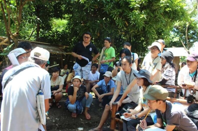
Featured image: International Solidarity Mission delegates listen to testimonies by Tumandok men and women in Barangay Agcalaga, Calinog. Photo Credits: Jalaur River for the People Movement.
The Tumandok (Panay-Bukidnon) indigenous peoples of the central Philippine Island of Panay are facing the real possibility of being forced from their homes due to the construction of the Jalaur Mega Dam, which will leave indigenous communities in the municipality of Calinog, Iloilo underwater.
Also known as the Jalaur River Multipurpose Project Phase 2 (JRMP II), the project is expected to displace 17,000 Tumandok individuals, affecting 16 indigenous people’s communities. The building of the dam will submerge houses and agricultural lands of the Tumandok.
These were the findings of the International Solidarity Mission (ISM) from July 16 to 18 organized by the Jalaur River for the People Movement. Delegates representing 26 organizations from five countries, including Belgium, Germany, Italy, Philippines, and South Korea, took part in the ISM.
The ISM delegates trekked to the indigenous communities along the Jalaur River in Calinog that are directly affected by the dam construction, talked with local officials, and dialogued with concerned government agencies in Iloilo City.
The Binanog dance performed during the 2016 Tumanduk nga Mangunguma nga Nagapangapin sa Duta kag Kabuhi (TUMANDUK) Assembly held in Tapaz, Capiz earlier this year. Photo Credits: TUMANDUK.
The Jalaur Mega Dam had its groundbreaking ceremony with former President Noynoy Aquino on February 2013 and is mainly funded by a loan from the Export Import Bank of Korea, with subsidies from the Philippine government.
The Philippine government is pushing for the construction of the Jalaur Mega Dam as the solution to providing irrigation and potable water in Panay Island. However, critics assert the same can be achieved without destroying indigenous communities by building smaller dams and rehabilitating existing irrigation systems.
Dr. Ernesto Hofileña, a retired anesthetist and agriculturist from Iloilo, for instance, argues that maximizing the 1,500-square kilometer catchment area that collects rain and run-off water downstream is better than constructing a big dam upstream where the catchment area is only 107 square kilometers. He wrote:
The average annual output of the Jalaur River is 1,197,504,000 cubic meters. If we can save this using a series of small dams, reservoirs, and deep lateral canals crisscrossing the farmlands across the Iloilo plain we won’t need a high dam with a storage capacity of less than a billion.
Manufacturing consent
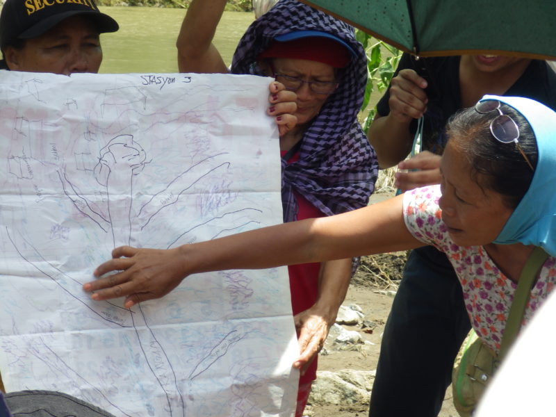
The Tumandok mapping the destruction and displacement to be caused by the construction of the Jalaur Mega Dam. Photo Credits: Jalaur River for the People Movement.
Contrary to the claims of the national and local government of almost full support by the indigenous peoples for the project, the international mission found out that no real free, prior, and informed consent (FPIC) was obtained from the Tumandok for the construction of the Jalaur Mega Dam.
In the first place, the ISM reported that the feasibility study made by the National Irrigation Administration for the dam construction was already tendered to the Korea Eximbank in November 2011. This was before the initiation of the first FPIC process on January 2012.
The ISM also found that the “consultative assemblies” organized by the National Commission on Indigenous Peoples only presented the advantages of building the Jalaur Mega Dam while masking the negative effects.
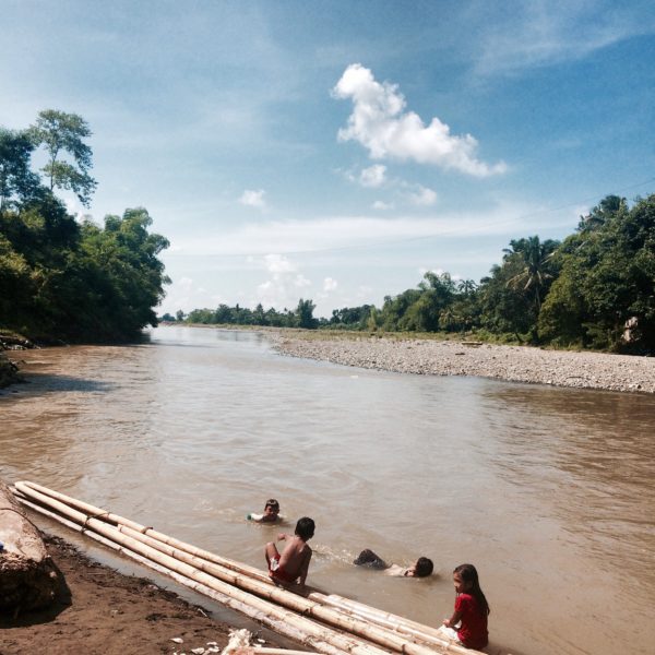
Children playing along the river banks of Jalaur in Barangay Agcalaga, Calinog.
Affected communities were given promises of incentives so that they would support the project, while those who resisted were threatened and intimidated by state forces.
Berna Castor, leader of the indigenous people’s group Tumanduk nga Mangunguma nga Nagapangapin sa Duta kag Kabuhi (TUMANDUK), said the elders who consented to the dam were not voted by the entire community and were organized by authorities precisely for the purpose of giving legitimacy to the project. Castor said:
Yes, they are Tumandok. But they are those whose lives and livelihood are not directly affected by the project. The people who will be most affected by the project do not approve of the project.
The Tumandok men and women who spoke to the ISM delegation shared their fears of flooding and landslides that the dam could cause as well as the drowning not only of their homes and villages, but also of their agricultural lands and cultural heritage.
Six Tumandok burial grounds and sacred sites along the Jalaur River will be desecrated with the building of the dam, according to a research study presented during the ISM by University of the Philippines Visayas graduates Mar Anthony Balani and Jude Mangilog.
Call to action and recommendations
Delegates of the International Solidarity Mission fording the Jalaur River.
The international mission’s call to actions included an appeal for the Philippine government to respect the right of the Tumandok to their ancestral domain and their processes of decision-making without coercion, bribery and false promises from government agencies and the military.
The mission demanded the stop of the militarization of indigenous communities and the investigation of human rights abuses that were committed to coerce the Tumandok into consenting to the project. It also called for the indemnification of the victims for damages during the project’s implementation.
The international mission moreover urged for the review of all development projects that encroach on the Tumandok people’s ancestral domain and likewise called on the South Korean government, the loan provider, to re-evaluate the issues surrounding the dam.
Finally, the mission recommended the conduct of an independent study assessing the viability of the proposed Jalaur Mega Dam as well as the feasibility of alternatives such as the building of small and micro-dams that are less dangerous while still providing irrigation water for farmlands.