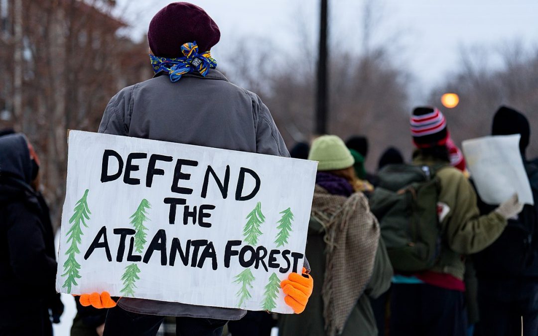
Editor’s note: In Atlanta City, local people are protesting a proposed police training facility. The project includes a mock metropolis, and is proposed to be built on the lands of Weelaunee Forest. Protestors have camped in the Forest. Clashes with the police led to one being killed over a month ago. This article discusses different aspects of the Cop City.
In September 2021, the Atlanta City Council passed legislation to build a $90 million police training facility, despite overwhelming opposition from the Atlanta community. The compound would include a mock city complete with houses, a school, a gas station, a bank, and a community centre; it would also feature a Black Hawk landing pad, shooting ranges, and a bomb testing site.
At 85 acres, it would be the largest police training facility in the United States. If constructed, it will be a rehearsal space for cops from all over the country and the world to practice urban warfighting with the latest military technologies.
Cop City—euphemistically and offensively called a “Public Safety Training Center” by its proponents—carries within it a confluence of catastrophes, including police brutality, militarism, racism, environmental damage, gentrification, and corporate profiteering.
Police militarisation
Police forces in the United States have always been militarised. There is a perpetual pipeline between the US military and police forces in terms of equipment and personnel. But more than that, both institutions seek domination and control over populations that are not part of, or act in opposition to, the political and economic elite.
The US police, which began as “slave patrols” to capture enslaved Black people escaping plantations, have white supremacy and capitalist interests embedded in their function. Regardless of diversity, training, or other reforms, the police seek to cage or control those perceived as a threat to the country’s racialised, capitalist order. The US military, meanwhile, asserts itself as a global police force to enforce this same order abroad. Its pursuit of a “national security state” and “full spectrum dominance” guide its actions in seeking to dominate the world.
The US military already trains militarised forces globally. Its infamous School of the Americas is one example, and its but the US military runs training operations for police and soldiers around the world. US police also already participate in military trainings, including with the Israel Defense Forces. As an organizer with Jewish Voice for Peace notes, “The exchanges refine and enhance the militarization rooted in American policing with Israeli tactics and technology of occupation and apartheid that are being tested on Palestinians on a daily basis.”
Cop City would be part of this cycle of exporting and importing violence in preparation for suppression of dissent as the world burns. The creation of this kind of compound is an escalation in the violence against those who are marginalised by the state, as well as an attack on the planet’s well-being.
Environmental impacts
In addition to the extreme carbon footprint of US militarism, Cop City would actively destroy wetlands and forest. Its construction would result in bulldozing a large part of the Weelaunee Forest, otherwise known as the South River Forest. This land is essential for environmental well-being, especially as the climate crisis worsens.
Stop Cop City forest defenders explain, “The wetlands within the forest help to mitigate the risk of dangerous flooding, and provide breeding grounds for amphibians and migration sites for wading birds…. Over 150 species call the Weelaunee Forest home, including river otters and white-tailed deer and Carolina wrens and salamanders.”
Furthermore, “The extensive tree canopy keeps the surrounding areas cooler (something hugely important as the risk of fatal heatwaves grows with each passing year), captures and stores carbon dioxide from the air, and acts as a natural filter that mitigates air pollution.” The forest’s canopy is already diminishing. Cop City would raze many acres more.
Racial injustice
In addition to the environmental destruction, Cop City also imposes further racialised violence upon land that has seen more than its share of pain.
The proposed site for Cop City is in a majority Black area of DeKalb County, on land that was once stolen from Muscogee-Creek people, that was then used as a plantation during slavery, and then as a prison form where incarcerated, mostly Black, people were forced to work on projects for the city of Atlanta.
Building a massive police facility where police will be trained to use military equipment and urban warfighting techniques in a predominantly Black area is a nightmare for residents, especially in the midst of relentless police brutality against Black and other communities of colour across the United States.
Corporate interests
But part of the interest in the site for this project is likely precisely because it is in a predominantly Black neighbourhood. The construction of projects like this are often tied to gentrification. As Atlanta has been tapped to host games in the 2026 World Cup and is seeking to host the 2024 Democratic National Convention, being able to offer the “security” afforded by a heavily-militarised police force is meant as a selling point.
Cop City has significant backing from the Atlanta Police Foundation, which is a private-public partnership and a major player in local politics. The Nationreports, “Its executive board is a veritable who’s who of corporate power and inherited wealth. Last year, the foundation expended large sums of its donors’ money lobbying for police expansion.”
The Foundation has leveraged its corporate backers—from Delta Airlines to the Waffle House—to raise two-thirds of the costs of constructing Cop City. The other third will be paid for by taxpayers. The Foundation has also relied upon the captured local media to manufacture consent for the project. The Atlanta Journal-Constitution, the city’s so-called paper of record, is owned by Cox Enterprises. The CEO of Cox Enterprises is Alex Taylor, who is leading the fundraising drive for Cop City. Thus, the paper of record has only ever recorded the support for Cop City from corporate elites.
Organising to Stop Cop City
Organisers in Atlanta have opposed Cop City since the beginning. They signed petitions, engaged in protest, and contributed 17 hours’ worth of commentary to public hearings at City Hall. After the plans for Cop City were approved, an even broader movement formed to defend the forest against destruction. Some have taken up residence in the forest while others have continued organising against the corporate backers across the country.
In December 2022, a joint police task force violently arrested six forest defenders and charged them with “domestic terrorism”. Then, on 18 January 2023, Georgia State Police marched into the forest and killed a nonviolent forest defender, Manuel “Tortuguita” Terán. The circumstances of this police killing of a climate activist are highly suspicious, as no body camera footage is available and the police have refused to release the names of the officers involved. An independent autopsy has confirmed that police shot Tort thirteen times. Since then, over ten more individuals have been arrested and charged with domestic terrorism, despite the fact that they are only accused with trespassing.
Tort’s killing comes on the heels of the most lethal year on record for police killing civilians. It marks the first known killing of an environmental activist by police in the United States. As noted in The Nation, the policing of protests is “structurally skewed in favor of the police—and, according to multiple studies, systematically biased against Black Lives Matter and the political left.”
On 31 January 2023, the Mayor of Atlanta announced that the permits have been approved to begin destruction of the forest. Police are preparing to do another sweep against forest defenders. On 6 February, heavily armed police raided the forest to clear it out and escort accompanied construction workers—at the same time that Tortuguita’s family held a press conference demanding answers for their killing.
But Cop City is not an inevitability; organisers are clear that it can—and must—be stopped. They explain that the mayor can cancel the lease, and they urge City Council to pass an ordinance doing so. The contractors and the corporate backers could be compelled to pull out of the projects.
How to take action
In their book Rehearsals for Living, Robyn Maynard and Leanne Betasamosake Simpson write about living in ways we want the world to be, such as through mutual aid and relationality. Cop City is the antithesis to this. It is a space for cops to rehearse militarised oppression and violence.
This will impact all our movements. Whether you are working on climate change, police violence, economic or social justice, racial justice, housing rights, disarmament and demilitarisation, etc., the training grounds at Cop City are meant to oppress you. Stopping Cop City is not just the responsibility of those living in Atlanta. All our struggles for a livable world are bound up in this struggle.
There are many ways to take action to Stop Cop City, including:
* Contact the contractors and subcontractors working on Cop City and tell them to pull out of the project (there has been some success with this already, showing that it’s an extremely useful technique to stigmatise work on this facility);
* Donate to the Atlanta Solidarity Fund to help bail out arrested protesters and fund the legal effort to challenge the repression of this movement; and
* Organise or join an event for the Global Week of Solidarity from 19–26 February 2023.
Ray Acheson is Director of Reaching Critical Will, the disarmament program of the Women’s International League for Peace and Freedom (WILPF). They provide analysis and advocacy at the United Nations and other international forums on matters of disarmament and demilitarization. Ray also serves on the steering group of the International Campaign to Abolish Nuclear Weapons (ICAN), which won the 2017 Nobel Peace Prize for its work to ban nuclear weapons, as well as the steering committees of Stop Killer Robots and the International Network on Explosive Weapons. They are author of Banning the Bomb, Smashing the Patriarchy (Rowman & Littlefield, 2021) and Abolishing State Violence: A World Beyond Bombs, Borders, and Cages (Haymarket Books, 2022)
Editor’s Note: The following Mongabay article is based on a recent study that found that marginalized subsistence communities are driving deforestation due to poverty. The article also writes that deforestation caused by these communities cannot still be compared to industrial deforestation. It is understandable that basic needs may drive people towards deforestation. But where does the poverty come from? It is unfortunate that the communities that once lived harmoniously with the forests are now doing the opposite. Why are they now unable to do so in the same forests?
It may be that the forests that they live in now do not produce as much as they used to in the past, or that the number of people dependent on the forests now exceeds the carrying capacity of the forests. Both of these are a possibility. Humans are currently in a population overshoot. Forests across the world are being used for industrial purposes, leaving less for the subsistence communities. In addition, the overall destruction of the environment has impacted the health, and hence productivity, of natural communities. In technical terms this is called “absolute poverty,” where a person’s basic needs are unmet. A related concept is that of “relative poverty,” where a person’s income is far less than the societal norms. In this type of poverty, the person thinks of himself/herself as poor in comparison to others he/she is exposed to on a daily basis. Exposure to the industrial culture is a tool that different states have employed to assimilate indigenous populations and, thus, destroy their culture. This turns indigenous cultures against their landbases: harmonious relationships are replaced by exploitative ones. While it is necessary to acknowledge this trend, it is also worth pointing out that a lot of the indigenous communities are risking their lives to protect their landbases.
Subsistence communities can drive forest loss to meet their basic needs when external pressures, poverty and demand for natural resources increase, says a new study unveiling triggers that turn livelihoods from sustainable into deforestation drivers.
The impact of subsistence communities on forest loss has not been quantified to its true extent, but their impact is still minimal compared to that of industry, researchers say.
Deforestation tends to occur through shifts in agriculture practices to meet market demands and intensified wood collecting for charcoal to meet increasing energy needs.
About 90% of people globally living in extreme poverty, often subsistence communities, rely on forests for at least part of their livelihoods—making them the first ones impacted by forest loss.
Subsistence communities, those who live off the forest and lead largely sustainable lifestyles, can actually become drivers of forest loss and degradation under certain circumstances, according to a new study. This happens when external changes put pressure on their traditional lifestyles.
This could be anything from market demands that shift agriculture practices to increased populations in need of resources living in forest areas. These shifts could make communities another alarming source of carbon emissions, say researchers.
Subsistence communities have often been associated with low environmental impact and a small carbon footprint. But as external pressures and demand for natural resources increase, these communities tend to intensify their forest activities to meet their basic needs, at the same time releasing more carbon stocks into the atmosphere from forest destruction, according to researchers.
In the new study published in the journal Carbon Footprints, researchers set out to look at this phenomenon on a global scale. They did a systemic review of 101 scientific reports, all based in the tropics, to see if they could identify the livelihood activities and triggers that lead to forest degradation. Thirty-nine reports are in Africa, 33 in Asia, and 29 in Latin America.
The authors point out that these are the same sustainable communities, such as Indigenous and local people (IPLCs), that will be the first ones impacted by forest loss and climate change, as they continue to depend on these diminishing forests and tend to be materially poor or deprived.
About 90% of people living in extreme poverty depend on forest resources for their survival, according to the U.N. Food and Agriculture Organization (FAO).
“At the end of the day, these communities need support, and their impact, I think, while it has not been quantified to its true extent, their impact is still minimal compared to what the energy industry does,” says Wendy Francesconi, author of the report and senior environmental scientist with the Alliance of Bioversity International and CIAT.
Their initial aim of the research was to collect data about how much forest cover is lost due to sustainable communities, but this proved too challenging to track, says Francesconi. Their impact is minimal and not documented as well as larger scale or industrial drivers of deforestation.
“I think one of the key messages is that we have to start paying more attention to these communities and how to support them better because they also have power in numbers—and impact in numbers,” she tells Mongabay via video call.
The authors identified two main activities the communities engaged in that became the main drivers of forest loss or degradation: intensified wood collecting (particularly for firewood or charcoal) and agriculture.
Other activities include illegal practices such as illicit crops or illegal logging and mining. The latter has been a growing concern for environmentalists who have seen Indigenous communities engage in illegal mining in Brazil and logging in Indonesia to supplement their income.
The factors pushing these changes include increased local population pressures in conjunction with changing lifestyles, availability of alternative labor, land tenure rights, market access, governance, migration, and access to technology.
External factors were highly context-dependent, however, and not all of them led to forest loss in all cases. A larger household size, for example, was associated with higher deforestation in most cases; but some case studies showed a higher likelihood for large families to share resources among each other, resulting in lower demand for resources and less forest loss, such as one case in Ethiopia.
It’s important to understand these dynamics so we don’t start to see “a more vicious cycle, where deforestation creates more poverty, then more deforestation, then more poverty, etc.” Martha Vanegas Cubillos, senior research associate at the Alliance for Biodiversity International and CIAT and another author of the study, tells Mongabay via video call.
Changing livelihoods in Indonesia
One of the studies analyzed from Asia looks at the impact of mangrove deforestation in South Sulawesi, Indonesia, and its socioeconomic consequences. The 2016 study identified that the total area of mangroves decreased by 3,344 hectares (8,263 acres), or 66.05%, in the study area of the Takalar District between 1979 and 2011.
The majority of this loss was for the creation of shrimp ponds, mainly driven by local fishermen changing their livelihoods to shrimp farming. There are two reasons for this shift: as an export product, shrimp have more stable prices, but also government incentives, like credit and subsidies, were available for farmers to expand shrimp ponds, says the report.
This forest loss had a number of impacts on the local community, as it reduced the area where they could continue with their traditional use of the mangroves, like collecting firewood, house materials, and fish traps. It also exposed them to coastal erosion and saltwater into their territory, and released the rich carbon stocks stored in the mangrove trees, says the report.
This shift in production made the communities here more vulnerable, as they put all their eggs in one basket, centralizing their earnings in shrimping, and removing the protective cover of the mangroves from climate changes, says Ole Mertz, professor in the department of geosciences and natural resource management at the University of Copenhagen, and one of the authors of the South Sulawesi study.
But Mertz is skeptical that any global generalizations can be made from a literature review alone, referring to the Carbon footprints study, saying these drivers are often context-dependent.
Speaking from his experience working with communities in South East Asia, the most important driver of forest loss by smallholder communities – a term he prefers to ‘sustainable communities’, which he considers an inaccurate generalization – has been the political pressure to develop land to something more productive.
This includes policies to promote industries like palm oil, rubber, or, in the case of South Sulawesi, shrimp ponds, which has more to do with political decisions rather than the community’s socioeconomic situation, he says.
“Poverty might in some cases be driving deforestation, but I think it’s always in combination with other things, with other drivers,” he tells Mongabay.
More energy needs, more deforestation in the DRC
Communities in the Democratic Republic of the Congo (DRC) are already feeling these external pressures, says Raymond Achu Samndong, a manager at the Tenure Facility, an IPLC organization based in Sweden.
In his 2018 paper – which was included in the Carbon footprints literature analysis – Samndong and fellow researchers take a closer look at deforestation at the community level in the Bikoro and Gemena regions, two REDD+ project areas in the DRC. After conducting interviews in the communities, 82% of households said they engaged in some type of forest clearing in the year prior to the study, despite the REDD+ incentives not to deforest.
All of them said it was for agriculture purposes, like moving or expanding crop area, while some also said it was for wood collection, either for charcoal production or artisanal logging. Charcoal and firewood are the main sources of energy in the DRC, with only 9% of the population having access to electricity, including in the capital Kinshasa.
As energy needs increase, particularly for businesses and restaurants in the city, the traditional use of charcoal is now a concerning driver of deforestation.
The main decision to clear forests in the REDD+ areas was economic poverty, lack of alternative livelihood or income generation, and lack of basic infrastructure and services, says the study.
Samndong says communities he’s worked with in the DRC are already seeing the effects of climate change, as changing weather patterns have reduced their harvest. They are aware that more deforestation will contribute to climate change and biodiversity loss, but community members tell him they don’t have any economic alternatives, “it’s like a survival strategy,” he tells Mongabay by a video call from his home in Sweden.
Solutions to deforestation should look at all the dimensions and drivers of it, not just depend on one economic incentive, like REDD+, to address it, adds the study. Better land use planning, tenure rights to communities, and more accountable institutions are among the needed solutions, researchers point out.
But Samndong says it’s essential that communities be involved in these plans. Billions of dollars have already been spent on development programs in the region over the years and nothing has changed, he elaborates.
“The problem is that development programs have been very challenging in Congo because they are mostly top-down,” he tells Mongabay, adding local communities still know and understand their local forests better than experts in the capital, or abroad.
Conflict and cash crops in Colombia
Deforestation in Colombia has long been a problem but has skyrocketed since 2016 when the FARC guerrillas and the Colombian government signed peace agreements to try to stem the conflict. Deforestation in parts of Colombia then accelerated—reaching a peak in 2017 with 219,552 hectares (542,524 acres) of forest loss—as the FARCs left many strongholds in the forests and mountainsides, which opened up previously forested areas to illegal economic development, such as growing small coca fields for cocaine production as cash crops.
One study published in 2013 takes a closer look at the conditions under which local communities plant coca. Their research, included in the Carbon Footprints analysis, found a direct correlation between coca cultivation areas and those deemed Rural Unsatisfied Basic Needs areas, indicating that poverty was a major factor in areas where communities engage in coca cultivation. The others include weakness and low presence of the state, violence and armed conflict, inaccessibility, and favorable biophysical conditions.
Vanegas Cubillos, who has long been working with communities in Colombia and Peru, says Colombia is a very particular case, as the ongoing armed conflict has greatly impacted rural communities. Migration and forced displacements have forced communities to inhabit new territories, often causing some level of deforestation in areas where fertile lands are scarce.
Both in Colombia and on a global scale, there are opportunities for both the public and private sectors to create economic benefits for communities, and to break the cycle of deforestation, she says.
“Until they realize that they really have to pay attention to these communities,” she says, “I think that this is a problem that can continue to get worse.”
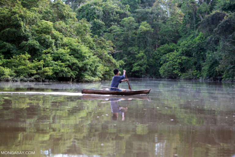
Featured image:Indigenous Tikuna paddling a dugout canoe on a tributary of the Amazon by Rhett A. Butler via Mongabay.
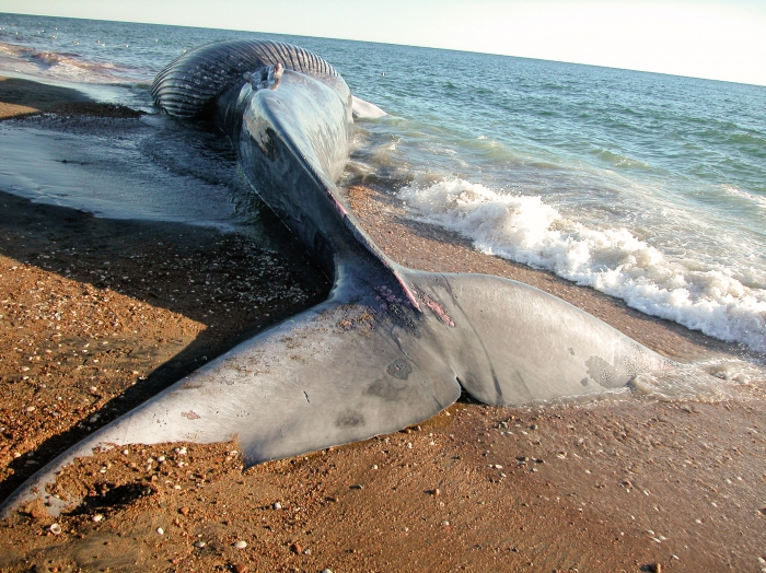
In the last few years whales stranded on the beaches of the East Coast have become common. In just the past two months there have been over a dozen. And that does not include the whales who have died in that time and sank to the bottom of the ocean. Fishermen blame industrial wind farm surveys, the wind industry blames climate change, and the vessel strikes of the global supply chains of civilization will not slow down. All the while mainstream “environmental” groups have become PR people for industrial energy. That stance is mutually exclusive from their professed goal to protect wildlife like desert tortoise, sage grouse, bats and to Save The Whales.
NOAA declared an official “unusual mortality event” for humpback whales in 2016, when the number of deaths on the East Coast more than doubled from the average in previous years. Coincidentally that is the same year when offshore wind development began, which coincides with the huge jump in NOAA Incidental Harassment Authorizations. The claim that this huge jump in mortality predates offshore wind preparation activities is patently false. This strong correlation is strong evidence of causation, especially since no other possible cause has appeared. It also seems odd that dead whales are now showing up on the west coast just as wind development is starting up there as well.
If what we are seeing is what happens during the surveying process for an offshore wind farm, we can only imagine what will happen when major construction begins. If vessel strikes are a leading cause of death, why on earth would you diminish habitat and increase vessel traffic with the construction of wind turbines? Yet in the recent denial of a vessel speed reduction, NOAA said it was “focused on implementing long-term, substantive vessel strike risk reduction measures.” Hopefully that will include the cancellation of any further wind farm construction. We certainly should not be increasing vessel traffic at this time, we should be restricting it. Vessel strikes and ocean noise from these extra ships and their sonar mapping is killing whales.
Noise interrupts the normal behavior of whales and interferes with their communication. It also reduces their ability to detect and avoid predators and human hazards, navigate, identify physical surroundings, find food and find mates. Such effects make it difficult for whales to avoid ships. It is one of NOAA’s four threats, along with vessel strikes, fishing gear entanglements and climate change.
Sound travels farther and four times faster in water than in air (at a speed of almost 1,500 meters per second). The noise produced by humans can therefore spread considerable distances underwater. These sounds can be relatively constant, such as the noise produced by a ship’s engine and propeller, or sudden and acute in the case of naval sonar and seismic air guns. The sound produced by a seismic air gun can cause permanent hearing loss, tissue damage and even death in nearby animals.
Evidence for the lethal effects of noise can be hard to document in the open ocean, but seismic surveys have been linked to the mass mortality of squid and zooplankton. In 2017, research revealed that a single air gun caused the death rate of zooplankton to increase from 18% to 40–60% over a 1.2 kilometer stretch of the ocean off the coast of southern Tasmania.
Examination of the dead whales revealed they had suffered trauma similar to decompression sickness. This was believed to have been caused by sudden changes in their deep diving behavior following exposure to sonar. The wind companies are using sonar in the geotechnical and site characterization surveys. There is also the detonation of unexploded ordnance (UXO) items from ship wrecks at this time, accidental and intentional.
Noise increases animals’ physiological stress. Research found that a reduction in shipping following the 9/11 terrorist attacks led to a six decibel drop in noise levels in the Bay of Fundy on Canada’s Atlantic coast. This coincided with lower levels of physiological stress detected in North Atlantic right whales when researchers measured stress hormones from floating whale feces.
During construction of the turbines, high-duty cycle impact pile driving (one strike every ~two seconds) will be used. And the pile driving is expected to occur for approximately four hours at one time for monopile installation, and 6 hours per pile for piled jacket installation.
This takes us to the biggest threat to whales and the ocean ecosystem that they live in: climate change. Climate change is caused by greenhouse gas emissions. These are created by industrial development. So climate change is a symptom of industrial development. That is the extractive industries of mining, deforestation, agriculture, factory fishing and dams which provide — through production, manufacture, transport, installation and operation — the current conveniences of a modern way of human life.
Industrial development destroys ecosystems. More industrial development, by the installation of thousands of offshore wind turbines, will not solve the problem of climate change. There’s one inescapable truth about the headlong rush to cover vast swaths of our countryside and oceans with 800-foot-high wind turbines: the more turbines that get built, the more wildlife will be harmed or killed. And no amount of greenwashing can change that fact. So it is distressing to see the numbers of whales washing up on our beaches. NOAA also says there is no proof that offshore wind is killing the whales. We must remember the onus isn’t on whales to prove guilt, it’s on industrial development to prove their innocence.
The production of the materials as well as the manufacturing processes for wind turbines and associated infrastructure of the extracted energy storage and transmission are made possible by burning fossil fuels. To obtain the raw material used in wind turbines, habitat is destroyed through open pit mining and mountaintop removal. The raw materials are then transported to processing plants to be turned into the component parts. It will take a tremendous amount of energy to mine the materials; transport and transform them through industrial processes like smelting; turn them into wind turbines, batteries, infrastructure and industrial machinery; install all of the above; and do this at a sufficient scale to replace our current fossil-fuel-based industrial system. In the early stages of the process, this energy will have to come mostly from fossil fuels, since they supply about 80 percent of current global energy. Their emissions will be added to the current use emissions. After manufacture, the turbine parts need to be transported to the project location. The construction and operation of offshore wind farms increase boat traffic, also leading to more greenhouse gas emissions and pollution. All of which adds to a non-existent carbon budget and thus increasing climate change. Not to mention the increased risk of marine mammal vessel strikes.
All of that energy use has a carbon payback period to plan, build, maintain and decommission the processes involved in an offshore wind turbine and its required infrastructure amounting to many years. This could be up to a quarter of its expected lifecycle. But this does not take into account the wildlife loss and habitat destruction from those processes. And then in 20 years the process must be done all over again. So this is not renewable. Also there are not enough metals on the planet to produce even the first generation of a total electric energy extracting transition, even if we mine the deep sea as we are starting to do.
Currently only 20% of our energy is electric. The other 80% is fossil fuel, the bulk of which is used by industry. The industrial advantage of fossil fuel is that it is stored energy that is extracted rather than an energy extracting device that requires storage and transmission infrastructure.
The paradox of “renewables” is that they need unprecedented volumes of non-renewable mined materials. Increasing “renewables” means large upticks in battery metals such as copper, cobalt, lithium and nickel. Wind turbines need rare earth metals such as neodymium of which there are scarce amounts. But the work wouldn’t stop there.
Closed mines themselves are a huge source of devastation. If all mining stopped today there would still be an area at least the size of Austria with degrading and, in some cases, dangerous levels of heavy metals. Mining brings materials that have been locked up in concentrations underground and lets them out into the world. Mines usually operate at depths below the water table — they need to be constantly dewatered using pumps. When a mine is abandoned, the ground water gradually re-floods underground passages and mineral seams over many months, creating acidic reservoirs of water. Above ground there are tailings ponds and piles of low-grade ore with traces of heavy metals. All of this material is exposed to oxygen and water. Exposing such elements wreaks havoc on ecosystems, soils and water supplies through acid leaching. A mine that is abandoned can have chronic pollution for hundreds if not thousands of years.
Cleaning up a mine consists of reducing water acidity, detoxifying the soil and treating waste before reintroducing flora and fauna to the site. It’s a lengthy, expensive process and can cost billions for a single large mine. Avoiding an environmental catastrophe and cleaning all the world’s mines at once would cost hundreds of billions or even trillions of dollars. So mining the materials needed for renewable energy will increase the threats to biodiversity. These threats will surpass those avoided by “renewable” climate change mitigation.
The concept of material footprints, in addition to carbon footprints, should be taken into consideration by governments. If not, the planet’s scarce non-renewable resources will continue to be destroyed. These factors will more than offset BOEMs calculations for climate change in the DEIS.
During their operation wind turbines create a disturbance in the air that can have far-reaching effects on the environment. The turbulence created is known to warm up the surface temperature around them by up to 2℉. This will change the climate by taking away the cooling breeze. Wind turbines will change weather patterns and currents which will create more and stronger storms.
Michael Moore, a senior scientist at the Woods Hole Oceanographic Institution, said whales face “a suite of risks” as turbines are built, such as increased vessel traffic and potential changes to the ecology. But that ecological change, he said, “needs significant further study to truly understand its significance.”
As Sunrise Wind admits, their planned construction and operations activities are not expected to “take” MORE than small numbers of marine mammals. They say incidental long-term impacts that have negative effects on large whales from the presence of turbine foundations is uncertain. For the right whale, according to NOAA Fisheries, “The potential biological removal level for the species, defined as the maximum number of animals that can be removed annually while allowing the stock to reach or maintain its optimal sustainable population level, is less than 1.” This means the death of a single right whale could make the difference between extinction and recovery.
There is no question wind turbines kill wildlife. Humans and domestic animals account for 96% mammal biomass on the planet. Only 4% is wild. Our activity has reduced the biomass of wild marine and terrestrial mammals by six times. Humanity has wiped out 60% of mammals, birds, fish and reptiles since 1970, leading the world’s foremost experts to warn that the annihilation of wildlife is now an emergency that threatens all life on the planet.
Jennifer Jacquet, a professor of environmental studies at New York University, said, “But we know that even in the face of a shifting climate, direct exploitation remains the largest factor affecting aquatic animals.”
BOEM is basing its conclusions in the DEIS on a false analysis that offshore wind turbines will reduce climate change. They will not. It makes no sense to increase disturbance to whales when they are suffering through an unusual mortality event. Whales as a keystone species are the canary in the coal mine. As they go, so do we. That in the effort to save the climate and continuance of business as usual, we are destroying the environment. If this offshore wind project continues, it will be humans who experience an unusual mortality event.
Carl van Warmerdam has lived his life on the West Coast of Turtle Island. He has always aligned with the counter culture ideals there. Now he currently lives on the coast of New England, the ancestral home of the North Atlantic Right Whale. If you would like to help Save the Whales email Lafongcarl@protonmail.com. We stopped offshore wind before, we can do it again.
Editor’s Note: While climate change is taken as THE pressing ecological concern of current era, biodiversity loss is the often less known but probably more destructive ecological disaster. UNEP estimates we lose 200 species in a day. That is 200 species that are never going to walk the Earth again. With these, we lose 200 creatures that play a unique and significant part in the natural communities, and immeasurable contributions of each to the health of the nature.
This study finds 69% average drop in animal populations since 1970. Over those five decades most of the decline can be traced to habitat destruction. The human desire for ever more growth played out over the years, city by city, road by road, acre by acre, across the globe. It is to want a new cell phone and never give a second thought as to where it comes from. Corporations want to make money so they hire the poor who want only to feed their families and they cut down another swath of rainforest to dig a mine and with it a dozen species we haven’t even named yet die. Think about what goes into a house to live in and the wood that must come from somewhere, and the coal and the oil to power it, and to power the cars that take people from there to the store to buy more things. And on and on, that is the American Dream.
Wildlife populations tracked by scientists shrank by nearly 70%, on average, between 1970 and 2018, a recent assessment has found.
The “Living Planet Report 2022” doesn’t monitor species loss but how much the size of 31,000 distinct populations have changed over time.
The steepest declines occurred in Latin America and the Caribbean, where wildlife abundance declined by 94%, with freshwater fish, reptiles and amphibians being the worst affected.
High-level talks under the U.N. Convention on Biological Diversity (CBD) will be held in Canada this December, with representatives from 196 members gathering to decide how to halt biodiversity loss by 2030.
In 2014, as temperatures topped 40° Celsius, or 104° Fahrenheit, in eastern Australia, half of the region’s black flying fox (Pteropus alecto) population perished, with thousands of the bats succumbing to the heat in one day.
This die-off is only one example of the catastrophic loss of wildlife unfolding globally. On average, wildlife populations tracked by scientists shrank by nearly 70% between 1970 and 2018, a recent assessment b WWF and the Zoological Society of London (ZSL) found.
“When wildlife populations decline to this degree, it means dramatic changes are impacting their habitats and the food and water they rely on,” WWF chief scientist, Rebecca Shaw, said in a statement. “We should care deeply about the unraveling of natural systems because these same resources sustain human life.”
WWF’s “Living Planet Report 2022,” launched this October, analyzed populations of mammals, birds, amphibians, reptiles and fish. “It is not a census of all wildlife but reports how wildlife populations have changed in size,” the authors wrote.
In 2014, as temperatures topped 40°C, or 104°F, in eastern Australia, half of the region’s black flying fox (Pteropus alecto) population perished, with thousands of the bats succumbing to the heat in one day. Image by Andrew Mercer via Flickr (CC BY-NC-SA 2.0).
A million species of plants and animals face extinction today, according to a landmark 2019 report from the Intergovernmental Science-Policy Platform on Biodiversity and Ecosystem Services (IPBES), an international scientific body. The new analysis uncovers another aspect of this biodiversity crisis: The decline of wild populations doesn’t just translate into species loss but can also heighten extinction risk, particularly for endemic species found only in one location.
Instead of looking at individual species, the Living Planet Index (LPI) on which the report is based tracks 31,000 distinct populations of around 5,000 species. If humans were considered, for example, it would like tracking the demographics of countries. Population declines in one country could indicate a localized threat like a famine, but it was happening across continents, that would be cause for alarm.
The steepest species declines occurred in Latin America and the Caribbean, where wildlife abundance dropped by 94% on average. In this region, freshwater fish, reptiles and amphibians were the worst affected.
Freshwater organisms are at very high risk from human activities worldwide. Most of these threats are linked to habitat loss, but overexploitation also endangers many animals. In Brazil’s Mamirauá Sustainable Development Reserve, populations of Amazon pink river dolphin or boto (Inia geoffrensis) fell by 65% between 1994 and 2016. Targeted fishing of these friendly animals for their use as bait contributed to the decline.
Climatic changes render terrestrial habitats inhospitable too. In Australia, in the 2019-2020 fire season, around 10 million hectares (25 million acres) of forestland was destroyed, killing more than 1 billion animals and displacing 3 billion others. For southeastern Australia, scientists showed that human-induced climate change made the fires 30% more likely.
These losses are happening not just in land-based habitats but also out at sea. Coral reefs and vibrant underwater forests are some of the most threatened ecosystems in the world. But they’re being battered by a changing climate that makes oceans warmer and more acidic. The planet has already warmed by 1.2°C (2.2°F) since pre-industrial times, and a 2°C (3.6°F) average temperature rise will decimate almost all tropical corals.
However, the bat deaths in Australia, Brazil’s disappearing pink river dolphins, and the vulnerability of corals are extreme examples that can skew the index, which averages the change in population sizes. In fact, about half of wildlife populations studied remained stable and, in some cases, even grew. Mountain gorillas (Gorilla beringei beringei) in the Virunga Mountains spanning Rwanda, the Democratic Republic of Congo and Uganda number around 604 today, up from 480 in 2010.
Despite these bright spots, the overall outlook remains gloomy. Even after discounting the extremes, the downward trend persists. “After we removed 10 percent of the complete data set, we still see declines of about 65 percent,” Robin Freeman, an author of the report and senior researcher at ZSL, said in a statement.
Often, habitat loss, overexploitation and climate change compound the risk. Even in cases where a changing climate proves favorable, the multitude of threats can prove insurmountable. Take bumblebees, for example. Some species, like Bombus terrestris or the buff-tailed bumblebee, could actually thrive as average temperatures rise. But an assessment of 66 bumblebee species documented declining numbers because of pesticide and herbicide use.
The report emphasizes the need to tackle these challenges together. Protecting habitats like forests and mangroves can, for example, maintain species richness and check greenhouse gas emissions. The kinds of plants and their abundance directly impact carbon storage because plants pull in carbon from the atmosphere and store it as biomass.
An assessment of 66 bumblebee species documented declining numbers because of pesticide and herbicide use. Image by mikaelsoderberg via Flickr (CC BY 2.0).
One of the deficiencies of the LPI is that it doesn’t include data on plants or invertebrates (including insects like bumblebees).
The report was released in the run-up to environmental summits that will see countries gather to thrash out a plan to rein in climate change in November and later in the year to reverse biodiversity loss. Government leaders are set to meet for the next level of climate talks, called COP27, in Egypt from Nov. 6-13. At the last meeting of parties, known as COP26 in Glasgow, U.K., last year, nations committed to halt biodiversity loss and stem habitat destruction, partly in recognition that this would lower humanity’s carbon footprint.
In December, the 15th meeting of the Conference of the Parties to the U.N. Convention on Biological Diversity (CBD) will be held in Montreal. Representatives from 195 states and the European Union will meet to decide the road map to 2030 for safeguarding biodiversity.
Citations:
Herbertsson, L., Khalaf, R., Johnson, K., Bygebjerg, R., Blomqvist, S., & Persson, A. S. (2021). Long-term data shows increasing dominance of Bombus terrestris with climate warming. Basic and Applied Ecology,53, 116-123. doi:10.1016/j.baae.2021.03.008
Herbertsson, L., Khalaf, R., Johnson, K., Bygebjerg, R., Blomqvist, S., & Persson, A. S. (2021). Long-term data shows increasing dominance of Bombus terrestris with climate warming. Basic and Applied Ecology,53, 116-123. doi:10.1016/j.baae.2021.03.008
Outhwaite, C. L., McCann, P., & Newbold, T. (2022). Agriculture and climate change are reshaping insect biodiversity worldwide. Nature,605(7908), 97-102. doi:10.1038/s41586-022-04644-x
Sobral, M., Silvius, K. M., Overman, H., Oliveira, L. F. B., Raab, T. K., & Fragoso, J. M. V. 2017. Mammal diversity influences the carbon cycle through trophic interactions in the Amazon. Nature Ecology & Evolution,1, 1670–1676. doi:10.1038/s41559-017-0334-0
Editor’s note: Roads in the middle of wildlife, both illegal and legal, cause habitat fragmentation. This, in turn, impacts wildlife. They disturb migration routes of many animals. Many die in roadkill. Some are more likely to be killed than others, affecting the population balance between species. The light pollution alters the circadian rhythms. Other forms of pollution affects other aspects of their lives. Learn more about the impacts of roads on wildlife here.
The following article demonstrates how, in addition to that, roads (mainly unofficial roads) are causing a widespread deforestation in the Amazon rainforest, one of the largest remaining rainforests. Amazon is home to not only some rare species of flora and fauna, but also to some of the last remaining uncontacted peoples in the world. Destruction of Amazon is an annihilation of these species and the lifestyles of these people.
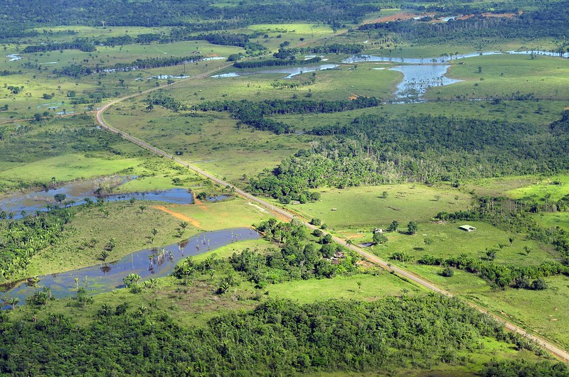
A groundbreaking study using satellite data and an artificial intelligence algorithm shows how the spread of unofficial roads throughout the Amazon is driving widespread deforestation.
One such road is on the verge of cutting across the Xingu Socioenvironmental Corridor, posing a serious risk of helping push the Amazon beyond a crucial tipping point.
Unprotected public lands account for 25% of the total illegal road network, with experts saying the creation of more protected areas could stem the spread and slow both deforestation and land grabs.
Officially sanctioned roads, such as the Trans-Amazonian Highway, also need better planning to minimize their impact and prevent the growth of illegal offshoots, experts say.
The Americas have a long history of occupation based on the destruction of nature and the violent massacre of native peoples, all in the name of a particular idea of “progress.” Brazil’s military dictatorship, which ran from 1964 to 1985, embraced this ideology to the point it had a specific motto — “integrate to not surrender” — for its nationalist project for the Amazon Rainforest. That mindset is still alive in the systemic and uncontrolled spread of unofficial roads in the Amazon, and the extent of this destruction is becoming increasingly clear.
A study by the Brazilian conservation nonprofit Imazon identified 3.46 million kilometers (2.15 million miles) of roads in what’s known as the Legal Amazon, an administrative region that spans the nine Brazilian states located within the Amazon Basin. The researchers estimated that at least 86% of the extent of these roads are unofficial, “built by loggers, goldminers, and unauthorized land settlements from existing official roads.” The sprawling network of roads also means that 41% of the Amazon Rainforest is already cut by roads or lies within 10 km (6 mi) of one.
While two-thirds of the road extent identified in the study is on private properties and settlements, the other third is on public lands. Here, unofficial roads have mushroomed, particularly in public areas without special protection from the government. The roads in these public areas run 854,000 km (531,000 mi), accounting for a quarter of the total in the Amazon.
According to Imazon, roads in these areas point to criminal activities such as illegal logging, mining, and land grabbing. The study also shows that 5% of the road network is inside conservation units, and 3% within Indigenous territories, running a total 280,000 km (174,000 mi) inside these ostensibly protected areas.
“These are arteries of destruction,” study co-author Carlos Souza Jr., an associate researcher at Imazon who coordinates the institute’s Amazon monitoring program, told Mongabay by phone. “The roads are opened to extract wood, and the ramifications spread from the main line, where the trucks and heavy machinery are.” He added the degradation is followed by the occupation of these areas, in what’s become a very familiar pattern in the Amazon.
According to Souza, previous studies estimated the length of official roads at around 80,000 km (nearly 50,000 mi) in the Brazilian Amazon, composed of federal, state and municipal highways and roads in official settlements, all of which are part of the planned infrastructure.
But the official numbers are much lower. The Federal Department for Transport Infrastructure (DNIT) told Mongabay in an email that it acknowledges 23,264 km (14,455 mi) of paved and unpaved roads within the Legal Amazon. That’s a tiny fraction of the more than 3 million km of mostly undocumented roads that Imazon identified in the region.
“Roads created without planning by municipalities, states and the federal government don’t appear on official maps,” Souza said, “but they end up being incorporated into the municipal network, demanding public money for their maintenance.”
The Imazon study, published in July in the journal Remote Sensing, used 2020 images from the Sentinel-2 satellite made available by the European Space Agency. The researchers applied an artificial intelligence algorithm created by Imazon to analyze the images.
Past efforts at making out roads in stacks of satellite images took researchers months of poring over the pictures. This time around, Imazon’s algorithm cut the analysis time to just seven hours, allowing the researchers to focus on the data. Studies using the previous methods had already indicated that the advance of unofficial roads was a driver of deforestation in the Amazon, but the new research will allow scientists to recreate a historical series with data from previous years using the new algorithm for the entire Amazon region.
Souza said mapping and monitoring the spread of roads is crucial to identifying threats to the forest, its people, and traditional communities. Previous studies have already shown that 95% of deforestation happens within 5.5 km (3.4 mi) of a road, and 85% of fires each year occur within 5 km (3.1 mi). Accounting for only the official road network, deforestation would be at least 50 km (31 mi) from the nearest road, and fires 30 km (18.6 mi) away.
“That proves mapping clandestine roads improves deforestation and fire risk prediction models and can be used as a tool to prevent forest destruction,” Souza said. “Monitoring usually looks for deforestation after the forest has already been cut down. If monitoring focuses on roads, the potential to prevent deforestation is huge.”
Souza and the team at Imazon are also building a network to deploy their tool in tropical forests worldwide to map the road footprint in other areas under pressure, such as the Congo Basin and Indonesia. PrevisIA, a deforestation prediction tool, is already using the new database. According to the latest analysis by Imazon, 75% of deforestation occurred within 4 km (2.5 mi) of PrevisIA’s predictions.
Both by length and density (the ratio between the area covered and the length of the road), unofficial roads in the Amazon are concentrated in the states of Mato Grosso, Pará, Tocantins, Maranhão and Rondônia. The data show that the zone known as the “arc of deforestation,” on the southeastern edge of the biome, continues to be the most targeted, but also points to a surge in the south of Amazonas state, western Pará, and the Terra do Meio region in central Pará.
Souza said that while most roads are very well maintained in private areas and with no public access, regulatory bodies such as the DNIT should work with environmental protection agencies to restrict traffic on these roads.
An imminent threat
An example of an illegal road that presents a danger to one of the most extensive contiguous forests in the Amazon was detected by Rede Xingu+, a network of conservation NGOs. The organization spotted an unofficial road running 42.8 km (26.6 mi) across two important conservation areas: the Terra do Meio Ecological Station and the Iriri State Forest. The road threatens to divide the Xingu Socioenvironmental Corridor, a 28-million-hectare (69-million-acre) swath of native forest that’s home to 21 Indigenous territories and nine conservation units.
According to the Instituto Socioambiental (ISA), an NGO that advocates for environmental and Indigenous rights, the illegal road starts in a deforestation hub inside the Triunfo do Xingu Environmental Protection Area. From there, it’s on the verge of completing the connection between the municipalities of Novo Progresso and São Felix do Xingu, a center for the illegal timber and gold trades. With just 10 km (6 mi) of forest to cut through in Iriri, the road could soon reach the Curuá River, inside the state forest, completing the connection and slicing right through the Xingu corridor, increasing the vulnerability of its forests dramatically.
“The threat is imminent,” Thaise Rodrigues, a geoprocessing analyst at the ISA, told Mongabay by phone, “and so far we are not aware of any legal action to stop it.” Rede Xingu+ spotted the road for the first time in January this year. Its progress was interrupted for a few months when it reached a mine inside the Terra do Meio Ecological Station. As of May this year, work on the road resumed, and it reachedthe Iriri State Forest. In July and August, the monitoring showed 575 hectares (1,420 acres) of deforestation around this road.
“When a large mass of forest is broken, it becomes vulnerable. The roads cause fragmentation, which intensifies deforestation,” Rodrigues said. The ISA has criticized both the Pará state and the federal governments for their inaction, given that both are responsible for the protected areas inside the Xingu corridor. The illegal road increases what’s known as the “edge effect,” where areas of forest exposed to clearings such as roads become more vulnerable to threats. And the deforestation wrought by these threats drives the Amazon closer toward a “tipping point,” beyond which the rainforest loses its ability to self-regenerate and devolves into a dry savanna.
According to the ISA, the Xingu corridor holds an estimated 16 billion metric tons of carbon dioxide, and its mass of lush vegetation is responsible for generating the “flying rivers” of water vapor that bring rain to the rest of the continent. Splitting up swaths of forest with roads also causes a loss of connectivity, which directly impacts the migration of aquatic and terrestrial wildlife, while accelerating the desertification of the soil. The ISA points to another serious risk: opening up the rainforest brings humans closer to the 3,000 known coronavirus species that Amazonian bats carry, making another global pandemic ever more likely.
Near the Iriri State Forest, the Baú Indigenous Territory is already under heavy pressure from mining activities and the deforestation front advancing from the municipality of Novo Progresso.
“The greater the network of roads around and inside protected areas,” Rodrigues said, “the greater the access for the consolidation of such illegal activities.”
She added that unprotected public areas are even more susceptible to land grabs. “The delimitation of protected areas would help, but the public authorities need to show interest in protecting these areas and the communities that live there.”
Imazon’s Souza said the creation of protected areas is the fastest way to contain the spread of these roads, since there’s little chance of land grabbers gaining legal title to the land that’s designated as protected.
“Deforestation is an expensive business,” he said, “and nobody will spend money if there’s no chance of owning that land in the future.” That applies even to areas where roads have already been cut, since that would make them less appealing to speculators.
Official roads are also risks
Experts say Brazil should also rethink the construction of government-built roads. One example is the BR-230, a project conceived under the military dictatorship that’s become a problem child for successive administrations. Construction of the road, known as Trans-Amazonian Highway, began in 1969, and it was inaugurated in 1972 despite not having been completed. Today, it cuts more than 4,000 km (2,500 mi) through the Amazon from Brazil’s northeast coast, with long stretches still unpaved and rendered completely impassable during the rainy season. The combination of cost, logistics, and the inherent difficulty of building colossal infrastructure in the middle of the forest have meant it’s still uncompleted 50 years after its inauguration.
Besides the Trans-Amazonian Highway, there’s the BR-163, which connects Cuiabá, in Mato Grosso, to Santarém, in northern Pará; and the BR-319, from Manaus, in Amazonas, to Porto Velho, in Rondônia. Both are expected to cut across the Brazilian Amazon in different directions. Experts say that despite being officially sanctioned projects, the precarious planning behind them compounds the risks to the region’s environment.
A 2020 study evaluated 75 road projects in the Amazon, including in Brazil, Bolivia, Colombia, Ecuador and Peru, composed of 12,000 km (nearly 7,500 mi) of planned roads. It showed that, if carried out over the next 20 years, the roads would cause the deforestation of 2.4 million hectares (5.9 million acres) of forest. Besides the environmental damage linked, 45% of the projects would also generate economic losses. Canceling these unfeasible projects would save $7.6 billion and 1.1 million hectares (2.7 million acres) of forests, the study showed.
It also made the case that carefully picking a smaller number of projects could achieve 77% of the economic benefits with only 10% of the socioenvironmental damage.
“Every project will cause environmental damage to some degree,” study co-author Thaís Vilela, a senior economist at the Washington, D.C.-based Conservation Strategy Fund, told Mongabay in an email. “But there is a subset of projects that have a positive financial return with lower environmental and social impacts.”
The research considered variables such as the project’s initial cost, deforestation, ecological relevance of the area, access to schools and health centers, and breaches of environmental regulations.
“Often, decision makers only consider the financial costs and benefits of the project,” Vilela said, “and there are political demands that often do not follow the economic logic.”
The research shows that the economic prospects of a project go from positive to negative when the potential environmental and social impacts are accounted for. To pave 2,234 km (1,388 mi) of the Trans-Amazonian Highway, for instance, 561,000 hectares (1.38 million acres) of forest would be destroyed. In terms of the impact on biodiversity, water, carbon storage, and the integrity of protected areas, BR-163, BR-230, and BR-319 would do the most significant damage to the environment, the study found. Paving 496 km (308 miles) of BR-163 alone would cause 400 million metric tons of carbon dioxide emissions by 2030.
As dire as these figures look, the true extent of the damage would be even greater because of the unofficial roads that would sprout off these main highways, the study authors said. Construction and improvement of these primary roads, they wrote, “might potentially lead to the construction of secondary, tertiary, and even illegal roads in the region, promoting additional impacts.”.
“Unofficial roads usually come from official ones,” Imazon’s Souza said. He blamed poor environmental impact assessments for allowing this proliferation of roads, adding that the major official highways also harm protected areas and Indigenous territories.
“There are areas where roads should not be built, as environmental and social damage would be greater than potential benefits,” Vilela said. “Ideally, the definition of these variables should involve all individuals directly affected by the project.”
The DNIT told Mongabay that its responsibility is limited to federal roads listed in the National Road System database, which doesn’t include unofficial roads. Mongabay also contacted IBAMA, the Brazilian environmental protection agency, and ICMBio, the government institute that oversees protected areas, but didn’t receive any response to requests for comment by the time this story was published.
Citations:
Botelho, J., Costa, S. C., Ribeiro, J. G., & Souza, C. M. (2022). Mapping roads in the Brazilian Amazon with artificial intelligence and Sentinel-2. Remote Sensing, 14(15), 3625. doi:10.3390/rs14153625
Barber, C. P., Cochrane, M. A., Souza Jr, C. M., & Laurance, W. F. (2014). Roads, deforestation, and the mitigating effect of protected areas in the Amazon. Biological Conservation, 177, 203-209. doi:10.1016/j.biocon.2014.07.004
Vilela, T., Malky Harb, A., Bruner, A., Laísa da Silva Arruda, V., Ribeiro, V., Auxiliadora Costa Alencar, A., … Botero, R. (2020). A better Amazon road network for people and the environment. Proceedings of the National Academy of Sciences, 117(13), 7095-7102. doi:10.1073/pnas.1910853117